Route from Bellevue to Daon

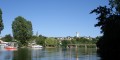
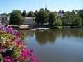
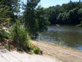
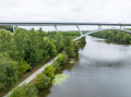
Starting from the village of Daon, the Bellevue route takes you along the towpath to explore the right bank of the Mayenne.

Details

201544
Creation:
Last update:
Last review:
  • Walking
    Activity: Walking
  • ↔
    Distance: 8.33 mi
  • ◔
    Average duration: 4h 00 
  • ▲
    Difficulty: Moderate

  • ⚐
    Back to start: Yes
  • ↗
    Ascent: + 174 ft
  • ↘
    Descent: - 184 ft

  • ▲
    Highest point: 233 ft
  • ▼
    Lowest point: 72 ft
  • ⚐ Country: France
  • ⚐ City: Daon (53200)
  • ⚑
    Start/End: N 47.75004° / W 0.642508°
  • ❏
    IGN map(s): Ref. 1520SB
  • Hour-by-hour weather

Photos

Description of the walk

Starting point: Les Rivières campsite.

(S/E) From the campsite, head to the bridge, cross it and join the towpath via the steps on the right (you can also go down via a small tarmac path 30 metres further on).

(1) Follow the river southwards along the towpath for 3.2 km until you reach the area known as La Borderie / La Bélinière

(2) At the hamlets of La Borderie / La Bélinière, leave the towpath by turning right onto the tree-lined path which leads uphill to a small tarmac road. Turn right onto this road and continue straight on for 1.6 km until you reach a T-junction.

(3) Turn left and continue along the road for 1.8 km until you reach the junction with the D213 (white wayside cross on the left)

(4) Cross the D213 and carry on straight ahead for 1.2 km until you reach the hamlet of Belle Vue.

(5) At Belle Vue, carry on straight ahead onto the tree-lined path, then turn right onto a gravel track. Follow this track to a junction and turn left onto the tarmac road. Carry on straight ahead until you reach the River Mayenne and its towpath.

(6) At the signs indicating the bend, turn right onto the towpath and head towards Daon Bridge.

(1) Walk up onto the bridge, cross it and turn left to reach the campsite (S/E)

Waypoints

  1. S/E : mi 0 - alt. 85 ft - Camping des Rivières
  2. 1 : mi 0.22 - alt. 75 ft - Bridge over the Mayenne
  3. 2 : mi 2.22 - alt. 72 ft - La Borderie / La Bélinière
  4. 3 : mi 3.34 - alt. 131 ft - T-junction
  5. 4 : mi 4.47 - alt. 230 ft - D 213 (white wayside cross)
  6. 5 : mi 5.21 - alt. 200 ft - Belle Vue
  7. 6 : mi 5.93 - alt. 89 ft - Turn right onto the towpath at the bend
  8. S/E : mi 8.33 - alt. 85 ft - Camping des Rivières

Notes

A few parking spaces are available in front of the campsite. Another, larger car park is situated above the campsite on Rue Creuse.

Reviews and comments

4.6 / 5
Based on 3 reviews

Reliability of the description
4.7 / 5
Ease of following the route
4.7 / 5
Route interest
4.3 / 5
User 3819493

Overall rating : 4.7 / 5

Date of your route : Mar 23, 2026
Reliability of the description : ★★★★★ Very good
Ease of following the route : ★★★★★ Very good
Route interest : ★★★★☆ Good
Very busy route : No

THE PERFECT CYCLING ROUTE

Machine-translated

jamois
jamois

Overall rating : 4 / 5

Date of your route : Oct 16, 2023
Reliability of the description : ★★★★☆ Good
Ease of following the route : ★★★★☆ Good
Route interest : ★★★★☆ Good
Very busy route : No

A walk that takes you along a good stretch of towpath beside the River Mayenne and allows you to explore the local bocage as you return to the starting point. Several kilometres along a quiet country lane.

Machine-translated

joebarpan
joebarpan
• Edited:

I can’t give an opinion at the moment, as I haven’t done this walk yet.

Machine-translated

Pierre Le Griffon
Pierre Le Griffon

Overall rating : 5 / 5

Date of your route : May 08, 2017
Reliability of the description : ★★★★★ Very good
Ease of following the route : ★★★★★ Very good
Route interest : ★★★★★ Very good

A pleasant walk along the River Mayenne.
After point 5, you can join the towpath by crossing an unfenced field, which allows you to avoid the road until point 6.
40% of the route is on roads, but there is no traffic.
The route took 3 hours to complete (3 hours 35 minutes indicated)

Enjoy the walk

Machine-translated

Other walks in the area

For more walks, use our search engine .

The GPS track and description are the property of this route's author. Please do not copy them without permission.