The Chemin d’Avesnes to Beaufort route

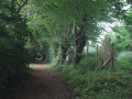
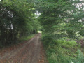
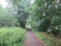
Starting from the charming village of Beaufort, explore the edge of the Haie d’Avesnes, a remnant of the ancient Celtic forest.

Details

1547863
Creation:
Last update:
Last review:
  • Walking
    Activity: Walking
  • ↔
    Distance: 4.70 mi
  • ◔
    Average duration: 2h 15 
  • ▲
    Difficulty: Easy

  • ⚐
    Back to start: Yes
  • ↗
    Ascent: + 115 ft
  • ↘
    Descent: - 115 ft

  • ▲
    Highest point: 669 ft
  • ▼
    Lowest point: 545 ft

Photos

Description of the walk

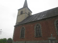
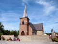
Starting point: In Beaufort, Church of the Assumption, on the town hall side.

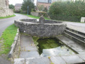
(S/E) Opposite the town hall, turn left and then immediately right onto Ruelle Joyeuse. You are now on the Avesnois-Thiérarche Regional Long-Distance Footpath – signposted in yellow and red. At the road (blue stone wayside shrine), make the first turn right then left and continue along the Chemin d’Avesnes through the hedgerows and fields to the edge of the Bois le Roi.

(1) At the edge of the woodland, turn left. You’ll leave theGR® de Pays, which heads towards Eclaibes.

(2) At the junction, turn left onto the Chemin Chevaleret. Viewpoint over Beaufort. At the junction (elevation 193), carry straight on.

(3) At the road, turn right, then left onto Rue de Damousies. At the Sainte-Marie Chapel, next to a farm, continue left towards Beaufort; ignore the next two roads on the right and carry on straight ahead along Rue de la Fontaine Taviaux.

(4) Between the houses, take the narrow, tree-lined lane, then at the main road (Rue Georges Clémenceau), turn left.

(5) On the RD55, turn into Ruelle de l’Argilière opposite. At the next road, continue along the lane, following a right-then-left bend.

(6) At the end, first turn right then left onto Rue Pasteur to join Ruelle de la Briquette. Then turn left into Ruelle du Louchy and you’ll come to the church (S/E).

Waypoints

  1. S/E : mi 0 - alt. 554 ft - Beaufort Church
  2. 1 : mi 1.12 - alt. 640 ft - Bois le Roi, on the left
  3. 2 : mi 1.91 - alt. 669 ft - Chemin Chevaleret
  4. 3 : mi 2.76 - alt. 597 ft - Road, on the right
  5. 4 : mi 3.58 - alt. 558 ft - A narrow lane through the hedgerows on the right
  6. 5 : mi 4 - alt. 587 ft - RD55, opposite
  7. 6 : mi 4.43 - alt. 554 ft - Rue Pasteur, right-left
  8. S/E : mi 4.7 - alt. 554 ft - Beaufort Church

Notes

In wet weather, waterproof footwear is essential.

This route is listed in the PDIPR (Departmental Plan for Walking and Hiking Routes).

Follow the yellow markings: (Yellow Cross = wrong direction, arrow to the right = turn right, arrow to the left = turn left, horizontal line = go straight on).

Always be cautious and plan ahead when you're outdoors. Visorando and the author of this route cannot be held responsible for any accidents occurring on this route.

The GR® and PR® markings are the intellectual property of the Fédération Française de Randonnée Pédestre.

Reviews and comments

4.4 / 5
Based on 3 reviews

Reliability of the description
4.7 / 5
Ease of following the route
4.7 / 5
Route interest
4 / 5
Jocelyne.duquenoy
Jocelyne.duquenoy

Overall rating : 4.7 / 5

Date of your route : Oct 14, 2025
Reliability of the description : ★★★★★ Very good
Ease of following the route : ★★★★★ Very good
Route interest : ★★★★☆ Good
Very busy route : No

A short, interesting route alternating between woods, countryside and villages, with the short stretches through the village adding an extra touch.

Machine-translated

brichauxmarc
brichauxmarc

Overall rating : 4.7 / 5

Date of your route : Oct 05, 2020
Reliability of the description : ★★★★★ Very good
Ease of following the route : ★★★★★ Very good
Route interest : ★★★★☆ Good
Very busy route : No

A really lovely walk and perfectly signposted
Nothing to complain about
Marc Brichaux

Machine-translated

Buzzrando
Buzzrando

Overall rating : 4 / 5

Date of your route : Feb 05, 2019
Reliability of the description : ★★★★☆ Good
Ease of following the route : ★★★★☆ Good
Route interest : ★★★★☆ Good

Enjoy your little walk

Machine-translated

Other walks in the area

For more walks, use our search engine .

The GPS track and description are the property of this route's author. Please do not copy them without permission.