Route des villages starting from Ceintrey

A tour of the villages of the Saintois region, in the canton of Vézelise.
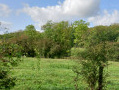
A walk across the plains with scenic views.
Places of interest: chapels, wayside crosses, churches, wash houses

Details

3305516
Creation:
Last update:
Last review:
  • Walking
    Activity: Walking
  • ↔
    Distance: 9.29 mi
  • ◔
    Average duration: 4h 40 
  • ▲
    Difficulty: Moderate

  • ⚐
    Back to start: Yes
  • ↗
    Ascent: + 453 ft
  • ↘
    Descent: - 440 ft

  • ▲
    Highest point: 1,033 ft
  • ▼
    Lowest point: 755 ft
  • ⚐ Country: France
  • ⚐ City: Ceintrey (54134)
  • ⚑
    Start/End: N 48.524423° / E 6.160276°
  • Accessible from the train station Gare de Ceintrey.
  • ❏
    IGN map(s): Ref. 3416O
  • Hour-by-hour weather

Photos

Description of the walk

Park in a small car park next to the Madon, on Rue de Pulligny in Ceintrey.

(S/E) Join the Route de Nancy, turn right, cross over the Madon and turn right onto the Route d’Autrey. Cross the level crossing and walk past the pylon.

(1) After the pylon, take the first path on the left. At a T-junction, carry straight on along the fence. At the next junction, turn left and join the D5.

(2) Cross it carefully, turn right onto the road and take the first track on the left. At the end of the track, turn right and carry on towards Clerey-sur-Brenon. The track turns into a road and, at the next junction, carry on straight ahead. You’ll come to a junction with a chapel.

(3) Turn right onto Rue de la Chapelle. At the junction by the church, turn left onto Rue de Velaine, pass the wayside cross and carry on straight ahead along the field path. You’ll reach the small road to Gerbecourt.

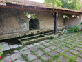
(4) Turn right to enter the village of Omelmont via Rue de la Plaine. At the end of the street, first turn right then left onto Rue des Accacias. At the end of the street, continue right onto Rue Jardin de la Fête until you reach the wash house.

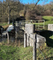
(5) Take the small path leading down to the left towards Houdreville and enter the woods. Cross the bridge over the Brenon and continue uphill towards Houdreville along the Chemin de la Cheviotte, passing in front of the church and continuing along Rue de l’Église. You’ll reach the junction with the Grande Rue.

(6) Turn right onto it. At the junction by the War Memorial, stay on Grande Rue. At a multi-way junction, also marked by a wayside cross, join the D50b road. Turn right onto it to quickly reach a three-way junction.

(7) Take the first farm track on the right, pass under the high-voltage power lines and, at the end of the track, turn left to join the Route d’Autrey (D50b).

(8) Turn right onto this road. After crossing the Ruisseau de Vilain Rupt, turn right onto Rue de Mesnil to reach the entrance to Autrey.

(9) Turn left onto Rue de Mesnil, continue to the crossroads by the church, turn right, and at the next crossroads you’ll reach Rue de Ceintrey.

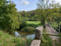
(10) Turn right onto it and continue until you reach the bridge over the Brenon.

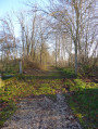
(11) Cross the bridge, then walk first alongside the Peute Côte woods and then the railway line before reaching the original junction.

(1) Continue straight ahead along the same route as on the way there to return to the car park on Rue de Pulligny (S/E).


Waypoints

  1. S/E : mi 0 - alt. 761 ft - Car park on Rue de Pulligny, next to the - Madon (le)
  2. 1 : mi 0.61 - alt. 771 ft - The pylon or mobile phone mast
  3. 2 : mi 1.26 - alt. 869 ft - The D5
  4. 3 : mi 2.41 - alt. 873 ft - The chapel
  5. 4 : mi 3.56 - alt. 922 ft - Gerbécourt Road
  6. 5 : mi 4.2 - alt. 932 ft - The wash house
  7. 6 : mi 4.83 - alt. 1,010 ft - Grande Rue
  8. 7 : mi 5.23 - alt. 1,020 ft - A field path to the right
  9. 8 : mi 6.19 - alt. 1,030 ft - The road to Autrey
  10. 9 : mi 7.26 - alt. 922 ft - Entrance to Autrey
  11. 10 : mi 7.69 - alt. 899 ft - Ceintrey Road
  12. 11 : mi 8.12 - alt. 755 ft - Bridge over the - Brénon (rivière)
  13. S/E : mi 9.29 - alt. 758 ft - Car park next to the Madon on Rue de Pulligny

Worth a visit

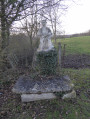
In Clerey-sur-Brenon: the Notre-Dame-de-Pitié Chapel. Next to the church, a square, two-storey building covered with a black plastic sheet – this is the beautiful Calvary Chapel. The Church of Saint-Elophe and its neo-Gothic portal. The Calvary on Rue de Velaine
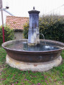
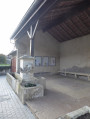
In Omelmont: the wash house with the walker, the mill, the owl and the seated figure. The Church of Saints Joseph and Claude. The wash house.
The crossing over the Brenon
In Houdreville: Saint-Epvre Church and the memorial to Thérése Poirel. The stone Calvary.
In Autrey: the church and the village square.
The views from each high point along the walk.

Reviews and comments

4.1 / 5
Based on 3 reviews

Reliability of the description
4 / 5
Ease of following the route
4.3 / 5
Route interest
4 / 5
ColetteGeneviève
ColetteGeneviève

Overall rating : 4 / 5

Date of your route : Sep 30, 2023
Reliability of the description : ★★★★☆ Good
Ease of following the route : ★★★☆☆ Average
Route interest : ★★★★★ Very good
Very busy route : No

Hello,
A lovely walk, best avoided in very hot weather (yesterday was PERFECT). We encountered a problem with paragraph 1 of the description. We ended up at the farmer’s, who had to lead us out of his cow paddock and back onto the D5. Please could you clarify this, if you would? There’s a picnic table on the descent along the little path towards Houdreville (after the wash house and before the bridge over the Brenon (paragraph 5). Beautiful scenery.
Colette

Machine-translated

Christecol
Christecol

Overall rating : 3.5 / 5

Date of your route : Nov 23, 2021
Reliability of the description : Not used / Not applicable
Ease of following the route : ★★★★★ Very good
Route interest : ★★☆☆☆ Disappointing
Very busy route : No

There are plenty of tarmac roads to cover (I know, it’s not always easy to do otherwise), and this ride would have been more at home in the mountain biking section; nevertheless, the section through the fields is lovely.

Machine-translated

CREUSELJM
CREUSELJM

Overall rating : 4.7 / 5

Date of your route : Feb 05, 2021
Reliability of the description : ★★★★☆ Good
Ease of following the route : ★★★★★ Very good
Route interest : ★★★★★ Very good
Very busy route : No

I’ve never found the path to Le Géal, and neither have the people of Autrey.

A lovely walk, with a sighting of a wild boar just 2 metres from the path as we left Clerey-sur-Brénon.

Machine-translated

Other walks in the area

For more walks, use our search engine .

The GPS track and description are the property of this route's author. Please do not copy them without permission.