Country:

 City:
City:


Park on Rue du Moulin, in the designated spaces in front of the factory.
(S/E) Opposite the factory, head right then turn left at the junction to join the Route du Mont Sainte-Odile (D425). Follow this road uphill to the right, following the Red Ring signposting. Cross the Breitenbach.
(1) Immediately afterwards, turn left onto Rue des Vosges, still following the Red Ring markings.
(2) Take the path on the left between houses nos. 11 and 12. Follow the path marked with the Red Ring, curving to the right to go round the small hilltop. You’ll come to a three-way junction.
(3) Turn left and you’ll come to a fence.
(4) At this point, make sure you don’t miss the ‘Red Ring’ path, which climbs to the right along the fence. You’ll reach a spot often used as a timber storage area.
(5) Continue straight on along the path that runs alongside the farm’s fence towards Champ du Feu and Charbonnière: marked with Red Saltires. Then turn right, cut across a forest track and carry on straight ahead to reach an area where the path is clear and you can see Breitenbach below. Shortly afterwards, you’ll come to a wide track that’s almost passable by vehicle.
(6) Turn left, keeping to the Red Saltire markings, and head for the Tannhütte refuge, the only shelter on the route.
(7) Continue along the track, which curves slightly to the right. Walk for about 2 km.
(8) Take the path leading uphill to the right, signposted with a Red Disc. The Col de la Charbonnière is about a quarter of an hour’s walk away: there is a picnic table there.
(9) Cross the road carefully and take the main path opposite, signposted ‘Yellow Saltire’. You’ll come to a three-way junction where the path splits into three.
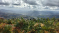
(10) Take the path furthest to the right: Yellow Saltire. Cross a forest track, continue straight ahead, then turn right to reach the second paragliding take-off area: exceptional views over the Val de Villé – picnic table.
(11) Continue along the Yellow Saltire path until you reach the vicinity of the Col du Kreuzweg.
(12) Head right to follow the road over the pass, passing the main entrance to Villa Mathis, then near the Parc Alsace Aventure, recognisable by its wooden bungee jumping tower! If needed, there is a shelter with tables, but as it is part of the park, the operators are under no obligation to accommodate walkers bringing their own picnic. Follow the Red Ring markings to the left of the park – definitely not the one that runs past the base of the tower: at the start, a sign indicates ‘Grande Bellevue’ is 30 mins away. Join the Route Forestière de la Ceinture and continue straight on along it until you reach a clearing in the trees.
(13) Turn right onto the wide, unmarked path leading to Grande Bellevue, from where there is no view (!). However, the grassy area is very pleasant and there is a picnic area. There’s no need to retrace your steps: stay on the path to rejoin the forest road further on.
(14) Head right for about a hundred metres, then turn right again onto the path marked ‘Red Ring’. Join the Chemin de la Bellevue and head right, following it to the Col de Bellevue: there’s a picnic table there.
(15) Take the wide path on the right, then turn left onto the narrower path marked with a Red Rectangle crossed by a White Rectangle, known as the Chemin des Ânes. The path descends steeply for nearly 3 km, until you reach a junction on the edge of the forest at a place called Sohle: a lovely view over the vineyards and the Ungersberg towards Albé.
(16) Turn right onto the path marked ‘Red Saltire’, which you’ll follow all the way to Breitenbach. Pass through a meadow and you’ll come to a fork in the path.
(17) Take the path that climbs to the right: the signposting is a bit hidden, but if you take the wrong one, the other path also leads back to the car park.
(18) In the pasture, look out for a wayside cross on the right. Take the path opposite, which descends steeply towards Breitenbach: marked ‘Red Saltire’. Cross a wooden bridge and you’ll enter the village straight away.
(19) Head left to follow Rue de la Fontaine, come out onto Rue du Stade and continue to the left to return directly to the car park (S/E).
 Visorando Member
 Easy
Easy 
 Moderate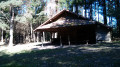
 Tourist office