Country:

 City:
City:


Park in the car park near the Villé Tourist Office. Feel free to pop in to ask for information about this route or find out about other itineraries.
(S/E) To start this route, head straight ahead onto Rue René Kuder, then turn left after the church onto Rue du Général Leclerc. This street climbs and takes you past the Villé nursery school.
Carry on straight ahead along the Promenade du Klosterwald, where you’ll cross a coach park. At the end of the car park, turn right onto Rue Bellevue and walk past the secondary school.
(1) Turn right to enter the forest and walk alongside a large fenced-off meadow. You are now following the Blue Ring–Yellow Ring markings. At the end of the meadow, you’ll come to a short but very steep climb marked with a Blue Cross. You’ll join a wide forest track.
(2) Take this path, keeping to your right. You’ll pass the Fontaine du Diable and continue following the Yellow Ring–Blue Cross markings.
(3) At the junction, take the path on the left, marked with a Yellow Ring and Blue Triangle. Continue straight on until you reach the edge of a clearing with a picnic area; at this point, turn left to reach a fork in the path.
(4) Turn right onto the forest track which climbs and is signposted with a Blue Saltire. Continue straight on until you reach the Col du Banc du Forestier.
(5) Turn left onto the path running behind the shelter. After fifty metres, take the path on the left, marked with a Yellow Rectangle and Yellow Diamond, which leads through a clearing beneath a high-voltage power line.
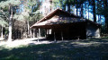
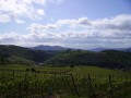
Follow the dual markings to the Belle-Vue gazebo. It’s all downhill from here. This path turns into a trail and takes you past the gazebo. It’s the ideal spot to have a snack and admire the view.
After the kiosk, you’ll begin a gentle descent.
(6) At the junction, carry on downhill by taking the path straight ahead. When you reach the second junction, you’ll climb slightly before arriving at a flatter section. At the third junction, keep to your left and follow the path downhill. Carry on straight ahead until you reach a small square.
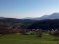
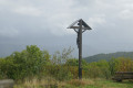
(7) Continue downhill, taking the path on your left. Further on, at the junction, turn left, leaving a wayside cross on your right, and start heading uphill. You are now above Bassemberg.
At the first junction, carry on straight ahead and at the second, keep to the right. You’re heading downhill again and will soon come across the Yellow Saltire signpost. You’ll reach a small square with a memorial stone and, on your left, a path leading into the forest.
(8) Follow this path until you reach a road in a housing estate, the Promenade de la Honel.
(9) Walk up this road on your left. At the top of the street, carry on straight ahead and enter the woods again. Take the first path you come to on your right and continue straight down until you reach the tarmac road near the Villé National Necropolis.
(10) Turn right, walk past the Necropolis and continue downhill to the junction with Rue Beau Site. Then walk down Rue Beau Site, turning left at a sharp bend.
At the bottom of this street, retrace your steps across the bus park, then carry on straight ahead, passing the school. At the church, turn right downhill to reach the Tourist Office car park (S/E).

 Tourist office
 Easy
Easy  Visorando Member