Country:

 City:
City:


Park in the car park at the junction of Faubourg Fauroeulx and Route de l’Étang, on the banks of the pond.
(S/E) As you leave the car park, turn left and head towards Porte Fauroeulx to enter the town. Go under the covered walkway on the left, reserved for pedestrians, at Porte Fauroeulx. Turn left before the tourist office. Take the path on the left that leads uphill to reach the ramparts. Turn left then right, go through the gate and enter the underpass. Opposite, return to the path and follow it to the left. You’ll reach the Tournefort Barracks (on your right) and the bandstand on Place du Jeu de Balle. Behind the bandstand stands the Château Marguerite de Bourgogne. Head towards the statue of the Lady with the Dogs
(1). Head down to the left along the ramparts. Note the Belgian Peace Garden on your right. Follow the path on the right and continue downwards. Turn right, cross a wooden footbridge and follow the tree-lined path. Walk to the left of the open-air theatre and the Wall of the Executed. At a fork in the road, veer left and admire the New Zealand Peace Garden on your right from above. Take the wooden footbridge on the right. Follow the stony path. Then turn left and note the entrance to the red-brick ‘Baudouin the Builder’ underground passage (inside, a manhole is covered with a grate). On emerging, turn left, then left again, and follow the dirt track (note the ‘Baudouin the Builder’ Tower on your left). Keep slightly to the right on the grassy path, then turn left into the entrance to the ‘phantom’ tunnel. Watch your head – Switch on your torch – You can walk along the ramparts to avoid this tunnel, which is the longest on the route.
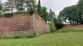
Turn left and follow the bend to the left to exit this tunnel. Head down to the right and return to the ramparts you have already passed through, then take the path on the left towards the rampart wall with an opening at the top of a flight of steps. Walk along the moat via the grassy path, cross a small wooden bridge, then a second one on the left. Take the stairs, enter the underground passage – a former system of sluice gates – and exit through the small door – watch your head – until you reach Rue Roger Salengro. Note the belfry opposite. Immediately take the staircase on the right – discover the hydrangea garden, walk alongside it, pass the two casemates bearing the date 1889 and arrive at the New Zealand Garden of Remembrance (New Zealand territory; memorial with a reading table.
(2) Take the brick-built underpass opposite – Watch your head – You’ve already passed close to this spot; go down the path on the right, carry on straight ahead; the path climbs slightly. When you emerge, you’ll be on Rue de la Libération; head across the road at the pedestrian crossing. Ignore the steps on the left (Étang du Fer à Cheval is on the left). Immediately turn left downhill (watch out for tree roots). Before the steps, take the underpass on the right (watch your head). When you emerge, follow the path to the left. Go down the steps on the right and follow theGR® andPR® signposted path. You’ll come to two casemate entrances: enter the left-hand casemate and turn left immediately once inside. On exiting, continue straight ahead along the path. At the junction, continue straight ahead along the path. At the end, turn right (on your right, the statue of the maiden at the Porte de Valenciennes). When you reach the cobbled road, head right towards the Porte de Valenciennes (FFI Monument).
(3) Cross the road and go down the steps on the left; you’ll be at the foot of the gate. Head straight on. Turn right before the Boulevard de la Comète and walk across the lawn between the fir trees behind the houses. Walk between the two mounds of earth and turn right. Enter the stone underpass on the left and go down the stairs; continue straight on towards the exit. As you come out, take the path on the left. At the foot of the rampart, you’ll see a gate directly in front of you; head towards it, go through (switch on your torch) and take the stairs. When you come out, turn right into the brick underpass dated 1832. Once you reach the back of Lowendal, turn left and head straight on towards the municipal library. Continue straight on along Rue Tour Clémence
(4). Cross Rue Victor Hugo at the pedestrian crossing and turn left. Cross Rue des Écoles at the pedestrian crossing, then pass through the Porte de La Flamengrie. Head down to the right into the ramparts. When you come to two staircases, take the one on the left. Pass under the arched passageway to reach the top of the ramparts. Turn right into the small brick-vaulted passage (on your right, you’ll see the pond and the Porte Fauroeulx). Turn left, then take the stairs on the left. At the top of the path, turn right. Exit onto Rue Léo Lagrange and follow it to the right to return to the starting point (S/E).

 AONB
AONB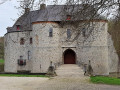
 Easy
Easy