


 Country:
 City:
City:


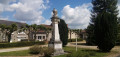
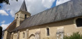
Park in the car park at Archigny Town Hall or at the nearby church. The start point (hiking sign) is at the west end of the church.
Yellow markings + directional signs (follow trail no. 5, ‘Le petit souper’)
(S/E) Head north, leaving the church on your left, and take Rue Charles Clerté. At a Fork in the road, keep left and head downhill.
(1) Cross Avenue des Gazillières on the left-hand side and walk past, on your left, a wash house, then a motorhome parking area. When the road bends to the left, turn right onto a shaded path. Pass a small pond on the left and walk gently uphill.
(2) At a crossroads (with an old house on the left), go straight on. Immediately, you’ll come to two roughly parallel paths: take the one on the right, which is grassy and shaded. You’ll emerge onto a small road; follow it to the left for about 250 metres.
Yellow + Red and White markings
(3) At the start of a gentle right-hand bend, leave the road and take a path on the left. Walk alongside a hedge on your left and a field on your right. At the end of the hedge, turn left and walk alongside a hedge on your right. Continue between two hedges. A very wet section (as of May 2025) can be bypassed by taking one of the two edges of the path. Continue along hedges or fields.
(4) At the end of the track, follow a road to the right. Pass the hamlet of La Raperie and you’ll soon reach a junction.
(5) Turn left onto a shaded path. Pass through another damp section, then head downhill.
(6) At a three-way junction, turn left. Shortly afterwards, ignore a path branching off to the left and turn right with the main path. Stay on the main path and head downhill, passing through more damp sections.
(7) Cross a stream and head uphill along a path overgrown with grass (as of May 2025). Further on, ignore a path on the left, pass a house on the right and continue along the tarmac road. Continue uphill and pass through the hamlet of Berthenoux.
Yellow + Blue + Red and White markings
Cross the D3 and continue opposite along a track towards La Traire.
Markings: Yellow + Blue
(8) Shortly afterwards, when the track turns left, there are two options:
- To avoid walking on paths overgrown with grass, continue left along the track and the GR®364, rejoining the main route at (9).
- Alternatively, as shown on the map, turn right onto a grassy, shaded path. At the first junction (signpost; elevation 130), go straight on. At the next junction, turn left.
Yellow + Blue + Red and White markings
(9) Further on, rejoin the track and follow it as it continues.
Yellow + Blue markings
After about 150 m, carry on straight ahead (let the GR® head off to the right). At the next junction (elevation 136), carry on straight ahead.
(10) You’ll come out onto a small road; follow it to the left (large wooden cross on the right-hand side). After about a hundred metres, turn right onto a path. Further on, ignore a path coming from the left. At the Fork in the road that appears immediately, keep to the right and pass a farm on your left.
(11) You’ll come out onto a small road; follow it to the right. After about 150 m, turn right onto a small, potholed road.
(12) At the entrance to a hamlet, turn sharply left and head downhill. At the T-junction, turn left. Shortly after passing an isolated house on the right-hand side, leave the road and take a stony track on the right. Walk past an old fountain.
(13) Walk straight through the hamlet of La Deballière and continue along a track. Head downhill, cross a stream and climb back up on the other side. Pass an old farmhouse on your right and, at a T-junction, turn left.
(14) At the junction, follow a small road to the left and head downhill. Stay on the tarmac, cross a stream and head back uphill. Pass by the foot of a cross and continue along the road.
(15) At the entrance to the hamlet of Boutigny, turn left onto a path that runs between two buildings. At a Fork in the road, keep to the right, walk alongside the buildings on your right and follow a shaded path not shown on the map. Further on, continue along the tarmac road, pass a small house on your right and head downhill.
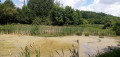
(16) At the bottom, cross the D3, follow it to the right and pass behind the crash barrier. Shortly afterwards, head down a path on the left (take care to spot this turn-off, marked by an arrow pointing ‘right’ for walkers heading in the opposite direction). Reach the far end of a pond.
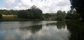
(17) Turn right and walk along the edge of the pond on your left. Then walk past a section of the pond set aside as a nature reserve, a reed bed, a second pond and, finally, a volleyball court.
(18) After passing some small buildings on the right-hand side, turn right onto a path that leads uphill. Cross the motorhome parking area seen at the start of the walk and leave the wash house, which you have also seen before, on your left.
Yellow markings
(1) At the Stop sign, turn right and head uphill. Ignore a street coming from the left and continue straight on along Rue Charles Clerté until you reach Archigny Church (S/E).


 Tourist office
 Easy
Easy 
 Visorando Member
 Association / Club / Walk leader
