Vermelles Ponds Route

A short family walk through the town and countryside

Details

58303847
Creation:
Last update:
Last review:
  • Walking
    Activity: Walking
  • ↔
    Distance: 4.00 mi
  • ◔
    Average duration: 1h 50 
  • ▲
    Difficulty: Easy

  • ⚐
    Back to start: Yes
  • ↗
    Ascent: + 26 ft
  • ↘
    Descent: - 26 ft

  • ▲
    Highest point: 135 ft
  • ▼
    Lowest point: 82 ft

Photos

Description of the walk

Park at Place de la République, between the town hall and the church in Vermelles.

(S/E) From the car park, go past the roundabout and head straight on along Rue Jean Jaurès until you reach Rue du Président Salvador Allende.

(1) Turn left onto this street, then right onto Rue Jean Jouhaux until you reach the junction.

(2) Turn carefully left onto Rue Florant Évard (D75) and, after 50 m, turn left onto Rue de la Liberté, continuing until you reach Rue Arthur Lamendin (D165e1).

(3) Cross the road carefully and, turning left then right, head straight on; then take the Ancien Cavalier on the left and follow it. At the junction, cross Rue Henri Duquesne and you will reach Rue Jules Guesde (D39).

(4) Continue straight ahead with care until you reach the next junction with a dirt track.

(5) Turn left, then cross Rue Voltaire and continue straight ahead along Chemin de Cuinchy. At the junction, cross the D75 carefully, pass under the power lines and continue to the next fork in the road.

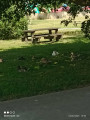
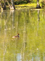
(6) Turn left towards the factory, then just before the entrance, keep left to go round the two ponds on the right-hand side until you reach the shelter.

(7) Continue to the right, pass under the power lines again and follow the road. At the bend, head straight on, passing under another power line, and join Rue du Marais.

(8) Go straight on; at the end of this street, turn left onto Rue de Montpellier, then, at its end, first turn right then left carefully and head for Rue Jean Jaurès opposite and the original junction.

(1) Continue straight ahead, go past the roundabout and return to the car park (S/E).

Waypoints

  1. S/E : mi 0 - alt. 108 ft - Place de la République - Église Saint-Pierre (Vermelles)
  2. 1 : mi 0.07 - alt. 102 ft - Rue du Président Salvador Allende
  3. 2 : mi 0.37 - alt. 98 ft - Crossroads
  4. 3 : mi 0.9 - alt. 135 ft - Rue Arthur Lamendin - Cimetière militaire britanique (Vermelles)
  5. 4 : mi 1.74 - alt. 128 ft - Rue Jules Guesde
  6. 5 : mi 1.95 - alt. 121 ft - Dirt track
  7. 6 : mi 2.51 - alt. 92 ft - Chemin de Cuinchy junction
  8. 7 : mi 3.1 - alt. 82 ft - Shelter
  9. 8 : mi 3.47 - alt. 89 ft - Rue du Marais. Near the - Surgeon (rivière) - Affluent du canal d'Aire
  10. S/E : mi 4 - alt. 108 ft - Place de la République - Église Saint-Pierre (Vermelles)

Notes

Toilets and picnic facilities at the Étangs de Vermells. No drinking water available.

Worth a visit

Reviews and comments

4.5 / 5
Based on 2 reviews

Reliability of the description
4.5 / 5
Ease of following the route
5 / 5
Route interest
4 / 5
Jls62
Jls62

Overall rating : 4.7 / 5

Date of your route : Aug 26, 2024
Reliability of the description : ★★★★★ Very good
Ease of following the route : ★★★★★ Very good
Route interest : ★★★★☆ Good
Very busy route : Yes

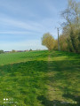
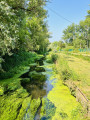
A route through fields, meadows and a landscaped marsh, starting and finishing in the town centre. A well-maintained path.

Machine-translated

Syned 26
Syned 26

I try to include as much information as possible; it’s true that sometimes you can’t see the street signs, but if you follow the map – which is straightforward – there’s no problem

Machine-translated

Syned 26
Syned 26

Thank you all

Machine-translated

Alain Trouillez
Alain Trouillez

Overall rating : 4.3 / 5

Date of your route : Aug 08, 2024
Reliability of the description : ★★★★☆ Good
Ease of following the route : ★★★★★ Very good
Route interest : ★★★★☆ Good
Very busy route : No

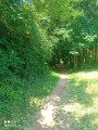
A varied, enjoyable route that isn’t monotonous, taking you through fields, along a lovely shaded bridle path and past ponds. Blackberries. We did this walk between midday and 1 pm on Thursday 8 August 24 and so didn’t come across any other walkers. It’s a shame that most of the street names are missing, but fortunately the map is very clear and makes it easy to find your way around.
Thanks to whoever created this route.

Machine-translated

Other walks in the area

For more walks, use our search engine .

The GPS track and description are the property of this route's author. Please do not copy them without permission.