Country:

 City:
City:


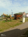
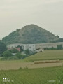
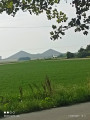
Start from the sports hall car park at the junction of Avenue de Paris and Avenue de Rome.
(S/E) Turn right as you leave the car park and ignore two junctions until you reach Rue de Londres.
(1) Turn right onto Rue de Londres, then take Avenue de Bruxelles. At the end, turn right onto Rue des Résistants and continue straight on. Go past the fourth junction and look for a path on the left.
(2) Follow this path until you reach a Fork in the road.
(3) Turn right to return to Rue des Résistants.
(4) Cross the road, then turn left and take the first right onto the path, then left, until you reach Rue de Cuinchy.
(5) Turn left, then immediately right, then first turn right then left, and follow the path until you reach an acute-angled fork to the right.
(6) Turn off here and go straight on until you reach Rue Jules Guesde.
(7) Cross the road and head opposite, then carry on straight on until you reach Rue Henri Duquesne. Cross the road and continue along the road until the next Fork in the road.
(8) Turn right, then left, and take Rue de la Liberté on the right until it ends.
(9) Turn right, then immediately left onto Rue de la Vignette, then right onto Rue Casimir Beugnet until you reach Rue Florent Evrard.
(10) Turn left and, at the roundabout, turn left onto Rue de Montpellier. Cross the Surgeon and continue to Rue du Marais.
(11) Turn left and carry on straight ahead until you reach the roundabout. Go straight across and follow the path, which, further on, turns 180° (caution: dangerous crossing). Continue to the next junction.
(12) Go straight ahead, then turn right onto Rue de la Fontaine de Bray. At the roundabout, go straight ahead (cross with care). Continue to the next roundabout.
(13) Turn right, then carry on straight ahead to reach the car park (S/E).
 Association / Club / Walk leader
 Easy
Easy 
 Visorando Member