The Squirrel Route in Saint-Barthélemy

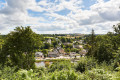
As you explore the commune of Saint-Barthélémy, you’ll discover numerous streams, healing fountains and charming little villages built of granite. Among them are Saint-Guen and its chapel, rebuilt in the 18th century, the ruins of the Kercadio mill, and the fountain and washhouse at Saint-Fiacre. On arrival, the lake will offer you a well-deserved moment of relaxation.

Details

105945377
Creation:
Last update:
Last review:
  • Walking
    Activity: Walking
  • ↔
    Distance: 7.22 mi
  • ◔
    Average duration: 3h 45 
  • ▲
    Difficulty: Moderate

  • ⚐
    Back to start: Yes
  • ↗
    Ascent: + 456 ft
  • ↘
    Descent: - 459 ft

  • ▲
    Highest point: 358 ft
  • ▼
    Lowest point: 108 ft

Description of the walk

(S/E) From the Town Hall car park, take Rue de la Mairie (D203) to the left, then left again onto Rue de Libihan.

(1) At the bend, leave the road, follow the fence and enter the small copse. After crossing it, turn left at the end of the path and continue left along the road to the hamlet of Bodrain.

(2) You will then come to a thatched-roof house. Turn right twice until you reach the road.

(3) Follow it to the left, then turn right to pass in front of the fountain and the chapel of Saint-Guen, first built at the end of the14th century and then restored from its ruins in 1974 by the village’s residents.

(4) Carry on, then keep left, then right, and left again twice. Take the first path on the right towards Kerluern. Turn left onto a wide path, then enter the woodland. A footbridge takes you across the Ruisseau de Guervaud. Continue on to the D142 road.

(5) Caution: dangerous stretch: at the wayside cross, follow the departmental road to the right, then take the road on the left towards Talhouët-Kergouav. Then turn sharply left until you reach the hamlet.

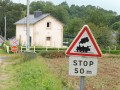
(6) Take a road on the right, followed by a track, then a road on the right which leads to the Tréblavet level crossing guard’s house.

(7) Turn left immediately after the level crossing. After following the railway line, cross it and the Ruisseau du Guervaud. Continue for 300 metres and turn left. The stream will then accompany you to the village of Le Resto.

(8) Carry on straight ahead, then, taking a left-right turn, cross Rue de la Poste. At the next road, turn right then left and join another road.

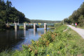
(9) At a place called Penpoul, head down to the left towards the D142 county road. Follow it to the left for 50 metres and cross it. Follow a path that branches off to the left to the lake.

(10) Cross the bridge over the lake, turn left then right, and take the tarmac road which takes you back to the starting point (S/E).

Waypoints

  1. S/E : mi 0 - alt. 302 ft - Marie - Église Saint-Barthélemy (Saint-Barthélemy)
  2. 1 : mi 0.41 - alt. 295 ft - Bend
  3. 2 : mi 1.18 - alt. 282 ft - Bodrain
  4. 3 : mi 1.72 - alt. 322 ft - Route
  5. 4 : mi 2.04 - alt. 358 ft - Saint-Guen
  6. 5 : mi 3.12 - alt. 262 ft - Route
  7. 6 : mi 3.74 - alt. 266 ft - Kergouav
  8. 7 : mi 4.58 - alt. 121 ft - Tréblavet level crossing
  9. 8 : mi 5.68 - alt. 256 ft - The Restaurant
  10. 9 : mi 6.46 - alt. 312 ft - Penpoul
  11. 10 : mi 6.98 - alt. 262 ft - Lake
  12. S/E : mi 7.22 - alt. 302 ft - Marie - Église Saint-Barthélemy (Saint-Barthélemy)

Notes

Public toilets in the village of Saint-Barthélemy (between the mini-market and the bakery); car park at the Town Hall.

Motorhome service area at the lake car park.

Worth a visit

- Saint-Guen Chapel and fountain.

The Chapel of Saint-Guen has a dual dedication: it honours both Saint-Guen and Saint-Méen, the patronage of the latter of whom seems to have become predominant today. Dating from the late14th or early15th century, only the south door remains, featuring a pointed arch with jambs adorned with small columns and capitals. The building as a whole was probably rebuilt in the first half ofthe 17th century. The bell turret dates from the late19th century. In 1974, the chapel was restored: the roof structure and roofing were rebuilt, and the gables, which had originally been left uncovered, were raised and roofed over.

- Ruins of the Kercadio mill.

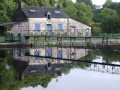
Further along the village, you can explore the ruins of an old watermill, a discreet yet evocative remnant of rural life in days gone by. The streams and granite-built villages offer a peaceful setting steeped in history.

- Saint-Fiacre fountain and washhouse.

Near Saint-Fiacre Chapel (to the north), the fountain and its adjoining washhouse date fromthe 17th century. Built of cut stone, the gable wall is decorated with a chalice and a shell motif. The washhouse’s rectangular basin is distinguished by its monolithic slabs. This simple but well-preserved site bears witness to a long-standing community tradition

- Communal lake.

At the end of the walk, you will come to a communal lake: a small, tranquil body of water, perfect for taking a break and enjoying the peace and quiet of the surroundings after exploring the nearby sites.

Other walks in the area

For more walks, use our search engine .

The GPS track and description are the property of this route's author. Please do not copy them without permission.