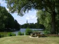
Denazé route

The Denazé route will take you on a tour of the Craon region, taking in small country lanes and a section of the old railway line, which has now been converted into a greenway.

Details

n°271040
Creation:
Last update:
Last review:
  • Walking
    Activity: Walking
  • ↔
    Distance: 5.36 mi
  • ◔
    Average duration: 2h 35 
  • ▲
    Difficulty: Easy

  • ⚐
    Back to start: Yes
  • ↗
    Ascent: + 108 ft
  • ↘
    Descent: - 108 ft

  • ▲
    Highest point: 269 ft
  • ▼
    Lowest point: 194 ft
  • ⚐ Country: France
  • ⚐ City: Denazé (53400)
  • ⚑
    Start/End: N 47.885348° / W 0.887258°
  • ❏
    IGN map(s): Ref. 1419SB, 1420SB
  • Hour-by-hour weather

Description of the walk

(S/E) Start from the church square in Denazé.

With your back to the church, cross the main street and head westwards opposite to take a green path (not shown on the map). After 100m, you’ll reach a tennis court; turn right and follow the grassy path for about 300m. You’ll then come out onto a tarmac road (D602). Turn left to reach the junction before the cemetery (signposted D128 Craon 6km).

(1) Turn right onto the D128 and continue straight on for about 950 metres until you reach the hamlet known as Le Verger.

(2) Turn right onto the C7 towards Athée. Follow this road for about 900 metres until you reach a junction with the Laval-Renazé Greenway (blue signs).

(3) Turn left onto the cycle route and follow it for 1.3 km until you reach the third junction.

(4) Then turn left onto a small tarmac road and follow it for almost 500m until you reach the first junction on the left.

(5) Turn left onto a small tarmac road and continue straight on along it for about 1.5 km. You will then reach a junction with a small tarmac road; opposite, slightly to the right, is a grassy path lined with trees.

(6) Take this path. After about 200 metres, at a three-way junction, take the left-hand path and follow it for about 600 metres until you reach a junction with a tarmac road.

(7) Turn left onto this road and continue straight on for 1.2 km. You will then reach a junction with another tarmac road.

(8) Turn right and carry on straight ahead for about 1 km to reach the village of Denazé and the church (S/E).

Waypoints

  1. S/E : mi 0 - alt. 269 ft - Denazé Church
  2. 1 : mi 0.34 - alt. 253 ft - Turn right onto the D128 before the cemetery
  3. 2 : mi 0.93 - alt. 230 ft - Turn right onto the C7 towards Athée
  4. 3 : mi 1.5 - alt. 226 ft - Turn left onto the Laval-Renazé cycle route
  5. 4 : mi 2.3 - alt. 194 ft - Turn left at the third junction with the cycle path
  6. 5 : mi 2.59 - alt. 210 ft - Take the first left after the cycle path
  7. 6 : mi 3.51 - alt. 259 ft - Cross over to the grassy path opposite
  8. 7 : mi 3.99 - alt. 249 ft - Turn left at the end of the track.
  9. 8 : mi 4.74 - alt. 220 ft - At the junction, turn right towards the village
  10. S/E : mi 5.36 - alt. 269 ft - Denazé Church

Notes

You can park in the town hall car park on Route de la Chapelle Craonnaise.

Reviews and comments

4.7 / 5
Based on 1 review

Reliability of the description
5 / 5
Ease of following the route
5 / 5
Route interest
4 / 5
Ledoux michel
Ledoux michel

Overall rating : 4.7 / 5

Date of your route : Sep 25, 2017
Reliability of the description : ★★★★★ Very good
Ease of following the route : ★★★★★ Very good
Route interest : ★★★★☆ Good

The route is accessible to wheelchair users.

Machine-translated

Other walks in the area

For more walks, use our search engine .

The GPS track and description are the property of this route's author. Please do not copy them without permission.