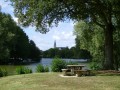
Margué Route

The Margué route offers a pleasant walk through the countryside around Laigné in southern Mayenne.

Details

n°200708
Creation:
Last update:
Last review:
  • Walking
    Activity: Walking
  • ↔
    Distance: 6.48 mi
  • ◔
    Average duration: 3h 05 
  • ▲
    Difficulty: Average

  • ⚐
    Back to start: Yes
  • ↗
    Ascent: + 108 ft
  • ↘
    Descent: - 115 ft

  • ▲
    Highest point: 312 ft
  • ▼
    Lowest point: 220 ft
  • ⚐ Country: France
  • ⚐ City: Laigné (53200)
  • ⚑
    Start/End: N 47.83356° / W 0.79441°
  • ❏
    IGN map(s): Ref. 1420SB
  • Hour-by-hour weather

Description of the walk

Access: From Laigné, head towards Château-Gontier via the D 22. After about 2 km, turn right to reach the Moulin de Margué.

(S/E) Set off from the Moulin de Margué heading east towards La Dauderie for about 400 m until you reach a crossroads. Turn left, continue for 60 m, then turn right onto the dirt track which, after 1 km, leads onto a small road at the hamlet of La Guineberdière on the left.

(1) Turn slightly to the right and continue for 500 m until you reach a crossroads.

(2) Turn right and continue along this road for 1.5 km until you reach a junction where the road meets a dirt track on the left.

(3) Turn left onto the track running alongside the trees and follow it all the way to the end (approximately 800 m) until you come out onto a small tarmac road at a bend. Carry on straight ahead along the road and follow it to the next junction. There, turn left towards the east onto the D 114 (be careful, as vehicles travel at high speed), go for 250 m and turn right onto the grassy, tree-lined track heading south-west. Follow the track all the way to the end. This joins a small tarmac road at a place called Saint-Denis. Carry on until you reach the junction with a wayside cross on the left.

(4) At the wayside cross, turn right and continue along this road for about 900 m until you reach the junction with the dirt track.

(3) Turn left towards the hamlet of Loge Coucou (white sign), continue for about 300 m along the road until you reach the buildings, then turn left onto the farm track. Continue along this track for 800 m until you reach a three-way junction in a bend.

(5) Take the path on the left, then carry on straight ahead to rejoin the tarmac road. At the road, turn left and continue along this road for 1 km, passing Les Hulairies (on the right) and Launay (on the left), until you reach a junction.

(6) Turn right and pass by the Métairie de Margué to return to the Moulin de Margué (S/E).

Waypoints

  1. S/E : mi 0 - alt. 226 ft - Moulin de Margué
  2. 1 : mi 0.95 - alt. 295 ft - La Guineberdière
  3. 2 : mi 1.28 - alt. 308 ft - Turn right at the junction
  4. 3 : mi 2.26 - alt. 302 ft - Loge Coucou
  5. 4 : mi 3.86 - alt. 299 ft - Calvary
  6. 5 : mi 5.08 - alt. 295 ft - Turn left at the three-way junction
  7. 6 : mi 5.88 - alt. 266 ft - On the right, at the crossroads
  8. S/E : mi 6.48 - alt. 226 ft - Moulin de Margué

Reviews and comments

4.3 / 5
Based on 2 reviews

Reliability of the description
5 / 5
Ease of following the route
5 / 5
Route interest
3 / 5
User 12632418

Overall rating : 4.3 / 5

Date of your route : Aug 18, 2026
Reliability of the description : ★★★★★ Very good
Ease of following the route : ★★★★★ Very good
Route interest : ★★★☆☆ Average
Very busy route : No

An easy route through the Mayenne countryside.
There isn’t much traffic on the few roads you need to take.
I agree with Klodius’s comment that he met a “local who was rather taciturn and unemotional”; for my part, I also came across two people who didn’t even deign to reply to my ‘hello’...
We don’t go hiking to socialise, but a bit of politeness is the least one can expect...

Machine-translated

Klodius
Klodius
• Edited:

Overall rating : 4.3 / 5

Date of your route : Mar 04, 2018
Reliability of the description : ★★★★★ Very good
Ease of following the route : ★★★★★ Very good
Route interest : ★★★☆☆ Average

A very easy route, much of it along paths that were partly muddy (which is to be expected after the rainy season), and very convenient as our dog was off the lead.
No other walkers at this time of year despite the fine weather; few points of interest, just a few friendly horses that came to meet our dog, and a fine bull. The listed mill either doesn’t exist or is very well hidden!
We met a local who was rather taciturn and unemotional… with his lovely Malinois near an abandoned farm, and in a meadow next to the path there was a magnificent bull.

Machine-translated

Other walks in the area

For more walks, use our search engine .

The GPS track and description are the property of this route's author. Please do not copy them without permission.