Country:
 City:


Car park between the church and the Town Hall.
(S/E) Walk round the church, passing in front of the entrance, then turn left and head down Rue du Val-Fleuri for about 150m.
(1) At the junction, take Rue Creuse on the left; it is tarmac-surfaced at the start before becoming a shaded path. Continue along this path; at the first junction, carry straight on.
(3) At the second junction, under the trees, take the path on the left running alongside the Ruisseau d’Oliveau. Continue straight on along this path, which remains shaded for a long stretch.
(3) At the T-junction, opposite the entrance to a property called “Le Parc”, turn right onto the tarmac road. At the junction where four roads meet, turn left towards the east, then, after 100 metres, go round the houses opposite you on the right to reach the towpath.
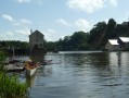
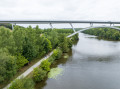
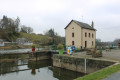
(4) Turn left to follow the “Chemin de halage Sud” (Southern towpath) along the River Mayenne, heading towards the dam, the lock and the restaurant “La Crêperie du Moulin de Neuville”. Continue along this towpath; about 400 metres from the restaurant you’ll come across some old fish spawning grounds, marked by an information board, then about 1.8 km further on you’ll see, on your left in the meadows, an alpaca farm – this is ‘La Chalopinière’ farm. You’ll arrive at the Rongère Mill and Lock.
(5) Just after the lock, leave the towpath and take the road on the left. As you go up this road, you’ll see the Château de la Rongère on your right, then on your left the path leading to “La Chalopinière” farm, the alpaca farm.
(6) At the junction, take the road on the left; this road turns into a track after you pass a beautiful manor house, L’Hermitage, on your left. Continue straight on along this track. At the next junction (a tarmac road leading to a house), turn right.
(7) At the crossroads, take the road on the left; then, 200 metres further on at the next junction, take the road on the right. This road becomes a track after you pass the entrance to the “La Haute Chesnière” property on your right. Continue straight ahead; after a stretch under the trees, turn right between several houses.
(3) At the next crossroads, you’ll find yourself in front of the entrance to the “Le Parc” property, which you passed on the way there. Take the track on the right and, after about 400 metres, take the track on the left. A right-hand bend, then a left-hand bend (with a private property on your right) and finally a straight stretch.
(8) At the crossroads, take the road on the right and, at the next junction 150 metres further on, go straight ahead.
(9) The road takes a 90° bend to the left; go straight on along the path in front of you. Continue straight on.
(2) Return to the path and Rue Creuse that you took on the way there. Walk up Rue du Val-Fleuri, which you also took on the way there. When you get near the church, go round it on the right to return to the car park (S/E).

 A lovely route, with a stunning view of the Château de la Rongère. A surprise encounter with the alpaca farm. The Neuville mill is a truly beautiful spot.
 Tourist office


 Moderate