Route des boutons d'or à Prisches

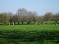
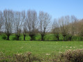
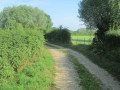
This family-friendly route through the hedgerow countryside is easy. It runs alongside country hedgerows and streets lined with traditional houses. As you wind your way along the paths, small heritage sites and local place-names evoke the legends of the Avesnois region.

Details

1548293
Creation:
Last update:
Last review:
  • Walking
    Activity: Walking
  • ↔
    Distance: 5.10 mi
  • ◔
    Average duration: 2h 30 
  • ▲
    Difficulty: Easy

  • ⚐
    Back to start: Yes
  • ↗
    Ascent: + 131 ft
  • ↘
    Descent: - 131 ft

  • ▲
    Highest point: 650 ft
  • ▼
    Lowest point: 509 ft

Photos

Description of the walk

Starting point: Saint-Nicolas Church.

(S/E) Head north-west along Rue de la Mairie and cross the D964. First turn left then right onto Ruelle Jean Thomas. Cross a stream and emerge onto Rue des Eaux; follow it to the right. Take the first left onto Ruelle Jean Philippe.

(1) At the next junction, turn right onto Rue du Campeau. After the hamlet of Le Campiau, pass under a high-voltage power line.

(2) When you reach the first houses on the left, turn left onto Chemin des Longues Bornes. At a Fork in the road, continue straight ahead (north-north-west; ignore the path branching off to the right).

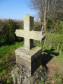
(3) At the foot of a hedge stands the Croix Vendois. Continue along the path, which soon turns to the right. Stay on the path, heading north-north-west then north-west.

(4) At the junction, turn right (Chemin des Carrettes). Carry straight on, ignoring the crossroads, until you reach the D117.

(5) Follow the D117 to the right and pass through the hamlet of Les Linières.

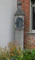
(6) At the junction, turn right onto the D964. At the wayside shrine, turn left into Rue du Rejet de Bourdiau.

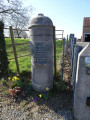
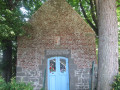
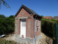
(7) At the junction, turn right. At the oratory (1776), turn right again. Walk past the football ground and then take the first right, Rue de la Mairie, to return to the car park (S/E).

Waypoints

  1. S/E : mi 0 - alt. 597 ft - Église Saint-Nicolas (Prisches)
  2. 1 : mi 0.4 - alt. 600 ft - Crossroads
  3. 2 : mi 1 - alt. 623 ft - Chemin des Longues Bornes
  4. 3 : mi 1.45 - alt. 630 ft - Vendois Cross
  5. 4 : mi 2.21 - alt. 522 ft - Chemin des Carrettes
  6. 5 : mi 3.09 - alt. 512 ft - D117 road
  7. 6 : mi 4.01 - alt. 636 ft - D117 road × D964 road
  8. 7 : mi 4.63 - alt. 646 ft - Junction
  9. S/E : mi 5.1 - alt. 597 ft - Saint-Nicolas Church. Near the - Rivérette (rivière) - Affluent de la Sambre

Notes

Route listed in the PDIPR (Departmental Plan for Walking and Hiking Routes)

Follow the yellow markings.

Worth a visit

Croix Vendois (3). A man from Prischois, a basket-maker by trade, is said to have come to the aid of a herdsman who had been struck dead by lightning during a violent storm; having hoisted him onto his back, he carried him back to the man’s home, where his entire family was present, yet they did not deign to thank their saviour. Deeply affected by such a lack of gratitude, the rescuer had a cross erected at the very spot where the accident occurred, bearing the date of the event and a rather unflattering inscription.

Linières, after (5). Odran, Lord of Chimay, was pursuing a stag when the animal sought refuge beneath the cloak of Saint Humbert, who was clearing the land for the construction of his monastery at Maroilles. The pack of hounds could not pounce on the stag, as if held back by a supernatural force. Seeing this, Odran asked to be admitted among the monks and donated his villa at Lignières to the abbey; it became known as the ‘Cense des Pauvres’ or the ‘Linières farm’.

Reviews and comments

4.3 / 5
Based on 3 reviews

Reliability of the description
4.3 / 5
Ease of following the route
4.7 / 5
Route interest
4 / 5
User 10851526

Overall rating : 4 / 5

Date of your route : Dec 01, 2025
Reliability of the description : ★★★★☆ Good
Ease of following the route : ★★★★☆ Good
Route interest : ★★★★☆ Good
Very busy route : No

This route has the merit of allowing you to discover the Avesnois bocage and its diverse landscape, fauna and flora – it's a shame that it isn't promoted more.
Unfortunately, the last two kilometres are too busy with traffic.
Best to do this in spring, as after a period of rain the paths are muddy and very wet.

Machine-translated

CHRISTINE THIERY
CHRISTINE THIERY

Overall rating : 4.3 / 5

Date of your route : Sep 08, 2024
Reliability of the description : ★★★★☆ Good
Ease of following the route : ★★★★★ Very good
Route interest : ★★★★☆ Good
Very busy route : No

A VERY ENJOYABLE, EASY AND VERY WELL-SIGNPOSTED ROUTE. WORTH DOING AGAIN IN THE SPRING

Machine-translated

AK
AK

Overall rating : 4.7 / 5

Date of your route : Mar 31, 2024
Reliability of the description : ★★★★★ Very good
Ease of following the route : ★★★★★ Very good
Route interest : ★★★★☆ Good
Very busy route : No

A lovely family walk through the pastures of Thiérache. This route is scenic and easy to follow, with no difficulty at all. Do make sure, however, to wear suitable footwear depending on the weather – particularly in case of rain (as some sections can be muddy). A short section of the walk is along a road, but as there is little traffic, this shouldn’t pose any particular problems.

Machine-translated

Other walks in the area

For more walks, use our search engine .

The GPS track and description are the property of this route's author. Please do not copy them without permission.