


 Country:
 City:
City:


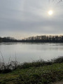
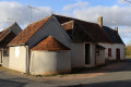
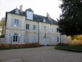
Parking available in the church square, near the château.
The route is marked in blue.
(S/E) Leaving the car park, head north-west, cross the D14 and then take the Route du Cimetière. Turn right onto the Route du Champ de Foire. When you reach the municipal stadium, turn left onto the path between the cemetery and the stadium, then turn right onto a track that goes round the stadium until you reach the D918.
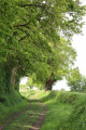
(1) Turn left onto the Chemin du Meez and follow it until you reach a small road at this hamlet, ignoring the side paths on either side of the main track.
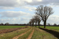
(2) Turn right, then after 300 metres, take a grassy track to the left, then right. Walk along the right-hand side of a private pond, then turn left to join a small road, which you should take on the left.
(3) Cross the D14 carefully and continue straight on along a track.
(4) At the next junction, follow the blue signposting to the left to reach Les Brandes, ignoring the yellow signposting straight ahead. The path to Les Brandes becomes a small road. Follow it to the junction with the D38.
(5) Cross the D38, continue straight ahead along a track, then turn left to join the D49 (altitude 199m). Continue straight ahead along the small road towards Les Villaziers. After 200m, leave the road as it turns right and take the access path running alongside the Étang du Bourg.
(6) At the exit barrier, turn left onto the Route de l’Étang as far as the water tower.
At the Stop sign, turn left then right to join the D918. Cross it carefully.
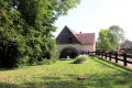
(7) Enter the park behind the village hall, where you’ll find a beautiful, renovated wooden market hall.
Walk through the park to reach Route de la Roacherie, which you should take on the left. Continue straight ahead at the next junction, leaving Rue du Vieux Four on your right.
(8) When you reach the D14 (Route de Lignières), turn left to rejoin the D918. Cross it carefully and take Rue du Commerce opposite, then turn right towards the castle to return to the starting point (S/E).

 Visorando Member
 Moderate
 Association / Club / Walk leader
