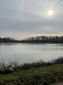
A walk in Verneuil-sur-Igneraie, from the Vallée Noire to its traditions

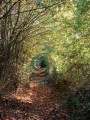
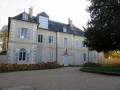
The hilltop village of Verneuil-Sur-Igneraie overlooks the Igneraie valley. This walk allows you to explore the surrounding countryside, offering a magnificent panorama of the Vallée Noire, a name straight out of the imagination of the writer George Sand. Here you’ll discover the Château du Petit Coudray, a beautiful manor house whose garden was the setting for the meeting between George Sand – then known as Aurore Dudevant – and Jules Sandeau, who would go on to encourage her talents as a writer. In the village, you’ll also find the historic potteries of the Vallée Noire.

Details

n°28744227
Creation:
Last update:
Last review:
  • Walking
    Activity: Walking
  • ↔
    Distance: 7.92 mi
  • ◔
    Average duration: 4h 05 
  • ▲
    Difficulty: Moderate

  • ⚐
    Back to start: Yes
  • ↗
    Ascent: + 518 ft
  • ↘
    Descent: - 548 ft

  • ▲
    Highest point: 837 ft
  • ▼
    Lowest point: 610 ft

Photos

Description of the walk

The starting point is at the cemetery car park.
Follow the yellow markings.

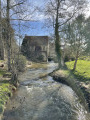
(S/E) Walk alongside the D69 to reach the church, then the town hall. Continue for 100 m and go down the grassy path on the left. At the bottom of the descent, walk alongside the Igneraie towards the east to reach a rest area.

(1) Take the small road on the left and carry on straight ahead to the entrance to the Orsan farm.

(2) Go up the small road on the left and pass the Petit Villette.

(3) Ignore the track on the left towards Vieille Guerre and carry on straight ahead along a farm track.

(4) At the crossroads, follow the road to the left. Take a track to the right and, 250 m further on, turn left onto a path that runs alongside a coppice. Take the road to the right again.

(5) At Gué de Vèvre, after crossing the bridge over the Igneraie, take the road to the right for 100 m, then follow the grassy track to the right. At the next Fork in the road, go through the gate on the left and head up the tree-lined track.
Once past another gate, turn left to reach the Château du Petit Coudray.

(6) With your back to the château, follow the small road until you reach the D69. Follow it carefully to the left as far as the entrance to the village of Verneuil, then head down a path on the right. Continue along the edge of the Bois des Tailles.

(7) When you reach the wash house and the picnic area, take the road on the left to return to the village and follow the D69 to the right. Pass the old pottery works, then, at the Fork in the road, turn right onto Rue des Varennes.

(8) Turn right onto Rue des Petits Prés. Pass a housing estate on your left and carry on straight ahead along a farm track. At the next junction, turn left and follow the grassy track until you reach a small road.

(9) Turn left and carry on straight ahead at the next junction. In Les Loges, turn right and follow the tarmac section, which later becomes a track suitable for vehicles.

(10) Turn right onto a farm track, then, at the T-junction, turn left. At the crossroads, carry on straight ahead to reach the hamlet of La Colterie.

(11) In the hamlet, leave the road on your left and theGRP® on your right, and head straight down a track.
Cross the D69 carefully and continue down the path opposite. At the next junction (elevation 192), take the path leading uphill opposite, then follow the small road to the right.

(1) Once past the cross, turn left and retrace your steps along the path you took on the way out to return to the D69, then turn right towards the town hall, the church and the cemetery car park (S/E).

Waypoints

  1. S/E : mi 0 - alt. 787 ft - D69, cemetery car park
  2. 1 : mi 0.64 - alt. 617 ft - Rest area
  3. 2 : mi 1.04 - alt. 679 ft - Turn-off towards Le Petit Villette
  4. 3 : mi 1.5 - alt. 627 ft - Go straight on, leaving La Vieille Guerre on your left
  5. 4 : mi 2.15 - alt. 699 ft - Road junction
  6. 5 : mi 2.77 - alt. 627 ft - Vèvre ford
  7. 6 : mi 3.46 - alt. 791 ft - Le Petit Coudray
  8. 7 : mi 4.07 - alt. 778 ft - Washing house
  9. 8 : mi 4.63 - alt. 823 ft - Rue des Petits Prés
  10. 9 : mi 5.49 - alt. 810 ft - Turn left
  11. 10 : mi 6.04 - alt. 823 ft - Junction on a farm track
  12. 11 : mi 6.62 - alt. 797 ft - La Colterie
  13. S/E : mi 7.92 - alt. 787 ft - D69, cemetery car park

Notes

Make sure you wear sturdy footwear: the ground surfaces vary and, depending on the season, some farm tracks can be very muddy.

Worth a visit

  • Château du Coudray: it was at this château that Jules Sandeau and George Sand first met.

https://www.pays-george-sand.com/decouvr…

  • Saint-Hilaire Church:

https://www.patrimoine-religieux.fr/egli...

  • Poteries de la Vallée Noire: during the 19th and early 20th centuries, the village was a major centre for the production of roof tiles, ceramics and pottery, with up to 19 workshops in the village. As late as the 1900s, new workshops were still being built; the products were transported by cart to Nohant-Vic station, on the line from Châteauroux to Montluçon. Artistic pottery is the last remnant of this industry.
  • The villages of Saint-Chartier and Nohant-Vic (Gorge Sand estate).

Reviews and comments

5 / 5
Based on 1 review

Reliability of the description
5 / 5
Ease of following the route
5 / 5
Route interest
5 / 5
JmSD
JmSD
• Edited:

Overall rating : 5 / 5

Date of your route : Jan 01, 2024
Reliability of the description : ★★★★★ Very good
Ease of following the route : ★★★★★ Very good
Route interest : ★★★★★ Very good
Very busy route : No

A route that showcases all the beauty of the Black Valley.
Best done in the afternoon so you arrive at sunset; a truly regal way to round off the year.
A short climb halfway along the route offers a magnificent view.
I highly recommend this walk in the footsteps of George Sand.

Machine-translated

Other walks in the area

For more walks, use our search engine .

The GPS track and description are the property of this route's author. Please do not copy them without permission.