Route de découverte de La Berthenoux

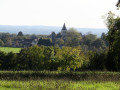
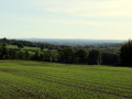
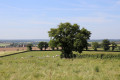
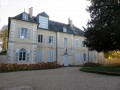
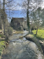
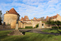
This walk takes you along the small roads and paths around the village of La Berthenoux, situated in the south-east of the Indre department, in the region associated with George Sand, allowing you to discover the area’s heritage and the beautiful views of the Igneraie valley.

Details

846204
Creation:
Last update:
Last review:
  • Walking
    Activity: Walking
  • ↔
    Distance: 5.33 mi
  • ◔
    Average duration: 2h 40 
  • ▲
    Difficulty: Easy

  • ⚐
    Back to start: Yes
  • ↗
    Ascent: + 233 ft
  • ↘
    Descent: - 217 ft

  • ▲
    Highest point: 876 ft
  • ▼
    Lowest point: 676 ft

Photos

Description of the walk

Car park and bus stop at Place de l’Église.
Follow the blue markings. For part of the route, these merge with the red and yellow markings ofthe GRP® ‘Sur les Pas des Maîtres Sonneurs’ trail.

(S/E) Take the D72 westwards, towards Verneuil, as far as the Chapelle de la Bonne Dame and its wash house, temporarily leaving the path you are following on your left.

(1) Retrace your steps for a few dozen metres to rejoin the aforementioned path (blue markings andGRP®), pass a wayside cross and then head back down until you reach the D72. Cross a bridge and then take the small road on the right towards Les Ginets.

(2) At the bend, continue along the road to the right, leaving theGRP® path straight ahead.

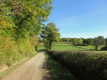
(3) At Les Ginets, take the first street on the right and continue along the wide, carriageable track. Ignore the side paths and follow the blue markings to reach the hamlet of Les Méz. The track becomes a small road.

(4) At the junction, turn right and head for the hamlet of Bretagne.
On leaving the village, turn right, cross a bridge, carry on straight ahead at the next junction and reach the D68.

(5) Cross the departmental road carefully and carry on straight ahead. Pass “Les Bergeries” on your left and continue to the next junction.

(6) Turn right and pass through the hamlet of Les Hérauts. In the bend as you leave the hamlet, the road becomes a track.

(7) Follow the first track on the right, which descends to the Bergeries stream and then climbs back up to the football pitch. Cross the D68a and take the farm track opposite, continuing to the next junction.

(8) Turn onto the road on the right. You will then come across theGRP® signpostingagain. Turn into the first street on the right. After the last house, turn left onto a small path which leads onto Rue du Pré de la Cure.

(9) At the junction with the D68, follow Rue des Maîtres Sonneurs all the way to the right, then turn left into Rue du Stade to return to the starting point (S/E).

Waypoints

  1. S/E : mi 0 - alt. 807 ft - Church Square
  2. 1 : mi 0.14 - alt. 791 ft - Chapelle de la Bonne Dame, then the GRP
  3. 2 : mi 0.82 - alt. 719 ft - Turn right onto the road towards Les Ginets
  4. 3 : mi 1.37 - alt. 715 ft - At Les Ginets, take the first street on the right
  5. 4 : mi 2.46 - alt. 817 ft - Turn right towards Brittany
  6. 5 : mi 2.97 - alt. 853 ft - Crossing the D68
  7. 6 : mi 3.37 - alt. 876 ft - Turn right towards Les Hérauts
  8. 7 : mi 3.61 - alt. 869 ft - Exit at Les Hérauts, path leading down to the right
  9. 8 : mi 4.78 - alt. 837 ft - GRP on the right
  10. 9 : mi 5.17 - alt. 807 ft - Crossroads at Rue des Maîtres Sonneurs
  11. S/E : mi 5.33 - alt. 807 ft - Church Square

Notes

No water points, no particular difficulties.
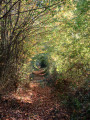
Lots of small roads… but a very picturesque little path towards the end.

Worth a visit

Reviews and comments

4.1 / 5
Based on 4 reviews

Reliability of the description
4.3 / 5
Ease of following the route
4 / 5
Route interest
4 / 5
MIREBEAU34
MIREBEAU34

Overall rating : 3.7 / 5

Date of your route : Jan 01, 2024
Reliability of the description : ★★★★☆ Good
Ease of following the route : ★★★☆☆ Average
Route interest : ★★★★☆ Good
Very busy route : No

1) Contrary to what is stated, the route is no longer signposted in blue; in fact, you need to follow the GR de Pays markings (yellow and red) for a long way, using your GPS.
2) At point no. 7, be sure to take the narrow path in the middle that leads down towards the river; this path is difficult to navigate in very wet weather.

Machine-translated

Lafarcib
Lafarcib

Overall rating : 4 / 5

Date of your route : Apr 05, 2021
Reliability of the description : ★★★★☆ Good
Ease of following the route : ★★★★☆ Good
Route interest : ★★★★☆ Good
Very busy route : No

A lovely walk to explore the area around the village of La Berthenoux; the varied landscapes offer a good glimpse of the Berry countryside in southern Boischaut. The path to the village of ‘Les Hérauts’ is narrow, so it’s easy to miss it; after that, there’s a brilliant finish via this route – though I reckon it’s hardly passable in winter. We spotted various animals along the way: sheep, cows, horses and, most unexpectedly, llamas!
Enjoy your walk in the sunshine.

Machine-translated

Hublot18
Hublot18

Overall rating : 4.3 / 5

Date of your route : Feb 27, 2021
Reliability of the description : ★★★★★ Very good
Ease of following the route : ★★★★☆ Good
Route interest : ★★★★☆ Good
Very busy route : No

A lovely path and narrow roads – passing through some beautiful spots
A bit of trouble finding the path at ‘Les Hérauts’ as it’s not very visible –
lovely spot
Thank you for the details and directions for this route – I’ll do it again sometime
All the best
Hublot 18

Machine-translated

marchalombre3
marchalombre3

Overall rating : 4.3 / 5

Date of your route : Jul 14, 2019
Reliability of the description : ★★★★☆ Good
Ease of following the route : ★★★★★ Very good
Route interest : ★★★★☆ Good

The walk starts at La Berthenoux church. Do take a moment to walk around it and admire the magnificent tower standing next to it, which is all that remains of the old fortified walls.
There are plenty of narrow lanes to follow on this walk, but the setting is so pleasant that it isn’t really a bother. The final stretch offers a lovely end to the walk, running alongside a hedge.

Machine-translated

Other walks in the area

For more walks, use our search engine .

The GPS track and description are the property of this route's author. Please do not copy them without permission.