Route from Saint-Kenan to Languenan

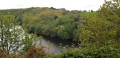
Set off to explore the countryside around Languenan. As you head towards La Rochette, you’ll be able to catch a glimpse of Saint-Jacut Bay in the distance.

Details

n°1672930
Creation:
Last update:
Last review:
  • Walking
    Activity: Walking
  • ↔
    Distance: 7.34 mi
  • ◔
    Average duration: 3h 35 
  • ▲
    Difficulty: Moderate

  • ⚐
    Back to start: Yes
  • ↗
    Ascent: + 197 ft
  • ↘
    Descent: - 200 ft

  • ▲
    Highest point: 427 ft
  • ▼
    Lowest point: 184 ft
  • ⚐ Country: France
  • ⚐ City: Languenan (22130)
  • ⚑
    Start/End: N 48.510657° / W 2.126905°
  • ❏
    IGN map(s): Ref. 1016ET, 1116ET
  • Hour-by-hour weather

Photos

Description of the walk

Park in the car park at Place de l’Église.

(S/E) From the church car park, head for the D26 and turn right towards Dinan, then turn right onto Chemin du Clos Ragaut. A little further on, take the grassy path on the left. Continue along the first path you come to on your right until you reach the road.

(1) At the road, turn left onto Rue du Rocher.

(2) At the bend, turn right onto the path between the fields. After about 600 metres, cross the D44 and carry on straight ahead.

(3) Turn right at the fork. At the road (elevation 115), turn left to reach Haut Callouet. In the hamlet, turn left towards Bas Callouet.

(4) Take the path on your right that leads through the fields (signpost missing). When you reach La Tourelle, cross the D28 and follow the sunken lane to reach Grand Bois Jean (ruined chapel). Walk through the hamlet.

(5) On leaving Grand Bois Jean, turn right onto the road and continue straight on. At the T-junction, turn left towards La Rochette.

(6) Before La Rochette, turn right onto the road. At the next junction, take the path on the right-hand side until you reach the junction with a road.

(7) Take the road on your left and carry on straight ahead. When you reach La Tréberdais, follow the path opposite and head into the woods. In the woods (elevation 57), do not take the Araucaria alternative route.

(8) At the crossroads, turn right and carry on until you reach the D28. Head slightly to the left, then take the first road on the right (elevation 76).

(9) At Mare Denier, take the road on your right towards Le Chesnay.

(10) At Le Chesnay, take the grassy path on the left, then, at the junction, take the path on the right and follow it alongside the woodland.

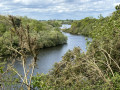
(11) At the Fork in the road, turn left and continue southwards, passing close to two ponds.

(12) Turn right onto Rue de la Courtoisie, which will take you back to Place de l’Église (S/E).

Waypoints

  1. S/E : mi 0 - alt. 338 ft - Church Square
  2. 1 : mi 0.28 - alt. 374 ft - Rue du Rocher
  3. 2 : mi 0.49 - alt. 404 ft - Grassy path
  4. 3 : mi 0.95 - alt. 417 ft - Turn right at the fork
  5. 4 : mi 2.05 - alt. 354 ft - Path on the right
  6. 5 : mi 3.16 - alt. 243 ft - Le Grand Bois Jean
  7. 6 : mi 3.84 - alt. 220 ft - Turn right before La Rochette
  8. 7 : mi 4.26 - alt. 213 ft - Turn left onto the road. Cross the - Floubalay (Ruisseau)
  9. 8 : mi 5.25 - alt. 226 ft - Turn right towards the D28
  10. 9 : mi 5.88 - alt. 272 ft - La Mare Denier
  11. 10 : mi 6.29 - alt. 292 ft - Le Chesnay
  12. 11 : mi 6.77 - alt. 315 ft - Fork in the road on the stony path
  13. 12 : mi 7.17 - alt. 331 ft - Rue de la Courtoisie
  14. S/E : mi 7.34 - alt. 341 ft - Church Square

Notes

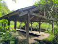
At the starting point, there are toilets and a bus shelter.
Signposting is good except at the change of direction before La Denilais (missing sign).

Worth a visit

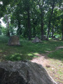
In the church square, there is a privateer’s grave.
At Grand Bois Jean, you’ll pass a ruined chapel.
After La Rochette, you’ll see Saint-Jacut Bay on your left on the horizon.

Reviews and comments

3.7 / 5
Based on 2 reviews

Reliability of the description
4 / 5
Ease of following the route
4.5 / 5
Route interest
2.5 / 5
Nois
Nois

Overall rating : 3 / 5

Date of your route : Jan 15, 2024
Reliability of the description : ★★★★☆ Good
Ease of following the route : ★★★★☆ Good
Route interest : ★☆☆☆☆ Very disappointing
Very busy route : No

A rather uninteresting route in Languenan

Machine-translated

JAQCUELINE
JAQCUELINE

Overall rating : 4.5 / 5

Date of your route : May 02, 2022
Reliability of the description : Not used / Not applicable
Ease of following the route : ★★★★★ Very good
Route interest : ★★★★☆ Good
Very busy route : No

Unmaintained grassy areas, unmarked muddy areas that are impassable

Machine-translated

Other walks in the area

For more walks, use our search engine .

The GPS track and description are the property of this route's author. Please do not copy them without permission.