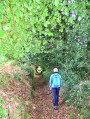
Route from Poul Fetan to Quistinic

This route, winding through steep-sided valleys and passing through villages, will enchant you with the diversity of its landscapes. Stroll along extraordinary sunken paths shaded by centuries-old beech trees. From Poul Fetan to the Blavet, let the history of rural life—etched into the stone, houses, barns, wells, bread ovens and mills—unfold before you. On your return, in the warmer months, head to Poul Fetan and immerse yourself in village life as it was in 1850.

Details

63305499
Creation:
Last update:
Last review:
  • Walking
    Activity: Walking
  • ↔
    Distance: 8.28 mi
  • ◔
    Average duration: 4h 25 
  • ▲
    Difficulty: Moderate

  • ⚐
    Back to start: Yes
  • ↗
    Ascent: + 732 ft
  • ↘
    Descent: - 712 ft

  • ▲
    Highest point: 413 ft
  • ▼
    Lowest point: 72 ft
  • ⚐ Country: France
  • ⚐ City: Quistinic (56310)
  • ⚑
    Start/End: N 47.893411° / W 3.148964°
  • ❏
    IGN map(s): Ref. 0820SB
  • Hour-by-hour weather

Photos

Description of the walk

Start at Quistinic, in the car park of the village of Poul Fetan (a heritage site where you can discover village life as it was in 1850). In the village of Quistinic, take the D159 towards Lanvaudan, then turn left at Kermoizan (follow the signs).

(S/E) Starting sign at the car park entrance. Leave the car park and turn right towards Hévédic.

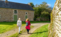
(1) Turn right, walk through the hamlet whilst admiring its rural heritage, and continue along the path flanked by embankments. Turn right.

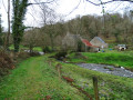
(2) Leave the return path on your right and carry on straight ahead. Then navigate two hairpin bends and carry on straight ahead, ignoring the paths on either side. Don’t miss the ruins of the Moulin du Bodery on the right. Follow the path to the Moulin du Glayo crossroads.

(3) Continue straight on along the main path, ignoring the turnings. You can take a short detour to the right to see the waterfall on the stream, a remnant of this mill. Carry on until you approach Kervéhennec.

(4) Turn right twice, keep to the right at the next junction and head towards Kermoizan.

(5) At the hamlet, turn right, then left after the house. Carry on to the right along the track to reach the D159. Continue straight ahead on the road, taking care for about a hundred metres. Then turn right at the wayside cross to reach Locunolé. Carry on to the village chapel.

(6) Turn right. On leaving the village, turn right and immediately take the sunken lane on the right. Stay on the main path, which continues straight ahead at the crossroads, then turn left at the next junction. Carry on straight ahead, ignoring the paths on either side. As you approach Coët Organ, stay on the main path, which curves to the left.

(7) Admire the Coët Organ cross and carry on straight ahead through the hamlet. Follow the road to the left, then turn right onto the farm track. Follow the track through the woods and turn left, following the yellow markings.

(8) Ignore theGRP® on your right and carry on straight ahead along the sunken lane until you reach a stream by the old Porzo wash house.

(9) Turn right to head back up towards the hamlet. Follow the road and take the first sunken track on the left to reach the D159.

(10) Carry on to the left, walking carefully alongside the road. Ignore the track on the right leading to Kerarvet, then take the path on the right into the woods. At the embankment, turn right and carry on straight ahead until you reach the road.

(11) Head towards Saint-Quion on the right and take the path on the left at the entrance to the hamlet, by the bread oven. As you approach the road, turn left and stay on the path running parallel to the road. At the end, head up to the left then immediately turn right to reach the D327.

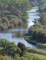
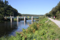
(12) Turn left and carefully follow the road along the verge, walking alongside the Blavet and ignoring the path on the left. Take in the scenery: the Blavet and the cliffs dotted with heather and gorse. You’ll come to a signpost.

(13) Head up to the left towards Poul Fetan along the winding path. Turn right onto the headland and carry on straight ahead after the stream, then straight on across the moor and along the wide path, ignoring the paths to the left: enjoy the views over the Blavet valley. Join the path you took on the way there.

(2) Enter the woods on the left and head towards Hévédic, keeping to the left.

(1) Head towards Poul Fetan on the left and turn left to return to the car park (S/E).

Waypoints

  1. S/E : mi 0 - alt. 295 ft - Car park in the village of Poul Fetan
  2. 1 : mi 0.09 - alt. 322 ft - Hévédic
  3. 2 : mi 0.35 - alt. 272 ft - Junction of the circular loop
  4. 3 : mi 0.88 - alt. 164 ft - Moulin du Glayo, crossroads
  5. 4 : mi 1.81 - alt. 404 ft - Kervéhennec
  6. 5 : mi 2.19 - alt. 344 ft - Kermoizan
  7. 6 : mi 2.78 - alt. 400 ft - Locunolé, chapel
  8. 7 : mi 4.03 - alt. 394 ft - Coët Organ, cross
  9. 8 : mi 4.78 - alt. 312 ft - Junction: go straight on
  10. 9 : mi 5.14 - alt. 312 ft - Stream
  11. 10 : mi 5.55 - alt. 335 ft - D159
  12. 11 : mi 6.19 - alt. 262 ft - Route to Saint-Quion
  13. 12 : mi 7.06 - alt. 72 ft - D327 - Blavet (fleuve)
  14. 13 : mi 7.35 - alt. 79 ft - Marker
  15. S/E : mi 8.28 - alt. 295 ft - Poul Fetan

Notes

This route is provided by Lorient Agglomération

This route is included in the Morbihan Departmental Plan for Walking and Hiking Trails and is accredited by the French Hiking Federation. You can follow the yellow markings. There is an information board with a map and details of local heritage sites at the start.

A tip: in the warmer months, make the most of your day to explore the village of Poul Fetan as well: go for a walk in the morning, have a picnic or eat at a local restaurant, and visit the site. Find out more on the website

Worth a visit

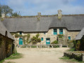
- Poul Fetan: a restored 16th-century hamlet, a 14-hectare tourist site offering an immersive experience of a 19th-century Breton village (villagers in traditional costume, fun activities), open from March to September.
- Hévédic: 16th–19th-century farms.
- Bodery grain mill: first recorded in the 18th century; remains of the mill, the diversion canal and the millstones.
- Glayo Mill: a grain mill first recorded in the 18th century, formerly associated with a windmill.
- Kermoizan: 17th–19th-century farms and dwellings, wayside cross.
- Locunolé: Saint-Gwénolé Chapel (1696), farmhouses dating from the 16th to the 19th centuries.
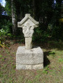
- Coët Organ: wayside cross (1667), 16th–19th-century farmhouses.
- Le Porzo: wash house, 17th–19th-century farmhouses.
- Saint-Quion: 16th–19th-century farmhouses.
- Le Blavet: 163 km of river (Nantes–Brest Canal, 1806–1825, including towpaths, navigation and freight transport).

Reviews and comments

4.7 / 5
Based on 2 reviews

Reliability of the description
5 / 5
Ease of following the route
5 / 5
Route interest
4 / 5
User 3547314

Overall rating : 4.7 / 5

Date of your route : May 08, 2026
Reliability of the description : ★★★★★ Very good
Ease of following the route : ★★★★★ Very good
Route interest : ★★★★☆ Good
Very busy route : No

A pleasant and interesting walk, well signposted from start to finish. Not much walking on the road. We highly recommend it!

Machine-translated

redonser
redonser

Overall rating : 4.7 / 5

Date of your route : Mar 27, 2026
Reliability of the description : ★★★★★ Very good
Ease of following the route : ★★★★★ Very good
Route interest : ★★★★☆ Good
Very busy route : No

The walk was exactly as described on Visorando. We did it in bright sunshine, in good conditions as it hadn’t rained for several days.
A few sections, though rare, can get very muddy if it has rained heavily, so be careful when choosing your footwear. Furthermore, even in dry weather, you need shoes that provide good ankle support.
The only downside is the stretch along the road at the end of the walk – traffic is too heavy and drives too fast!

Machine-translated

Other walks in the area

For more walks, use our search engine .

The GPS track and description are the property of this route's author. Please do not copy them without permission.