From Saint-Mathurin to Saint-Gwenolé in Quistinic

Starting from the village of Quistinic, set off along sunken paths, beside streams and through the heart of the forests to explore the western part of the municipality. Discover the history of Quistinic, its chapels, calvaries, rural houses, mills and more. This route covers the western section of the Chapels Route.

Details

63527379
Creation:
Last update:
Last review:
  • Walking
    Activity: Walking
  • ↔
    Distance: 10.45 mi
  • ◔
    Average duration: 5h 25 
  • ▲
    Difficulty: Moderate

  • ⚐
    Back to start: Yes
  • ↗
    Ascent: + 745 ft
  • ↘
    Descent: - 745 ft

  • ▲
    Highest point: 528 ft
  • ▼
    Lowest point: 138 ft
  • ⚐ Country: France
  • ⚐ City: Quistinic (56310)
  • ⚑
    Start/End: N 47.904363° / W 3.135404°
  • ❏
    IGN map(s): Ref. 0820SB
  • Hour-by-hour weather

Photos

Description of the walk

Start: the village of Quistinic, Place Saint-Mathurin. Start sign at the corner of Rue d’Hennebont, near the shops.

(S/E) Facing the start sign, turn right, walk past the church and continue straight on along Rue de la Résistance. Walk down the street and follow the path alongside the cemetery.

:1:: Turn left at the corner by the cemetery, then follow the sunken track to the right. At the road, turn left to reach Keriquello.

(2) Admire the bread ovens and carry on straight ahead along the farm track which turns right, then left. Before Villeneuve Jamain, take the track on the right and continue straight ahead along the wide path, between the fields, until you reach Kerléguennec.

(3) At the entrance to Kerléguennec, carry on straight ahead and follow the track to the right and then to the left. At the farm track, turn left, then left again at the road to reach Kerhouarn.

(4) At the hamlet, turn left and enter the sunken lane. Turn left onto the road and carry on straight ahead to Kervéhennec.

(5) Carry on straight ahead along the track. Back on the road, turn right, then take the track on the right before Kervégant.

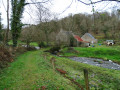
(6) Stay on this track, turning right. Turn left at the T-junction, and you’ll arrive near the Moulin de Chauzel.

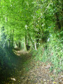
(7) Turn left and then turn right onto the path lined with low walls. Turn right into the woods just before Rosnen: don’t miss the granite boulders. Continue along this path, then take the sunken lane on the right. At the end, turn right towards the Kermelin Fountain, which you can’t miss.

(8) Follow the road to the left. Turn right onto the path, then left onto the sunken lane. Follow it uphill, keeping straight on. At the road, head left towards the Locunolé chapel in the hamlet.

(9) Continue to the left between the fences until you reach a cross.

(10) Head towards Kermoizan on the left and, once you reach the hamlet, take the path between the road sign and the bus shelter. Follow the path to the right, then straight on to go round the back of the house. Continue to the right and leave the village, passing close to the barn. Stay on this path and turn left at the junction to head towards Kervéhennec.

(11) Turn left twice to go round the hamlet, then turn left at the junction to reach the Moulin du Glayo. Take care, as several paths cross here. Follow the ‘Route des Chapelles’ signposts carefully: right, straight on and left. You’ll reach a junction by the mill.

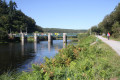
(12) Turn left towards the Moulin du Glayo (waterfall on the left). Head up to the road on the left, turn right and take the wide path on the left. Continue straight on, overlooking the Blavet, before turning left until you reach a cross.

(13) Turn right towards Talhoët Tuchentil. Turn right at the entrance to the hamlet, then left and straight on towards Kervily, ignoring the paths on the right

(14) When you reach the hamlet, go round it on the left. Continue along the road to the left, ignoring the paths, until you reach the access path to Léhart.

(15) Head towards Léhart along the track on the right. Leave the village on the left. At the crossroads, take the track opposite. Continue left at the next two junctions until you return to Quistinic.

(16) Turn left and walk for 80 metres, then head down Rue Paul Gauguin on the left. At the end of the street, turn right before the farm track. Follow the path leading to the Fontaine Saint-Mathurin (to the left and straight on). Turn left twice after the wash house and head towards the church via Rue Roz (right) and Rue de la Mairie (left) (S/E).

Waypoints

  1. S/E : mi 0 - alt. 449 ft - Place Saint-Mathurin
  2. 1 : mi 0.17 - alt. 423 ft - Cemetery
  3. 2 : mi 0.73 - alt. 509 ft - Kériquello
  4. 3 : mi 1.89 - alt. 453 ft - Kerléguennec
  5. 4 : mi 2.38 - alt. 453 ft - Kerhouarn
  6. 5 : mi 2.79 - alt. 453 ft - Kervéhennec
  7. 6 : mi 3.23 - alt. 456 ft - Kervégant
  8. 7 : mi 3.82 - alt. 410 ft - Chauzel Mill
  9. 8 : mi 4.73 - alt. 236 ft - Kermelin Fountain
  10. 9 : mi 5.3 - alt. 400 ft - Locunolé Chapel
  11. 10 : mi 5.69 - alt. 387 ft - Cross
  12. 11 : mi 6.21 - alt. 410 ft - Kervéhennec
  13. 12 : mi 7.2 - alt. 161 ft - Glayo Mill
  14. 13 : mi 8.07 - alt. 292 ft - Cross towards Talhoët Tuchentil
  15. 14 : mi 8.51 - alt. 207 ft - Kervily
  16. 15 : mi 8.75 - alt. 285 ft - Path towards Léhart
  17. 16 : mi 9.75 - alt. 443 ft - The village of Quistinic
  18. S/E : mi 10.45 - alt. 449 ft - Place Saint-Mathurin, Quistinic village

Notes

This route is organised by Lorient Agglomération.

This route is included in the Morbihan Departmental Plan for Walking and Hiking Routes and has been accredited by the French Hiking Federation. You can follow the yellow signposts. There is an information board with a map and details of heritage sites at the start.

Worth a visit

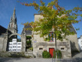
- Saint-Pierre Church (1752) and Saint-Mathurin Chapel (1900).
- Kériquello: farms and farmhouses (17th–19th centuries), bread ovens.
- Kermelin Fountain (1722).
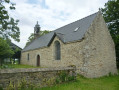
- Saint-Gwenolé Chapel (1696).
- Kermoizan wayside cross.
- Glayo Mill: a grain mill first recorded in the18th century, formerly associated with a windmill.
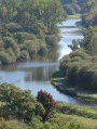
- Blavet Valley: 163 km of river (Nantes–Brest Canal 1806–1825, including towpaths, navigation and freight transport).
- Talhoët Tuchentil wayside cross.
- Saint-Mathurin Fountain (1678) and Saint-Pierre washhouse (19th century).

Reviews and comments

5 / 5
Based on 2 reviews

Reliability of the description
5 / 5
Ease of following the route
5 / 5
Route interest
5 / 5
Le Carrer Sylvie
Le Carrer Sylvie

Overall rating : 5 / 5

Date of your route : Jul 26, 2026
Reliability of the description : ★★★★★ Very good
Ease of following the route : ★★★★★ Very good
Route interest : ★★★★★ Very good
Very busy route : No

A lovely walk through the countryside around Quistinic. This route follows the ‘Chapel Trail’, and we leave it about 3 km from the village.
Most of the route takes you through woodland. This is particularly welcome in the current heat.
We’ll definitely do it again in the autumn.

Machine-translated

Pascal C56
Pascal C56

Overall rating : 5 / 5

Date of your route : Aug 10, 2025
Reliability of the description : ★★★★★ Very good
Ease of following the route : ★★★★★ Very good
Route interest : ★★★★★ Very good
Very busy route : No

A beautiful loop in the Quistinac countryside that follows well-marked trails and paths.
Be sure to visit the three chapels along the route, each with its own unique character. The Sainte Barbe chapel offers a beautiful view of the Blavet valley. Don't miss the view from "lann Vilin Avel" at point 3, which is well worth a short break.
I highly recommend this enchanting circuit.
NB: there are several trails in the municipality of Quistinic, all of which are of the same high quality.

Machine-translated

Other walks in the area

For more walks, use our search engine .

The GPS track and description are the property of this route's author. Please do not copy them without permission.