Montgaudon Route

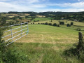
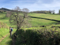
A countryside walk that will be a real feast for the eyes. In the land of Charolais cattle and amongst some picturesque ruins, you’ll cross the beautiful plains of the Nièvre. A refreshing change of scenery...

Details

5108021
Creation:
Last update:
Last review:
  • Walking
    Activity: Walking
  • ↔
    Distance: 5.90 mi
  • ◔
    Average duration: 3h 15 
  • ▲
    Difficulty: Moderate

  • ⚐
    Back to start: Yes
  • ↗
    Ascent: + 591 ft
  • ↘
    Descent: - 587 ft

  • ▲
    Highest point: 1,283 ft
  • ▼
    Lowest point: 915 ft

Description of the walk

Start from the Tourist Office, 13 Rue Henri Renaud. There are parking spaces along the square below.

(S/E) Leave the car park, walk past the Town Hall and head towards Rue Henri Renaud. Turn right and walk straight up the street.

(1) Stay on the main road which branches off to the left. Walk past the fire station.

(2) At the junction, take the road on the left towards Preporché.

(3) Just past the transformer, follow the path to the left. At the fork, carry on straight ahead: there may be a stream running across the path. Continue on to Préporché.

(4) When you reach the houses, turn right for 100 metres, then take the path on the left. You’ll come to a road at a place called La Milande.

(5) Take the road to the right, then immediately take the path to the right.

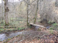
(6) At the ruins, carry straight on and follow the path uphill. You’ll come out onto a road at Le Carry.

(7) Follow the road, turning right. After 600 m, take the path on the left just past a house. Follow this path and keep right when you reach the road. You’ll arrive at the Fourmonté crossroads.

(8) Cross the road and continue along the path opposite, which eventually joins the D985.

(9) Follow the road to the right with care and turn right at the pond. Carry on straight ahead.

(1) Turn left onto Rue Henri Renaud, heading towards the town hall and the car park on the left (S/E).

Waypoints

  1. S/E : mi 0 - alt. 915 ft - Town Hall car park
  2. 1 : mi 0.21 - alt. 971 ft - Junction, turn left
  3. 2 : mi 0.37 - alt. 971 ft - At the junction, turn left
  4. 3 : mi 0.57 - alt. 994 ft - Path on the left
  5. 4 : mi 1.58 - alt. 1,027 ft - Préporché
  6. 5 : mi 2.42 - alt. 1,037 ft - Road and path on the right
  7. 6 : mi 2.58 - alt. 1,086 ft - Ruins
  8. 7 : mi 3.47 - alt. 1,148 ft - La Carry, on the right
  9. 8 : mi 4.47 - alt. 1,050 ft - Le Fourmonté, opposite
  10. 9 : mi 5.15 - alt. 981 ft - D985 road
  11. S/E : mi 5.9 - alt. 915 ft - Town Hall car park

Notes

Blue signposting.

Alternative route: at (8), turn right onto the departmental road leading to (2). Then turn left and head towards (1). Continue straight on to the Town Hall (S/E).

Reviews and comments

3.9 / 5
Based on 3 reviews

Reliability of the description
4.3 / 5
Ease of following the route
3.3 / 5
Route interest
4 / 5
EMCI13
EMCI13

Overall rating : 5 / 5

Date of your route : Sep 05, 2026
Reliability of the description : ★★★★★ Very good
Ease of following the route : ★★★★★ Very good
Route interest : ★★★★★ Very good
Very busy route : No

On today’s hike, we climbed up to the hills above Saint-Honoré-les-Bains along narrow paths.
The Montgaudon route was a real treat for the eyes. We were able to admire old stone houses and take in the magnificent landscapes typical of the Morvan.
We also admired the 16th-century church at Preporché and its modern stained-glass windows depicting the four seasons.
A very pleasant walk in cloudy weather.
We used the GPS as there were few or no signposts and we’d downloaded the route for safety’s sake. There was a bit of road walking, but very little, which allowed us to discover some old houses.
We didn’t come across a single soul!
Well worth a go

Machine-translated

User 13896195

Overall rating : 2.7 / 5

Date of your route : Feb 08, 2026
Reliability of the description : ★★★★☆ Good
Ease of following the route : ★☆☆☆☆ Very disappointing
Route interest : ★★★☆☆ Average
Very busy route : No

We started with both feet in the water, and it lasted until Préporché. Then we found ourselves on a muddy, flooded path. In short, we ended up taking the road back because it was so impassable.

Machine-translated

JM SIMOENS
JM SIMOENS

Overall rating : 4 / 5

Date of your route : Jul 11, 2023
Reliability of the description : ★★★★☆ Good
Ease of following the route : ★★★★☆ Good
Route interest : ★★★★☆ Good
Very busy route : No

A lovely walk starting from Saint-Honoré-les-Bains, on the edge of the Morvan.
The route takes you through fields and woods, with lovely views of the countryside around this village in the Nièvre.
Best done when it’s not too hot, as the route is fairly exposed.

Machine-translated

Other walks in the area

For more walks, use our search engine .

The GPS track and description are the property of this route's author. Please do not copy them without permission.