Larochemillay – Bibracte

The second part of this route takes in the wide-open countryside between Larochemillay and Bibracte. You’ll explore the landscapes of the southern Morvan, from castles to traditional villages – enjoy your trip!

This walk is part of a multi-day hike: Towards the pastures of the Southern Morvan

Details

65085128
Creation:
Last update:
Last review:
  • Walking
    Activity: Walking
  • ↔
    Distance: 14.74 mi
  • ◔
    Average duration: 8h 20 
  • ▲
    Difficulty: Difficult

  • ⚐
    Back to start: No
  • ↗
    Ascent: + 1,811 ft
  • ↘
    Descent: - 1,115 ft

  • ▲
    Highest point: 2,008 ft
  • ▼
    Lowest point: 1,070 ft
  • ⚐ Country: France
  • ⚐
    Area: Morvan
  • ⚐ City: Larochemillay (58370)
  • ⚑
    Start: N 46.87761° / E 4.001296°
  • ⚑
    End: N 46.931993° / E 4.048514°
  • ❏
    IGN map(s): Ref. 2824OT
  • Hour-by-hour weather

Photos

Description of the walk

Set off from the lodge in Larochemillay.

(S) Walk through the village heading east. Take the road on the right towards Poil, then take the first left.

(1) Leave theGR®® at Machefer and turn right onto a lovely path leading towards Ettevaux. Continue along this PR®® ®-marked path.

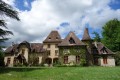
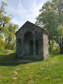
(2) Carry on and, at the Croix Saint Louis, enjoy a fine view of Ettevaux Castle, which dates from the 18th century and was remodelled in the 19th. In the beautiful grounds, note the neo-Gothic chapel, rebuilt in 1821 on the site of an older one. Continue along the small road to Les Banchots, following thePR®® (yellow).

(3) Turn right, then take thesecond path on the left, still following the yellowPR® ®. Continue straight on until you reach a road.

(4) Turn right and walk round the Château de Villette, which dates from the 18th century and was rebuilt on the site of a 14th-century fortified house that no longer exists.

(5) Take a path on the left, still signpostedPR®® (yellow), until you reach a small road.

(6) Turn left onto this road, walk past the cemetery and continue straight on to the village of Poil.

(7) Cross the village to the left and continue to follow thePR®® to the right. There’s a lovely view of the 15th-century Manoir Seigneurial du Mousseau. Keep to the right all the way to Corcelles.

(8) Turn left onto a track and, at the Fork in the road, continue to the right. You’ll come to a small road.

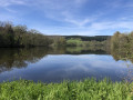
(9) Turn left twice, go down the path and pass the Étang de Cognières.

(10) Carry on to the Ancien Moulin du Gué.

(11) Keep right three times until you reach the Roche Pendue crossroads.

(12) Turn left to follow an orange-marked bridle path until you reach a fork.

(13) Then turn right and carry on straight on until you reach the Route du Dessus du Jeu.

(14) Turn left, pass a woodland on your left, then continue until you reach a junction.

(15) Keep left towards the Étang de Poisson. Follow the path to Molnet, keeping to the right and then to the left.

(16) Walk through the hamlet and continue along thePR®® on the small road to Saint-Léger-Sous-Beuvray.

(17) You’ll arrive at a large square; walk past the hairdresser’s and the bakery on your right, then take the road towards Autun and immediately turn left towards Saint-Prix. Walk past the school, to the right of the bakery (accommodation at the ‘Maison du Beuvray’ 1.5 km away. All shops are around the large square. Take the D179, heading due north, to La Boutière.

(18) Take a small road on the right, then a track on the right. At the end, turn left, then follow the Route du Rebout to the right (farm).

(19) Follow the edge of the Bois de Brunesois and continue uphill to Le Rebout without joining the main road. The farm is 50 metres on the right.

(20) Keep left to cross the neighbourhood, then turn right onto aPR®® path which climbs straight up through the forest to the Bibracte Museum (watch out for the road) (E).

Waypoints

  1. S : mi 0 - alt. 1,306 ft - Larochemillay - Église Saint-Pierre (Larochemillay)
  2. 1 : mi 0.04 - alt. 1,302 ft - Larochemillay
  3. 2 : mi 0.61 - alt. 1,280 ft - Junction; end of the GR
  4. 3 : mi 1.69 - alt. 1,352 ft - Ettevaux - Alène (rivière) - Affluent de l'Aron
  5. 4 : mi 2.22 - alt. 1,444 ft - Les Banchots
  6. 5 : mi 3.19 - alt. 1,135 ft - Road junction
  7. 6 : mi 3.44 - alt. 1,161 ft - Junction after the Château de Villette
  8. 7 : mi 4.05 - alt. 1,148 ft - Junction on the road
  9. 8 : mi 4.65 - alt. 1,083 ft - The village of Poil
  10. 9 : mi 5.26 - alt. 1,188 ft - Corcelles junction
  11. 10 : mi 5.75 - alt. 1,240 ft - Route
  12. 11 : mi 6.42 - alt. 1,096 ft - Étang de Cognières (Poil)
  13. 12 : mi 6.88 - alt. 1,112 ft - Ancien Moulin du Gué - Braconne (rivière) - Affluent de l'Arroux
  14. 13 : mi 7.34 - alt. 1,168 ft - Carrefour de la Roche Pendue
  15. 14 : mi 7.96 - alt. 1,250 ft - Junction
  16. 15 : mi 8.57 - alt. 1,260 ft - Route du Dessus du Jeu
  17. 16 : mi 9.23 - alt. 1,125 ft - Junction - Étang de Poisson (Saint-Léger-sous-Beuvray et La Comelle)
  18. 17 : mi 10.24 - alt. 1,217 ft - Molnet
  19. 18 : mi 11.21 - alt. 1,424 ft - Saint-Léger-sous-Beuvray
  20. 19 : mi 11.25 - alt. 1,427 ft - Saint-Léger-sous-Beuvray
  21. 20 : mi 11.92 - alt. 1,296 ft - La Boutière
  22. 21 : mi 12.26 - alt. 1,289 ft
  23. 22 : mi 13.88 - alt. 1,762 ft - Le Rebout
  24. 23 : mi 14.02 - alt. 1,821 ft - Le Rebout
  25. E : mi 14.74 - alt. 2,008 ft - Musée de Bibracte

Notes

All shops in Saint-Léger-sous-Beuvray (bakery, chemist’s, grocery shop, restaurant, hotel, campsite, etc.)
Bring a packed lunch for Larochemillay – there’s accommodation and facilities for cooking, but not always food to eat.
Accommodation is available in the towns of Villapourçon, Larochemillay, Poil and Saint-Léger-sous-Beuvray.

Worth a visit

Nestled on the south-western slope of Mont Beuvray, Larochemillay overlooks the Roche valley from a height of 399 metres, sheltered by the castle of the same name. On the other side of the valley stands Mont Touleur, with the ruins of a fortress at its summit. Once the administrative centre of the canton, Larochemillay has retained traces of its former commercial and administrative importance around a large central square where the market used to be held. The village has preserved its winding alleyways and bourgeois houses dating from the 15th to the 18th centuries, in particular the Maison Couveau, with its buttresses and openings featuring ogee lintels.

In Machefer, a bourgeois mansion was built in the 19th century. Next to it stand a large outbuilding and a dovecote in the form of a very slender tower.

Further information is available from the local tourist information offices:
Grand Autunois Morvan for Saint-Prix and Saint-Léger-sous-Beuvray. 03 85 86 80 38.
Morvan Sommets et Grands Lacs for Glux-en-Glenne. 03 86 22 82 74.
Rives du Morvan for Larochemillay and Poil. 03 86 30 43 10.

Always be cautious and plan ahead when you're outdoors. Visorando and the author of this route cannot be held responsible for any accidents occurring on this route.

The GR® and PR® markings are the intellectual property of the Fédération Française de Randonnée Pédestre.

Other walks in the area

For more walks, use our search engine .

The GPS track and description are the property of this route's author. Please do not copy them without permission.