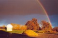
The ‘Route des Trotteurs’ in Ruillé-Froid-Fonds

Recommended for those who aren’t put off by a long walk, the Ruillé-Froid-Fonds route will take you through the countryside of southern Mayenne, a region much loved by horse breeders. The proximity of two stud farms and the cool, refreshing atmosphere of the Bois du Puy will round off your exploration.

Details

415389
Creation:
Last update:
Last review:
  • Walking
    Activity: Walking
  • ↔
    Distance: 11.97 mi
  • ◔
    Average duration: 5h 40 
  • ▲
    Difficulty: Moderate

  • ⚐
    Back to start: Yes
  • ↗
    Ascent: + 207 ft
  • ↘
    Descent: - 230 ft

  • ▲
    Highest point: 390 ft
  • ▼
    Lowest point: 217 ft

Description of the walk

Car park at the church square.

(S/E) Start at the church square. Head towards Rue d’Anjou and turn right onto it until you reach Rue des Tonneliers
which you should follow. At the end of this street, turn left (Route du Bignon). After 1.3 km, turn
right. At the Croix Courdeau, turn left onto the stony track. Continue for 1.7 km
until you reach Le Gage. Turn right and follow the road for about 1.7 km (temporary road).

(1) Turn right onto the grassy strip next to a track. Continue along this green track, which winds
the fields for 1.5 km, then rejoin a track leading to the Haras du Verger.

(2) Turn right onto the D152 for 300 m, then left for 200 m. Turn left onto the green path
leading to the Haras du Grand Buisson. Cross the road and carry on straight ahead to enter the Bois
du Puy. Cross the D109 (temporary road) and carry on straight ahead until you reach a tarmac road.

(3) Turn right onto this tarmac road. After 1.1 km, turn right towards La Sarchère.
Take the green path straight ahead and, after the Pont Perdreau stream, turn left. On the
tarmac road, turn left towards the village of Froid Fonds. At a place called Le Presbytère, turn right
onto a track. Follow it to the D154.

(4) Turn right onto the D154 (temporary road). Continue for 500 m and turn left onto the Chemin des
Faribaudières, then turn right towards La Basse Faribaudière. Continue straight on to reach the village of
Ruillé-Froid-Fonds and the church car park (S/E).

Waypoints

  1. S/E : mi 0 - alt. 285 ft - Church Square
  2. 1 : mi 3.56 - alt. 358 ft - Path on the right
  3. 2 : mi 4.78 - alt. 374 ft - Turn right onto the D152
  4. 3 : mi 7.88 - alt. 312 ft - On the right along the tarmac road
  5. 4 : mi 10.64 - alt. 266 ft - Turn right onto the D154 (temporary road)
  6. S/E : mi 11.97 - alt. 285 ft - Church Square

Notes

Parking spaces are available in the church square. In the village centre, you can enjoy a meal at the restaurant Le Camélia (which is also a hotel).

Ruillé-Froid-Fonds Town Hall – 8 Rue du Calvaire, 53170 Ruillé-Froid-Fonds // 02 43 07 71 53

Restaurants and bars: Le Camélia (hotel-restaurant), Le Bon Accueil

Toilets: behind the town hall

Worth a visit

Château du Puy: construction began in 1650, with new buildings added during the
18th century, and the complex was completed with a country park featuring arbours and ponds. The estate survived
survived the Revolution but was the scene of some clashes in 1832. The buildings and grounds are
listed as historic monuments.

Church: dedicated to Saint Protais and Saint Gervais, the town’s patron saints, and dating from the 12th century, it was burnt down twice during the Revolution, in 1792 and 1793. During this same period, it served as barracks for the National Guard. The bell is listed as an object by the Historic Monuments authority.

Horse breeding: a land of horses, the commune gained some renown thanks to the 2015 Prix d’Amérique, as the two horses that finished in the top two were both trained in the commune (‘Up and Quick’ was trained there by Franck Leblanc and ‘Voltigeur de Myrt’ by Roberto Donati).

Chapel: situated in the village of Froid-Fonds, it dates back to the 11th century. It was bequeathed to the monks of Solesmes at the end of the 20th century. Dedicated to the Virgin Mary, it is surrounded by the village’s old cemetery.

Reviews and comments

4.3 / 5
Based on 3 reviews

Reliability of the description
4.3 / 5
Ease of following the route
5 / 5
Route interest
3.7 / 5
sophora japonica
sophora japonica

Overall rating : 4.7 / 5

Date of your route : Apr 21, 2021
Reliability of the description : ★★★★★ Very good
Ease of following the route : ★★★★★ Very good
Route interest : ★★★★☆ Good
Very busy route : Yes

A lovely walk in the sunshine. The route is very well signposted, but 50 per cent of it follows small tarmac roads that link up with the sunken paths which were not removed during land consolidation. The walk through the Puy Forest is very pleasant and makes for a lovely picnic spot.

In conclusion, this route is best done in spring or autumn as there is little shade on the tarmac sections, which make up a significant part of the walk. Furthermore, the paths have deep ruts which are likely to be very muddy in wet weather.

Thanks to the Pays de Grez for maintaining and signposting the route.

Machine-translated

isadu92
isadu92
• Edited:

Overall rating : 4.3 / 5

Date of your route : Oct 24, 2018
Reliability of the description : ★★★★☆ Good
Ease of following the route : ★★★★★ Very good
Route interest : ★★★★☆ Good

Hello
We’ve done the first half of the walk. We’ll save the second half for another day.
A bit too much tarmac at the start.
Point 5 has now been amended: after the ‘Le Bignon’ sign, you need to walk a further 100 metres or so to find the path you need to take on the right. And this path is no longer under the trees, but runs alongside a cultivated field.
The local walkers’ association is currently adding signposts: posts for information boards.
Another change: the Verger stud farm has changed its name to Eymy stud farm.
Enjoy your walk, everyone
Kind regards.
Mrs Chevreul

Machine-translated

Presbytere
Presbytere

Overall rating : 4 / 5

Date of your route : Aug 27, 2017
Reliability of the description : ★★★★☆ Good
Ease of following the route : ★★★★★ Very good
Route interest : ★★★☆☆ Average

Just a small error to point out.
Point 9: after the water tower on the left, you need to turn right, not left.

Machine-translated

Other walks in the area

For more walks, use our search engine .

The GPS track and description are the property of this route's author. Please do not copy them without permission.