The Maladrerie route starting from Gravigny

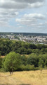
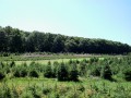
Recipe for a lovely walk: take a pinch of forest paths, sprinkle with a few stretches of a wild riverbank, and add a dash of culture and heritage.
The result is the Maladrerie route, an ideal route for families. Short and easy, it winds through the hills and woods of Gravigny before returning to the town by following the River Iton to the Maladrerie Saint-Nicolas. The leprosarium is one of the few still in existence in Normandy. It is not open to visitors, but is listed on the register of Historic Monuments. In the12th century, the lepers themselves carried out the work in the fields and cared for the sick.

Details

101889644
Creation:
Last update:
Last review:
  • Walking
    Activity: Walking
  • ↔
    Distance: 3.39 mi
  • ◔
    Average duration: 1h 45 
  • ▲
    Difficulty: Easy

  • ⚐
    Back to start: Yes
  • ↗
    Ascent: + 210 ft
  • ↘
    Descent: - 210 ft

  • ▲
    Highest point: 430 ft
  • ▼
    Lowest point: 180 ft
  • ⚐ Country: France
  • ⚐ City: Gravigny (27930)
  • ⚑
    Start/End: N 49.047021° / E 1.165896°
  • ❏
    IGN map(s): Ref. 2013O
  • Hour-by-hour weather

Photos

Description of the walk

Park in the car park near Gravigny Church.

(S/E) Head due east along Rue Gabriel Péri, then turn right onto Rue de Huest. You will then come to a junction of footpaths.

(1) Take the path on the right, continue through the fields until you reach the edge of the N154.

(2) Turn right onto the GR®26, marked in white and red. Follow it through fields and woodland. You’ll reach the hamlet known asl’Échelette des Vignes.

(3) Take a pleasant path opposite and head towards the junction with the Route d’Argence.

(4) Leave the GR® here and turn right onto the Route d’Argence, walking alongside the municipal gardens until you reach the crossroads at the Iton ford.

(5) Turn left, cross the Iton, then turn right onto the Allée des Jardins André Hébert. Walk alongside the Père Hébert gardens until you reach the left bank of the Iton.

(6) Walk along the landscaped banks of the Iton before returning to the car park at Gravigny Church (S/E).

Waypoints

  1. S/E : mi 0 - alt. 220 ft - Gravigny Church car park
  2. 1 : mi 0.26 - alt. 230 ft - Path junction
  3. 2 : mi 0.71 - alt. 295 ft - N154
  4. 3 : mi 1.76 - alt. 420 ft - L’Échelette des Vignes
  5. 4 : mi 2.12 - alt. 240 ft - Route d’Argence
  6. 5 : mi 2.47 - alt. 190 ft - Municipal Gardens
  7. 6 : mi 2.7 - alt. 190 ft - Iton riverbanks - L'Iton
  8. S/E : mi 3.39 - alt. 220 ft - Gravigny Church car park

Worth a visit

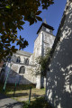
(S/E) Gravigny Church
(3) L’Échelette des Vignes
(5) Municipal Gardens
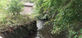
Between (6) and (S/E) the banks of the Iton:this natural area, accessible to all, offers a peaceful setting that’s perfect for a stroll. The proximity of the river brings a pleasant sense of coolness, which is particularly welcome on summer days. Take the time to observe the local flora and fauna whilst enjoying the tranquillity of the surroundings.

Always be cautious and plan ahead when you're outdoors. Visorando and the author of this route cannot be held responsible for any accidents occurring on this route.

The GR® and PR® markings are the intellectual property of the Fédération Française de Randonnée Pédestre.

Other walks in the area

For more walks, use our search engine .

The GPS track and description are the property of this route's author. Please do not copy them without permission.