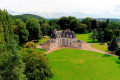
Pagnol in the Eure Valley

Following the course of the River Eure and winding through the valley, this peaceful walk offers a variety of viewpoints, allowing you to discover the many facets of this valley where Marcel Pagnol and his wife fell in love at first sight with an old mill.

Details

51091453
Creation:
Last update:
Last review:
  • Walking
    Activity: Walking
  • ↔
    Distance: 9.62 mi
  • ◔
    Average duration: 5h 00 
  • ▲
    Difficulty: Moderate

  • ⚐
    Back to start: Yes
  • ↗
    Ascent: + 705 ft
  • ↘
    Descent: - 682 ft

  • ▲
    Highest point: 495 ft
  • ▼
    Lowest point: 79 ft

Photos

Description of the walk

Starting point: 8 Route de Saint-Vigor, Crève-Cœur, La Croix-Saint-Leufroy
Parking: Sports ground

Markings: Yellow

(S/E) From the Crève-Cœur stadium car park, head right until you reach the Stop sign.

(1) Turn right, then left to join the D10, towards Evreux. At the junction, continue on the D10 towards Irreville.

(2) Shortly afterwards, take the small road on the left towards Reuilly. Carry on until you reach a track on the right.

(3) Take this track. It climbs towards Irreville and rejoins the D10. Cross the D10 carefully, turning left then right, to reach the village houses.

(4) Turn right twice and follow the track. Take the D69 on the left, taking care, until you reach a Fork in the road.

(5) Turn right onto a flat track that continues into the woods. At the Fork in the road, turn left until you reach a crossroads.

(6) At the four-way crossroads, turn right. At the second junction, head straight down the sunken track until you reach the D71.

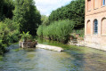
(7) Follow it to the right. The road runs high above the river and the watercress beds. At the crossroads, turn left and cross the River Eure. Pass through the village via the D69. On leaving the village, you’ll come to a Fork in the road.

(8) Turn right, then take the path on the left, opposite the entrance to the fortified farm. Cross the D836 with care and continue along a path leading uphill through the fields. Pass in front of a barn and arrive at a crossroads.

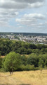
(9) Turn left (panoramic view), follow the track, then take the road on the left until you reach the hamlet of Coupé.

(10) Take the first road on the right, towards La Boissaye and its manor house.

(11) At the crossroads, take the first road on the right, cross the D10 with care, and continue straight on until you reach a fork in the road.

(12) Take the path on the right and head into the woods until you reach a wayside cross.

(13) Head down towards the valley along the path on the right and reach La Croix-Saint-Leufroy. Continue to the end of the path onto the D836.

(14) Turn right onto the D836 and follow it for a few dozen metres; cross the road carefully and follow the small road to the left. Join the D10 and follow it to the left until you reach the river.

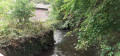
(15) Cross the Eure and immediately turn left onto the path running alongside the river. Once you reach the back of the stadium, turn right and head for the car park (S/E).


Waypoints

  1. S/E : mi 0 - alt. 92 ft - Stadium car park
  2. 1 : mi 0.12 - alt. 89 ft - Stop
  3. 2 : mi 0.67 - alt. 95 ft - T-junction
  4. 3 : mi 0.89 - alt. 121 ft - Junction
  5. 4 : mi 1.78 - alt. 420 ft - Irreville
  6. 5 : mi 2.25 - alt. 407 ft - D69 junction
  7. 6 : mi 3.03 - alt. 397 ft - Junction
  8. 7 : mi 3.96 - alt. 121 ft - D71 road
  9. 8 : mi 4.52 - alt. 82 ft - Y-junction
  10. 9 : mi 5.68 - alt. 358 ft - Junction
  11. 10 : mi 6.46 - alt. 492 ft - A place known as Coupé
  12. 11 : mi 6.85 - alt. 489 ft - Crossroads - Manoir de la Boissière
  13. 12 : mi 7.23 - alt. 489 ft - Junction
  14. 13 : mi 7.76 - alt. 492 ft - Calvary – Panorama
  15. 14 : mi 8.73 - alt. 92 ft - D836
  16. 15 : mi 9.19 - alt. 92 ft - Crossing the - Eure (rivière)
  17. S/E : mi 9.62 - alt. 92 ft - Stadium car park

Worth a visit

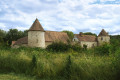
The fortified farmstead of Crève-Cœur, dating from the 14th and 17th centuries. Bertrand du Guesclin, who played a major role in driving out the English during the Hundred Years’ War, is said to have spent the night in one of the manor’s towers on the eve of the Battle of Cocherel, from which he emerged victorious against the English (1364). The manor house served both defensive and agricultural purposes. The latter function came to predominate after the 15th century. It was built on a quadrangular plan with round towers at the corners and was surrounded by a floodable moat.

The 15th- and 16th-century Manoir de la Boissière, a Renaissance-style building, was likely an outbuilding of La Croix-Saint-Leufroy Abbey. It became the abbey’s property from the 16th century onwards and remained so until the 18th century. In 1791, it was nationalised before being sold. This building has been listed as a Historic Monument since 1992.

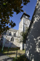
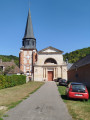
Saint Paul’s Church: the bell tower dates from the 16th century and the chancel from the 19th century. The bell tower houses three bells named Julie Élisabeth, Geneviève Simone and Marie.

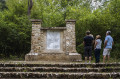
The commemorative plaque forthe 4th Hussars at Crève-Cœur, by the bridge, in memory ofthe 4th Hussars and their ill-fated battle on 14 June 1940, was unveiled on 11 June 1946.

Reviews and comments

4.7 / 5
Based on 2 reviews

Reliability of the description
5 / 5
Ease of following the route
5 / 5
Route interest
4 / 5
Office de Tourisme Seine-Eure

Hello,

Thank you for your review of the "Pagnol in the Eure Valley" tour.
We look forward to seeing you again on our other hiking trails in Seine-Eure.
Kind regards,
The Seine-Eure Tourist Office team

Machine-translated

ealet
ealet

Overall rating : 4.7 / 5

Date of your route : Aug 15, 2025
Reliability of the description : ★★★★★ Very good
Ease of following the route : ★★★★★ Very good
Route interest : ★★★★☆ Good
Very busy route : No

A beautiful route with lots of variety (forest trails, small villages, beautiful views of the valley)
on tarmac, but on quiet roads.
the route is well described and very well signposted
i recommend it and don't regret travelling so far to do this route
thanks to the authors of this hike for sharing

Machine-translated

Office de Tourisme Seine-Eure

Hello,

Thank you for your feedback.
Kind regards,

The Tourist Office team

Machine-translated

lilianetroniou
lilianetroniou

Overall rating : 4.7 / 5

Date of your route : Aug 03, 2024
Reliability of the description : ★★★★★ Very good
Ease of following the route : ★★★★★ Very good
Route interest : ★★★★☆ Good
Very busy route : No

A lovely walk, though perhaps a bit too much driving.
A lovely spot for a picnic in Cailly-sur-Eure – once you’ve crossed the bridge, turn right into the cul-de-sac.
At the end, there’s a bench by the water’s edge.

Machine-translated

Other walks in the area

For more walks, use our search engine .

The GPS track and description are the property of this route's author. Please do not copy them without permission.