Route des bois de Fagne from Aibes

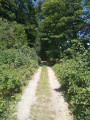
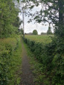
If you find yourself longing for silence, tranquillity and rolling, bucolic landscapes, the Fagne Woods route will meet your expectations and leave you with a sense of rest and a holiday atmosphere… It’s hard to believe you’re in the North, especially if the sun is shining.

Details

n°1547812
Creation:
Last update:
Last review:
  • Walking
    Activity: Walking
  • ↔
    Distance: 6.62 mi
  • ◔
    Average duration: 3h 15 
  • ▲
    Difficulty: Moderate

  • ⚐
    Back to start: Yes
  • ↗
    Ascent: + 197 ft
  • ↘
    Descent: - 200 ft

  • ▲
    Highest point: 748 ft
  • ▼
    Lowest point: 591 ft

Photos

Description of the walk

Starting point: town hall car park.

(S/E) Turn left onto the D 963, towards Colleret and Jeumont. At the wayside shrine, turn right onto the GR® de Pays de l’Avesnois (marked yellow on red). After the cemetery, you’ll come to a Fork in the road.

(1) Take the small road on the left. Cross over the railway line, then walk alongside it and follow the first path on the right towards the Ferme de Coulmie; this takes you off the GR® de Pays.

(2) Pass the Ferme de Coulmie on your left (before 1789, it belonged to Aulnes Abbey) and follow a stony path on your right, lined with a lovely hedge of hornbeams. Cross the Ruisseau de Grand Rieux and continue along this path until you reach a tarmac road.

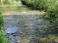
(3) Turn right, cross the railway line with care and take the road. Then turn left onto a grassy path, the Route de Grand Rieux, which runs alongside the stream of the same name. You will come to a junction.

(4) Turn right towards the Bérelles water tower near the D963.

(5) Cross the departmental road with care and , opposite, take the path lined with willows and reeds, which winds through the hedgerow countryside to the Carrefour des Cinq Chemins.

(6) Turn right onto the pleasant path running alongside the Bois du Mesnil. As you leave the woods, take the first turn right then left and, a little further on, pass the imposing farmhouse on your left.

(7) Continue straight on along a grassy path through rolling countryside until you reach the village of Quiévelon.

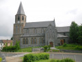
(8) Turn right onto the main street and follow it to the rock grotto with the statue of the Virgin Mary. Turn right onto the Route d’Aibes. At the entrance to the village, take the first street on the left which leads down towards the church and return to the starting point, making the first turn right then left. (S/E) 

Waypoints

  1. S/E : mi 0 - alt. 646 ft - Town hall car park
  2. 1 : mi 0.38 - alt. 653 ft - Fork
  3. 2 : mi 1.35 - alt. 597 ft - Coulmie Farm
  4. 3 : mi 2.09 - alt. 650 ft - Route de Grandireux
  5. 4 : mi 3.05 - alt. 709 ft - Crossroads
  6. 5 : mi 3.74 - alt. 738 ft - Departmental road
  7. 6 : mi 4.29 - alt. 738 ft - Carrefour des Cinq Chemins
  8. 7 : mi 4.89 - alt. 669 ft - Farm
  9. 8 : mi 5.3 - alt. 646 ft - Quiévelon
  10. S/E : mi 6.62 - alt. 643 ft - Town hall car park

Notes

In wet weather, wear waterproof footwear.

This route is listed in the PDIPR (Departmental Plan for Walking and Hiking Routes)

Follow the yellow signposts (Yellow Cross = wrong direction, arrow pointing right = turn right, arrow pointing left = turn left, horizontal line = go straight on)

Worth a visit

Rock with a statue of the Virgin Mary at Quiévelon: this grotto was built on the initiative of a parish priest from Colleret, who served the parish of Quiévelon, and three other parishioners. The inauguration took place on 15 August 1958, in the presence of the Archbishop of Cambrai. Every year on 15 August, a major Marian pilgrimage brings together parishioners from the surrounding villages.

Always be cautious and plan ahead when you're outdoors. Visorando and the author of this route cannot be held responsible for any accidents occurring on this route.

The GR® and PR® markings are the intellectual property of the Fédération Française de Randonnée Pédestre.

Reviews and comments

5 / 5
Based on 1 review

Reliability of the description
5 / 5
Ease of following the route
5 / 5
Route interest
5 / 5
naya59!
naya59!

Overall rating : 5 / 5

Date of your route : Apr 28, 2025
Reliability of the description : ★★★★★ Very good
Ease of following the route : ★★★★★ Very good
Route interest : ★★★★★ Very good
Very busy route : No

A very pleasant route through fields and woods

Machine-translated

Other walks in the area

For more walks, use our search engine .

The GPS track and description are the property of this route's author. Please do not copy them without permission.