Country:

 City:


The walk starts from the car park opposite the town hall.
(S/E) Opposite the town hall, turn left towards Place de la Libération, where the Croix du Fond de Barre stands in the centre.
(1) Head right towards the village centre, then turn immediately left into Rue Charles Valette. At the top, you’ll reach a square; cross it and head up to the left. At this junction stands the Croix de Bernède. Head up to the left and join the tarmac road.
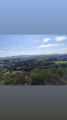
(2) Cross the road, head left for about fifty metres, then turn right. Keep to the right at the three-way junction ahead, then turn right again at the bend between the two hills to climb up to Mont Barre and the orientation table , from where you can enjoy a 360° view.
(3) Continue along the path northwards, then take a circular loop to the left to return to the junction between the two hills and head straight up to the summit, dominated by the Croix du Mont Gos.
(4) Head straight down the slope along a path very close to the aerial masts. Turn left at the junction, then follow the path as it curves to the right to reach a quarry. Turn left, immediately ignore the track on the left and continue for about fifty metres.
(5) Take the path on the left, which runs diagonally, join a road and follow it to the right.
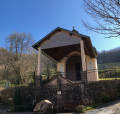
(6) Keep to the right at the junction where the Croix de la Bourgade is located. Carry on straight ahead to the next junction, where the Croix du relais de Mont Gos is situated. Head straight down the road to the three-way junction and pass in front of the Croix du Coucut.
(7) Turn right towards the Canac le Bas farm; as you pass, look out for the Croix du Bas de Canac on the right. Continue uphill towards the Canac le Haut farm and, as you pass, look out again for the Croix du Haut de Canac. At the top of this hill, the Croix de Canac stands on the left.
(8) Stay on the same road. At the next junction, turn left and continue until you reach the signpost bearing the farm’s name: the Croix de Brunette is located there.
(9) At this point, turn round and head up the left-hand side to reach a junction where the Croix des Abourets stands. Head down towards the village, then take the small path leading to Rue du Foirail: enjoy the view over the village rooftops. Head down towards the church entrance. 5 metres further on, you’ll find the Croix de Récupération and the Croix du Cimetière Vieux.
(10) Turn right, follow Rue de l’Église to the left for a few metres, then turn right onto Rue Jacques Vabre. Halfway along, turn left onto Rue du Gassot. Continue to the right along Rue du Cimetière until you reach the end.
(11) Turn right to walk alongside the cemetery, where the Croix du Cimetière Neuf is located, and return to the car park (S/E).

 AONB

 Visorando Member
 Difficult
 Easy