Le Plo de Canac

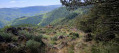
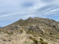
From the Dourdou valley, the path climbs up to the Plo de Canac through stony slopes and boxwood forests.
The steep climb at the start is rewarded with beautiful views once the walker reaches the maquis plateaus, perfumed by the warm scents wafting in from the Mediterranean.

Details

9346365
Creation:
Last update:
Last review:
  • Walking
    Activity: Walking
  • ↔
    Distance: 7.47 mi
  • ◔
    Average duration: 4h 55 
  • ▲
    Difficulty: Difficult

  • ⚐
    Back to start: Yes
  • ↗
    Ascent: + 1,696 ft
  • ↘
    Descent: - 1,703 ft

  • ▲
    Highest point: 3,097 ft
  • ▼
    Lowest point: 1,814 ft

Photos

Description of the walk

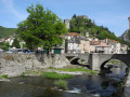
The village of Canac (Tarn) stretches out in a long, narrow strip on both sides of the D162.
Park in the small square in the centre of the village.

Yellow signposts for “Plo de Canac”

(S/E) From the centre of the village, head north until you reach the Ruisseau d’Espeyres and cross it.
Leave the village and pass the entry and exit signs. A few dozen metres past the exit sign, you’ll find a small path leading uphill to the left.

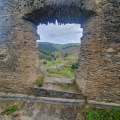
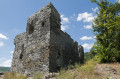
(1) Follow the path. This rocky, steeply sloping track passes through a chestnut grove, then a boxwood grove. Climb up to the ruins of Canac Castle.

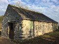
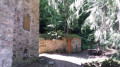
(2) Take a short detour to explore the ruins, which offer a fine view of Canac. Retrace your steps and resume the steep climb. The slope levels off after the 871 mark and joins a flat track.

(3) Turn right onto this track, follow the hairpin bend, then walk through a fir forest until you reach a Y-junction leading to the Plo de Canac.

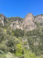
(4) Head off to the right for a round trip to the rocky outcrop overlooking the valley.

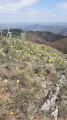
(5) The Plo de Canac (945 m) is marked by a large cairn at the summit. Hikers are treated to a lovely view over the Dourdou valley. Retrace your steps.

(4) Continue to the right along a wide track, ignoring the small side paths. Cross the Ruisseau du Fangas and reach the road at the 878-metre mark. The Merdelou wind turbines stand out on the right.

(6) Turn left, then head towards and pass Lardénas. Walk 200 metres past the last house. Take the path on the left.
At the Y-junction, head right. A few dozen metres further on, turn right into the edge of the woodland. Halfway up the slope, go through a fence. Find a path on the right, at the bottom of the slope.

(7) Turn right, then left onto a grassy clearing. Head due north along the path leading to Catonières. At the tarmac road, keep right. After the bend and the last house, take the path and cross the stream. Climb up to reach the D169.

(8) Turn left to enter the hamlet of Massié. Take the first road on the left. The road becomes a concrete track. The descent is just as challenging as the climb. Follow the yellow markings to reach Pante.

(9) Cross the hamlet, then the stream. Head downwards, keeping a south-easterly direction. At a three-way junction, keep left. After a left-hand bend, you’ll come to a Y-junction.

(10) Turn left, join a path below and follow it to the right. Continue the descent along the wide track which runs alongside the Ruisseau d’Espeyres, high above it. At the final three-way junction, take the left-hand path. The path winds its way down, always on a more or less steep descent, and reaches a T-junction near the Ruisseau de Poux.

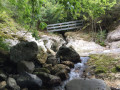
(11) Turn left and cross the stream. The path curves to the left, passes beneath some ruins and descends to the D162, near a wrought-iron wayside cross.
Continue straight ahead along the road to reach the small clearing (S/E).

Waypoints

  1. S/E : mi 0 - alt. 1,873 ft - A small square in the centre of the village
  2. 1 : mi 0.16 - alt. 1,847 ft - Path leading uphill to the left
  3. 2 : mi 0.37 - alt. 2,126 ft - Out-and-back route to the castle ruins
  4. 3 : mi 1.14 - alt. 2,963 ft - Turn right onto the flat track
  5. 4 : mi 1.68 - alt. 2,982 ft - Y-junction towards Plo de Canac
  6. 5 : mi 1.96 - alt. 3,097 ft - Plo de Canac
  7. 6 : mi 2.84 - alt. 2,877 ft - Turn left at the fork
  8. 7 : mi 3.87 - alt. 2,595 ft - Pin on the right
  9. 8 : mi 4.41 - alt. 2,802 ft - Le Massié
  10. 9 : mi 5.15 - alt. 2,500 ft - Pante
  11. 10 : mi 5.93 - alt. 2,523 ft - Turn left
  12. 11 : mi 7.29 - alt. 1,873 ft - Take the path downhill to the left
  13. S/E : mi 7.47 - alt. 1,873 ft - A small square in the centre of the village

Notes

There are no water points or toilets.

Please note: the signposting in place suggests this route be walked in the opposite direction to that described here
I am suggesting this route because that is how I walked it at the time.
It is better to tackle the steep climb at the start of the route than to descend it at the end of the day when you are tired.
Although the 12 km distance would classify this route as of moderate difficulty, the actual effort required is greater due to the elevation gain and the steep sections.

The author has completed this walk on several occasions, most recently on 1 November 2017.

Worth a visit

Reviews and comments

4.6 / 5
Based on 3 reviews

Reliability of the description
4.7 / 5
Ease of following the route
4.3 / 5
Route interest
4.7 / 5
Bernard Roumestant
Bernard Roumestant

Thank you for your comments
It is true that this year, the most recent storm had a particularly severe impact on the forests of the Haut-Languedoc, including the coniferous forest at Plo de Canac

Machine-translated

francoise caussat
francoise caussat

Overall rating : 5 / 5

Date of your route : Jul 04, 2026
Reliability of the description : ★★★★★ Very good
Ease of following the route : ★★★★★ Very good
Route interest : ★★★★★ Very good
Very busy route : No

Hello, I did this walk yesterday, 3 July 2026. It’s a brilliant walk with plenty of shaded sections and a few stretches along sunny tracks. Despite this year’s stifling heat, the temperature was really pleasant. However, we did the walk starting from number 10. It’s true that the return leg is very bumpy and technical, but personally I preferred doing it this way because, had we followed the route recommended by Visorando, the initial climb – which for us was the return leg – would have been difficult for me. We didn’t meet anyone, apart from a couple who live in one of the little hamlets we passed through; they were very friendly. This walk is signposted all the way along.

Machine-translated

lucalgieri
lucalgieri

Overall rating : 4.3 / 5

Date of your route : Apr 27, 2023
Reliability of the description : ★★★★★ Very good
Ease of following the route : ★★★★☆ Good
Route interest : ★★★★☆ Good
Very busy route : No

A superb walk – the Plo de Canac is a lovely spot for a picnic.
We did the route in the opposite direction, as the climb was easier and the descent offered continuous views of the valley.
A lovely forest and an interesting castle.
Thank you for this lovely walk.

Machine-translated

Bernard Roumestant
Bernard Roumestant

Overall rating : 4.3 / 5

Date of your route : Jul 26, 2021
Reliability of the description : ★★★★☆ Good
Ease of following the route : ★★★★☆ Good
Route interest : ★★★★★ Very good
Very busy route : Yes

It’s an excellent idea to showcase this route, which is of departmental interest for its views, its vegetation – which changes from mountain forest to chestnut groves – and the remains of a Renaissance fortified house built during the final stages of the Wars of Religion.
A very beautiful walk (challenging due to the steep gradients, as noted). Well maintained by the Department… though a little behind schedule this year! The signposting, as mentioned, suggests doing the walk in the opposite direction to the description. And in this direction, you can enjoy the sweeping view over the upper Dourdou valley as you descend towards Canac. The route, as currently signposted, passes directly by the castle ruins.
Information boards provide details of the history of the ruins, which are accessible to the public via a wooden footbridge. However, access to the tower requires some caution, and children must be accompanied by adults (steep stairs).

Machine-translated

Other walks in the area

For more walks, use our search engine .

The GPS track and description are the property of this route's author. Please do not copy them without permission.