The summit of Merdelou via St Méen

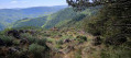
Amidst beech woods teeming with mountain flora, make your way to one of the highest points in southern Aveyron and enjoy a 360° view of the Monts d’Orb and Lacaune and, on a clear day, the Pyrenees

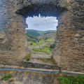
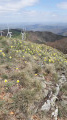
From Saint-Méen, a place of pilgrimage and the source of the River Rance, make your way to the summit of Merdelou (1,100 m) through a landscape of coppiced woodland, forests and high-altitude grasslands. A fitting reward for your efforts: a panorama of outstanding beauty stretching as far as the high plateaus of Espinouse and Somail, complete with a map marker!

Details

n°39270666
Creation:
Last update:
–
Last review:
  • Walking
    Activity: Walking
  • ↔
    Distance: 5.85 mi
  • ◔
    Average duration: 3h 30 
  • ▲
    Difficulty: Moderate

  • ⚐
    Back to start: Yes
  • ↗
    Ascent: + 942 ft
  • ↘
    Descent: - 968 ft

  • ▲
    Highest point: 3,632 ft
  • ▼
    Lowest point: 2,667 ft

Photos

Description of the walk

(S/E) Village of St Méen

(1) From the hamlet of St Méen, follow the D109 for 200 metres towards Couffouleux.

(2) Leave this road and turn right onto a track. Continue along this shaded, winding forest track, which features a few hairpin bends.

(3) You’ll reach an open spot at an altitude of 1,082 metres known as ‘Les Quatre Chemins’. Continuing straight on, there are 600 metres left to the summit (orientation table).

(4) For the return journey, head back to “Les Quatre Chemins” and turn right onto the track that descends towards the Rance valley. At first, the gradient is quite steep with a few tight bends, then levels out as you reach the farmland.

(5) You’ll reach the D109 in the middle of a bend. Turn left and head uphill along this road to St Méen, which is 700 metres away. (S/E)

Waypoints

  1. S/E : mi 0 - alt. 2,877 ft
  2. 1 : mi 0.04 - alt. 2,864 ft
  3. 2 : mi 0.31 - alt. 2,871 ft
  4. 3 : mi 2.21 - alt. 3,550 ft
  5. 4 : mi 3.23 - alt. 3,465 ft
  6. 5 : mi 5.37 - alt. 2,717 ft
  7. S/E : mi 5.85 - alt. 2,877 ft

Notes

How to get there:
From Camarès, take the D51 then the D109

Car park:
Car park in the hamlet of St Méen

Worth a visit

Saint-Méen Chapel
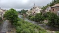
On one of the roads linking Camarès to Lacaune, at an altitude of 800 metres, lies a small hamlet called St-Méen. A spring gushes forth amongst the houses. Born in England in 540, Méen – whilst passing through Rouergue on a pilgrimage to Rome – is said to have caused a spring to gush forth at the foot of the Merdelou to heal those suffering from the plague. In the Middle Ages, there was a hospital and a church here, both of which have since disappeared; however, the chapel, built in 1919, attracts large crowds on 24 June, the day of the pilgrimage. People come from far and wide to collect holy water from the spring, which is reputed to cure skin diseases.

Reviews and comments

5 / 5
Based on 1 review

Reliability of the description
5 / 5
Ease of following the route
5 / 5
Route interest
5 / 5
User 9679999

Overall rating : 5 / 5

Date of your route : Sep 06, 2025
Reliability of the description : ★★★★★ Very good
Ease of following the route : ★★★★★ Very good
Route interest : ★★★★★ Very good
Very busy route : No

A peaceful hike with surprising views 👍

Machine-translated

Other walks in the area

For more walks, use our search engine .

The GPS track and description are the property of this route's author. Please do not copy them without permission.