Country:

 City:
City:


Parking is available at the car park at the end of the Chemin du Camping de Mittlach, in the hamlet of Langenwasen, a few dozen metres before the forest ranger’s house.
Yellow Cross markings
(S/E) At the far end of the car park, a marker indicates the path leading into the forest; take this path and cross the footbridge over the Fecht. This marks the start of the climb towards the Pfahlrunz Waterfalls. The path joins a wider track. Walk about twenty metres to the right to discover thefirst waterfall.
Head back about 50 metres along the wide track until you reach a junction where, on the right, attached to a tree, is a Club Vosgien signpost marked ‘Waterfalls’.
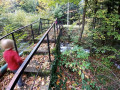
(1) Leave the wide track and take the steep path on the right, which winds in numerous hairpin bends overlooking the stream. On several occasions, you can take small footpaths, such as at point (2), which lead closer to the bank.
When the slope levels out, the path widens, becomes straighter and reaches a four-way junction.
A possible shortcut – see Practical Information.
Unmarked
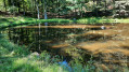
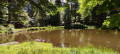
(3) Leave the Chemin du Schweisel straight ahead and take the path on the right, which shortly afterwards crosses the Chemin Renaud; continue straight on. After a bend to the left and then to the right, don’t miss a path on the left leading to a charming little pond and a shelter with benches and a picnic table.
(4) Retrace your steps to rejoin the wide path on the left. At the next Fork in the road, ignore the Chemin des Souilles and head uphill to the left. A few hundred metres further on, you’ll reach the junction with the Chemin du Herrenberg.
Red Rectangle markings forthe GR®5
(5) Turn left onto theGR®5, which climbs steeply towards the Col du Herrenberg. As you emerge from the forest, after the gate, follow a grassy path to join a wider path on the left at the edge of a beech forest.
(6) This is a gentle, level path offering lovely views over the stubble fields. Further on, it merges with a wide forest track coming from the right which leads to the pass. Continue to the next junction (elevation 1189 on the IGN map).
(7) Let the Red Rectangle-marked trail branch off to the right and keep left onto the forest track to reach a junction just before the pass and the Route des Crêtes.
(8) Turn left uphill onto the Scheisel scree slope via theGR®5. It takes a detour to the right to avoid a protected area before reaching the summit, marked by a boundary stone. Enjoy a beautiful panoramic view of the main peaks of the Vosges massif
(9) Continue down theGR® towards a small pass to reach the junction with a cross-country path marked with a Yellow Cross – the one you left at point (3).
(10) Carry on straight along theGR®; after a short climb, the path enters a beautiful beech forest. It emerges near the Route des Crêtes, then runs alongside the road below and, passing through an archway, reaches the Refuge du Hahnenbrunnen.
The volunteers from the Mulhouse Touring Club always give a very warm welcome there.
Red Rectangle & White Rectangle Markings
(11) Go round the refuge on the road side, cross a track, leave theGR®5– which continues to the right above the road – and head left uphill towards a Fork in the road. Turn left; the path is almost level all the way to the Uff Rain farm. It leaves the heathland and enters the forest, emerging again near the source of the Fecht (or Salzbach stream) on your left.
(12) The path descends towards an access track to the farmhouse inn and joins it just before a Fork in the road. There’s a lovely view of the peaks of the “Trois Kopfs” and the Kastelberg hill.
(13) Keep to the right, overlooking the farm. Enter the forest and, after a left-hand bend, you’ll reach a Fork in the road.
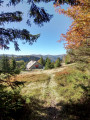
(14) Leave the track and turn right for a short climb. After about 1 km, the path opens out onto the Uff Rain scree slope , offering an exceptional panorama facing the summit of the Hohneck. Continue to the farm. Enjoy the view, then go round the farm, heading down to the right.
Yellow Triangle signposting
(15) With your back to the terrace at the rear of the farm, head left towards a small archway and a Yellow Triangle marker. Descend along a barely visible grassy path towards a tree bearing a Club Vosgien signpost directing you towards the forest entrance. Pass through an archway (watch out for the cable on the ground) and head downhill to quickly reach a wide path.
(16) Turn right, then immediately left. Take a hairpin bend to the right at the next junction and join the Chemin du Hahnenbrunnen.
(17) Carry on straight ahead, keep to the left, then take a hairpin bend to the left downhill. After another hairpin bend – to the right this time – carry on straight ahead for just under 2 km. At the junction, take one final hairpin bend to the left and, after a few dozen metres, you’ll find the path marked with a Yellow Triangle heading downhill to the right. A shortcut is available; see Practical Information.
Unmarked
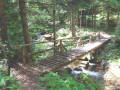
(18) Ignore this path and its markings; continue down a gentle slope which leads to the right bank of the Fecht. Take a few steps to the right and follow the path on the left, which leads to a pretty wooden footbridge – an ideal spot to enjoy the river and its waterfalls.
(19) Head up to the left bank and turn right onto the return path, which descends gently, crosses the river and then joins the path on the right bank. Before reaching the car park, note the Forest House and its fountain – see ‘During the walk’(S/E).



 Visorando Member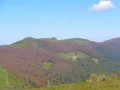
 Moderate
 Easy
Easy 
 Tourism professional