


Refine your search for walks in Camping de Mittlach
Camping de Mittlach walks


 The Schweisel, flowing along the banks of the Pfahlrunz and the Salzbach
 Visorando Member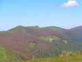
 7.81 mi
 +2,119 ft
 -2,106 ft
 5h 25
5h 25
 Moderate
 Departure from Metzeral (Haut-Rhin)
The Schweisel is a peak on the main ridge of the Vosges, between the Thann valley to the west and the Munster valley to the east.It is renowned not only for its exceptional panoramic views but also for its heathland, forest and wetland area, the Schweiselwasen, on its eastern slope. It is via this eastern slope, criss-crossed by numerous streams, that this route takes you on a journey of discovery.
High-altitude grasslands and beech forests via the Pfahlrunz and Salzbach waterfalls
 11.56 mi
+2,215 ft
-2,192 ft
7h 15
11.56 mi
+2,215 ft
-2,192 ft
7h 15
 Difficult
Departure from Metzeral (Haut-Rhin)
Difficult
Departure from Metzeral (Haut-Rhin)
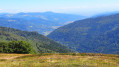
After a pleasant climb alongside the Pfahlrunz waterfalls, a final push leads to the Schweisel hilltop and its exceptional viewpoint. This is followed by a walk through a beautiful beech forest along the ridge, which leads to the Hahnenbrunnen mountain refuge.
The return route via the Salzbach and Uff Rain ridges offers remarkable views of the highest peaks before a long descent through the Muhlbach Woods. It ends at a pretty footbridge over the Salzbach stream, which becomes the River Fecht; following its left bank leads back to the car park.
Walks near Camping de Mittlach
Hahnenbrunnen Pass and Uff Rain from Langenwasen
 9.32 mi
+2,182 ft
-2,146 ft
6h 10
Difficult
Departure from Metzeral (Haut-Rhin)
9.32 mi
+2,182 ft
-2,146 ft
6h 10
Difficult
Departure from Metzeral (Haut-Rhin)
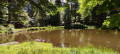
A lovely climb towards the Vosges ridge along the River Pfahlrunz, with a stop at a charming little lake (unnamed). Lots of remarkable trees. Then an easy walk along theGR®5along the ridge before heading towards the farm inns at Salzbach and Uff Rain, with panoramic views of the Vosges peaks.
Hahnenbrunnen – Willer-sur-Thur
 13.02 mi
+886 ft
-3,524 ft
6h 45
Moderate
Departure from Metzeral (Haut-Rhin)
13.02 mi
+886 ft
-3,524 ft
6h 45
Moderate
Departure from Metzeral (Haut-Rhin)
The final stage passes via the Markstein and beneath the Grand Ballon, with more downhill sections and shade provided by the trees, ending in the Thur Valley where you can catch a train to Mulhouse.
From Lac de Blanchemer to Lac de Longemer
 6.46 mi
+738 ft
-1,532 ft
3h 35
Moderate
Departure from La Bresse (Vosges)
6.46 mi
+738 ft
-1,532 ft
3h 35
Moderate
Departure from La Bresse (Vosges)
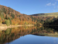
Second stage of this hike with bivouac. This time, Lac Lalande, Lac de Retournemer, Cascade Charlemagne and Cascade de Retournemer will be on your route, allowing you to discover magnificent colours.
From Lac de Blanchemer to the Chalet de Rouge Mousse
 7.13 mi
+1,880 ft
-2,054 ft
4h 55
Moderate
Departure from La Bresse (Vosges)
7.13 mi
+1,880 ft
-2,054 ft
4h 55
Moderate
Departure from La Bresse (Vosges)
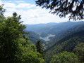
Starting from Lac de Blanchemer, the route follows theGR®531, taking you via the Rainkopf (alt. 1,305 m), before descending towards the Tourbière de Machais, the Col de Bramont and the Étang de Sèchemer to reach the Chalet de Rouge Mousse.
Markstein – Petit Ballon – Linthal
 Tourist office12.88 mi
+1,407 ft
-3,619 ft
7h 10
Difficult
Departure from Oderen (Haut-Rhin)
Tourist office12.88 mi
+1,407 ft
-3,619 ft
7h 10
Difficult
Departure from Oderen (Haut-Rhin)
Take the time to admire the landscapes and views that make this second day’s walk so special. The route follows the ridges for the most part, leading to the Petit Ballon via the Klintzkopf. Once again, you’ll be able to fully enjoy the panoramic views over the plains and valleys on either side of the mountain. This route, which passes through forests and stubble fields, will allow you to discover the richness of the local flora.
Schiessrothried Lake - Charlemagne car park
 5.08 mi
+2,352 ft
-1,398 ft
4h 25
Moderate
Departure from Metzeral (Haut-Rhin)
5.08 mi
+2,352 ft
-1,398 ft
4h 25
Moderate
Departure from Metzeral (Haut-Rhin)
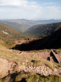
From Schiessrothried, tour of Petit Hohneck, Dagobert's cave, Frankenthal and Col de Falimont.
This route is not accessible in winter. The route is closed between (3), (4), (5) and (6) from 1 November to 30 April 2022 (Prefectural Order of 18 May 2022).
Le Markstein – Thann
 Tourism professional
 17.72 mi
+2,359 ft
-5,187 ft
10h 10
17.72 mi
+2,359 ft
-5,187 ft
10h 10
 Very difficult
Departure from Oderen (Haut-Rhin)
Very difficult
Departure from Oderen (Haut-Rhin)
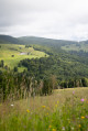
From the Markstein, the sixteenth stage of the journey across the Vosges proposed by Passion Vosges magazine continues along the Great Vosges Ridge towards the massif’s highest point, the Grand Ballon. After a visit to the Hartmannswillerkopf battlefield (1914–1918) and a climb to the summit of the Molkenrain, a long descent through the forest begins, heading towards Thann and its famous Gothic collegiate church. Franck Buchy’s account of this sixteenth stage can be found in *Passion Vosges*.
From the ridges towards the Petit Ballon
8.32 mi
+866 ft
-784 ft
4h 35
Moderate
Departure from Ranspach (Haut-Rhin)
The Munster Valley, Hohrodberg, Haut-Koenigsbourg Castle – just how far will the Col d’Oberlauchen take your view?
Setting off from Markstein, before crossing the resort’s ski slopes, you can stop off to visit the Notre-Dame-des-Neiges Chapel for a brief cultural break. Heading towards the Petit Ballon, this route crosses numerous passes and peaks, such as the Klintzkopf and the Hilsenfirst, not to mention the Col d’Oberlauchen, from which you’ll be able to spot many of the area’s distinctive features… Keep your eyes peeled!
Charlemagne car park - Schiessrothried Lake
 5.84 mi
+728 ft
-1,683 ft
3h 20
Moderate
Departure from Xonrupt-Longemer (Vosges)
5.84 mi
+728 ft
-1,683 ft
3h 20
Moderate
Departure from Xonrupt-Longemer (Vosges)
day1: hike around Hohneck, snowfield route and descent to Schiessrothried Lake.
Descent into the Noble Valley
11.33 mi
+705 ft
-3,825 ft
5h 50
Moderate
Departure from Sondernach (Haut-Rhin)
Begin your descent through varied landscapes towards the first villages of the Alsace plain, situated on the Wine Route.
After enjoying the 360° view from the Petit Ballon over the valleys of Guebwiller and Munster and the Hohneck and Grand Ballon mountain ranges, it is as you begin the descent at the end of the ridge that you will catch sight of the Petit Ballon glacial cirque. Beautiful little paths, winding through woods and meadows, vineyards and mountains, will take you to the village of Soultzmatt, via Wintzfelden and Osenbach, not forgetting a short stop at the remarkable site of the ruins of Schwartzenthann Convent.