The Gentiane and Wissgrut scree slopes via the Chemin Marcel Tassion

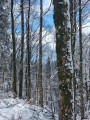
The walk is a bit of a challenge at the start with a significant climb, but it’s along a shaded forest track with a gentle gradient.
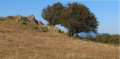
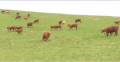
The magic happens again when you emerge from the forest and reach the stubble fields, where you can enjoy a different atmosphere.

Details

22071093
Creation:
Last update:
Last review:
  • Walking
    Activity: Walking
  • ↔
    Distance: 6.65 mi
  • ◔
    Average duration: 4h 35 
  • ▲
    Difficulty: Moderate

  • ⚐
    Back to start: Yes
  • ↗
    Ascent: + 1,791 ft
  • ↘
    Descent: - 1,798 ft

  • ▲
    Highest point: 3,635 ft
  • ▼
    Lowest point: 1,821 ft

Photos

Description of the walk

Take the D465 to the large car park at Roche du Cerf and Saut de la Cuvotte.

(S/E) Take the Chemin Privé Marcel Tassion, near the former holiday camp (running parallel to the path marked with a Blue Disc), and follow this forest track for 2.5 km. Cross the Pont des Soupirs over the Goutte du Bon Pommier and join the path marked with a Blue Disc at a fork.

(1) Turn right onto this path and follow it for about 170 m until you reach another fork.

(2) Leave the signposted path, turn left and stay on the forest track until the next fork in the tracks.

(3) Turn right and follow this forest road to the crossroads near the Gentiane mountain police station.

(4) Turn right, walk for about 100 m and join a stony path.

(5) Turn right, pass under a chairlift and head towards the Ferme Auberge du Wissgrut. You’ll come to a fork in the path.

(6) Go straight on. Here, the path is marked with a Red Rectangle. You’ll reach a four-way junction after passing a car park and the Ferme Auberge du Wissgrut.

(7) After the Vierge du Wissgrut hill, turn right and head down towards the Gros Hêtre.

(8) At this junction, take the path on the right, marked by a Blue Triangle, which descends along the ridge. You’ll reach a four-way junction at an elevation of 900. Turn left to continue descending along the marked path and join a forest track 500 m further on. Follow it downhill for about 100 m.

(9) Leave this forest track by turning right to stay on the path, which is still marked with a Blue Triangle.

(10) Return to the forest track, this time marked with a Yellow Triangle. Before a hairpin bend on this forest track, veer right off it and follow the same markings until you reach a road (D465)

(11) Turn right and, for 800 m, walk carefully along this road until you reach the start of the car park after the Roche du Cerf, the Saut de la Cuvotte and its small waterfalls. You will then reach the car park (S/E).

Waypoints

  1. S/E : mi 0 - alt. 1,919 ft - Large shaded car park
  2. 1 : mi 1.52 - alt. 2,963 ft - Junction, go straight on
  3. 2 : mi 1.65 - alt. 3,022 ft - Junction, turn left
  4. 3 : mi 2.1 - alt. 3,186 ft - Junction, turn right
  5. 4 : mi 2.71 - alt. 3,461 ft - Mountain Gendarmerie
  6. 5 : mi 2.75 - alt. 3,471 ft - Plain de la Gentiane
  7. 6 : mi 3.4 - alt. 3,602 ft - Border between Haut-Rhin and the Territoire de Belfort
  8. 7 : mi 3.89 - alt. 3,537 ft - Belle Chaume - Wissgrut
  9. 8 : mi 4.16 - alt. 3,428 ft - Junction, turn right
  10. 9 : mi 5.05 - alt. 2,631 ft - Junction on the path - Col de Chantoiseau (920m)
  11. 10 : mi 5.29 - alt. 2,411 ft - Goutte des Forges
  12. 11 : mi 6.13 - alt. 1,821 ft - Roche du Cerf. Saut de la Cuvotte
  13. S/E : mi 6.65 - alt. 1,919 ft - Saut de la Cuvotte

Notes

To get from waypoint (5) to waypoint (6), you can take the ridge path marked with a parallel Red Rectangle rather than the one suggested, but the view is less unobstructed.
(1) Please take care along the D465; walk on either side of the road depending on the width of the pavements.

Reviews and comments

4.4 / 5
Based on 3 reviews

Reliability of the description
4.7 / 5
Ease of following the route
4 / 5
Route interest
4.7 / 5
martinemeillet
martinemeillet

Overall rating : 4.7 / 5

Date of your route : Jun 08, 2026
Reliability of the description : ★★★★★ Very good
Ease of following the route : ★★★★☆ Good
Route interest : ★★★★★ Very good
Very busy route : No

It was a bit of a tough climb as we missed the Marcel Tassion path and followed the Blue Circle markings, but the panoramic view from Wissgrut was well worth it, even though the mist in the distance hid the Alps from view.

Machine-translated

bouledjouidja rabah
bouledjouidja rabah

Hello
I’m glad you enjoyed this walk.
There’s still a sense of magic in these places.
All the best.

Machine-translated

JP Dulac
JP Dulac

Overall rating : 4 / 5

Date of your route : May 27, 2024
Reliability of the description : ★★★★☆ Good
Ease of following the route : ★★★★☆ Good
Route interest : ★★★★☆ Good
Very busy route : Yes

Moderate-difficulty hike
Life is good at La Gentiane and Wissgrut
Take care on the descent towards the Roche du Cerf; there is an alternative route as you approach the road

Machine-translated

bouledjouidja rabah
bouledjouidja rabah

I’m glad you enjoyed the walk.
It’s true that this place is magnificent, with the stubble fields and the view of the Alps.
All the best

Machine-translated

90rando
90rando

Overall rating : 4.7 / 5

Date of your route : Jan 29, 2024
Reliability of the description : ★★★★★ Very good
Ease of following the route : ★★★★☆ Good
Route interest : ★★★★★ Very good
Very busy route : No

A lovely route with a lovely climb through the woodland at the start, but the high bridge over the gentian-filled meadow and the view of the Alps are a real feast for the eyes.

Machine-translated

Other walks in the area

For more walks, use our search engine .

The GPS track and description are the property of this route's author. Please do not copy them without permission.