Ratilly Castle and the headwaters of the Vrille

Local heritage and springs make this a delightful route.

Details

55865
Creation:
Last update:
Last review:
  • Walking
    Activity: Walking
  • ↔
    Distance: 6.95 mi
  • ◔
    Average duration: 3h 40 
  • ▲
    Difficulty: Moderate

  • ⚐
    Back to start: Yes
  • ↗
    Ascent: + 558 ft
  • ↘
    Descent: - 538 ft

  • ▲
    Highest point: 978 ft
  • ▼
    Lowest point: 738 ft

Photos

Description of the walk

(S) The walk starts from the car park opposite the emergency services centre.

Walk along the cemetery wall heading north. At the first junction with Rue du Petit Pont, take the left-hand path of the two in front of you. When you reach a track that is half tarmac, half grass, follow it until, at the next junction, you take the road opposite, heading towards Les Pautrats.
Take the next path on the left, which is somewhat hidden amongst the greenery and a little damp at the start. This path is about 100 metres long and leads onto a small tarmac road. Take the path opposite, which will bring you to the front of Ratilly Castle (1).
In the right season (see the link), the path that goes round the château is open. Out of season, go round via the road below the château. Continue along the small road, heading straight on, passing Les Martins and Les Pautrats on your right, then Bourg sans Paille on your left, until you reach a forest track.
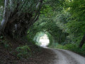
Turn right and follow this track downhill for 400 metres. Take the path on the right which leads into the woodland. Follow it until you reach the first house, then turn left. Cross the road, walk uphill for 50 metres and turn left (2).
Take the first path (rue de Beugnon), walk down to the very end, turn left, then walk 100 metres and turn right.
Walk for 250 metres, then turn left. Join the small road (with a wayside cross on the left), turn right, then take the next path on the right. You will then follow the route of the Vrille springs to the ford.
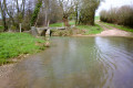
(4) When you reach the ford, cross the small stone bridge to reach a road, which you will cross. Walk up the stony path, pass the Croix Saint Jean, and take the first path on the right. Continue to the next road junction.
When you reach this crossroads (Les Gourleaux), turn right onto the tarmac road, walk past the microlight take-off strip, and continue until you reach the outskirts of Treigny. You will arrive at Rue des Canards; walk up this street on the right, passing the ‘Cathédrale de la Puisaye’. At the roundabout, take the left-hand street and carry on straight ahead to return to the starting car park.

Waypoints

  1. S/E : mi 0 - alt. 768 ft - Motorhome car park
  2. 1 : mi 0.86 - alt. 902 ft - Château de Ratilly
  3. 2 : mi 3.21 - alt. 961 ft - You’ll pass very close to the old water tower
  4. 3 : mi 4.36 - alt. 781 ft - On your left, the field where the Vrille springs forth
  5. 4 : mi 4.82 - alt. 751 ft - Vrille ford - La Vrille
  6. S/E : mi 6.95 - alt. 768 ft - Motorhome car park - Auberge de jeunesse de Treigny

Notes

Throughout the route, ignore the various signposts and follow this description only.
Make sure you bring water and wear suitable footwear. The path between the forest track and the hamlet of Le Chaîneau is a sunken track, which means that in wet weather, the path becomes muddy. The rest of the route is fairly straightforward.
Option to shorten the walk: when you reach the ford (4), do not cross the Vrille, but continue along the path to reach Treigny via Rue du Couvent (passing in front of the new cemetery). Once you reach the church, resume the final part of the route.

Worth a visit

Along the route, you’ll find Ratilly Castle (1), an avenue of pollarded trees, a chestnut grove planted to celebrate the births of children in the village, pottery exhibitions, a former water tower converted into a stargazing site (2), springs, fords and the church. The time spent walking is one thing; the time spent on visits is quite another.
This walk is well worth taking, with plenty of stops for sightseeing. Don’t forget that you’re in the heart of the Puisaye pottery region!
Places to visit include:
Ratilly Castle.
Treigny Convent.

Reviews and comments

4.8 / 5
Based on 2 reviews

Reliability of the description
5 / 5
Ease of following the route
4.5 / 5
Route interest
5 / 5
lamome59
lamome59

Overall rating : 4.7 / 5

Date of your route : Aug 13, 2024
Reliability of the description : ★★★★★ Very good
Ease of following the route : ★★★★☆ Good
Route interest : ★★★★★ Very good
Very busy route : Yes

A lovely route

Machine-translated

Antoine Monneret
Antoine Monneret

Hello,

I haven’t done this walk…

It seems that there are numerous bugs other than this one affecting the use of Visorando (e.g. the hike details disappearing whilst you’re using the app… you have to re-enter all the information to find it again!)
We did the “Le Moulin Rouge and the Château du Fort” walk in Mézilles (89).
If you follow up with me about it, I’ll get back to you.
And, without further ado: a superb walk!
Thanks again for your app (it could do with some improvement but is very useful),

Antoine

Machine-translated

POULIN Gérard
POULIN Gérard ★

Pure joy .

Machine-translated

SALAMANDRE58450
SALAMANDRE58450
• Edited:

Overall rating : 5 / 5

Date of your route : Oct 05, 2016
Reliability of the description : ★★★★★ Very good
Ease of following the route : ★★★★★ Very good
Route interest : ★★★★★ Very good

Hello,
A brilliant walk. We had a fantastic day. The sun shone on us throughout the whole walk. The woods were lovely at this time of year. The ground wasn’t muddy… what a stroke of luck! And to top it all off, we picked a few porcini and parasol mushrooms, and even found a salamander!! Pure bliss.
Thank you for introducing me to the Vrille at its source. I’d only ever known it from where it joins the Loire.
Kind regards.

Machine-translated

Other walks in the area

For more walks, use our search engine .

The GPS track and description are the property of this route's author. Please do not copy them without permission.