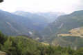
Arvieux – Furfande Refuge

Ascent to the Furfande Refuge from Arvieux via theGR®58.
Hike completed on 5 July 2018 as part of a route.

This walk is part of a multi-day hike: Chalets et bergeries d'estive autour d'Arvieux

Details

1265750
Creation:
Last update:
Last review:
  • Walking
    Activity: Walking
  • ↔
    Distance: 4.30 mi
  • ◔
    Average duration: 4h 40 
  • ▲
    Difficulty: Moderate

  • ⚐
    Back to start: No
  • ↗
    Ascent: + 3,123 ft
  • ↘
    Descent: - 676 ft

  • ▲
    Highest point: 8,192 ft
  • ▼
    Lowest point: 5,089 ft

Photos

Description of the walk

At the entrance to Arvieux coming from Brunissard, park in the Furfande hikers’ car park, which is on the right bank of the Izoard torrent.

(S) Take the Col de Furfande road, which runs alongside the Champ la Maison torrent, first on the left bank and then crossing over to the right bank.

(1) Leave the Col de Furfande road at a bend and continue straight on along the path that runs alongside the stream. You’ll reach the hamlet of Le Pied de la Garduère at 1,830 metres, where the path rejoins the Col de Furfande road.

(2) Take a path branching off to the right into the forest. Pass the first bend and reach a crossroads marked by a cairn.

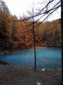
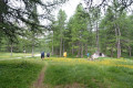
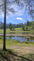
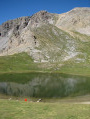
(3) Stay on the path and head due south through a beautiful larch forest. Pass a small, unnamed lake. Reach the Plan du Vallon hut at 2,025m.

(4) Continue along the path which runs alongside the Col de Furfande road, then joins it before leaving it again at a bend. You’ll reach the hamlet known as Dépassé de l’Eau.

(5) Follow the left bank of the torrent to rejoin the forest road up to the pass.

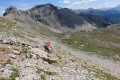
(6) Leave the road and continue along the path, heading first due south and then south-west. The final hairpin bends of the path lead to the Col de Furfande, marked by a cross.

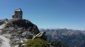
(7) Then head straight south to reach the Refuge de Furfande (E).

Waypoints

  1. S : mi 0 - alt. 5,089 ft - Furfande hikers’ car park
  2. 1 : mi 0.63 - alt. 5,463 ft - Champ Blanchon
  3. 2 : mi 1.24 - alt. 6,014 ft - Foot of the Garduère
  4. 3 : mi 1.48 - alt. 6,237 ft - Cairn
  5. 4 : mi 2.01 - alt. 6,644 ft - Plan du Vallon hut
  6. 5 : mi 2.56 - alt. 7,067 ft - A place known as Dépassé de l’Eau
  7. 6 : mi 2.84 - alt. 7,323 ft - Road junction
  8. 7 : mi 3.61 - alt. 8,192 ft - Col de Furfande (2456m)
  9. E : mi 4.3 - alt. 7,520 ft - Refuge de Furfande

Notes

The Plan du Vallon hut is a very basic shelter.

Worth a visit

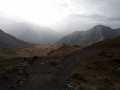
On the way up, after the Plan du Vallon hut, you’ll see the Dent de Ratier on your left and the Pic du Gazon on your right.
For those not staying at the refuge, a detour via the barns and chalets at Furfande is a must.
For information : Furfande Refuge

Always be cautious and plan ahead when you're outdoors. Visorando and the author of this route cannot be held responsible for any accidents occurring on this route.

The GR® and PR® markings are the intellectual property of the Fédération Française de Randonnée Pédestre.

Reviews and comments

4.8 / 5
Based on 2 reviews

Reliability of the description
5 / 5
Ease of following the route
5 / 5
Route interest
4.5 / 5
Lebill75
Lebill75

Overall rating : 5 / 5

Date of your route : Jul 29, 2025
Reliability of the description : ★★★★★ Very good
Ease of following the route : ★★★★★ Very good
Route interest : ★★★★★ Very good
Very busy route : No

Great hike starting from the village of Arvieux. Much of the beginning of the hike is in the shade, so it's perfect if it's hot. There are no water sources until you reach the refuge, where the food is very good. We finished off with a tour of the furfande chalets. The round trip from Arvieux + tour of the chalets is about 24 km. There is also a fountain at the start of the car park in Arvieux. A very beautiful hike.

Machine-translated

Guyjeff
Guyjeff

Overall rating : 4.7 / 5

Date of your route : Oct 23, 2019
Reliability of the description : ★★★★★ Very good
Ease of following the route : ★★★★★ Very good
Route interest : ★★★★☆ Good

A lovely, well-signposted walk – you just need to follow the GR58 markings; with the directions provided, it’s easy. Well, it’s an uphill climb all the way, but the walk is very varied – sometimes along the edge of the stream, sometimes through the larch trees, and there’s a tiny, absolutely beautiful turquoise lake. We stopped at the pass in a gale-force wind typical of this time of year, so we didn’t carry on to the mountain hut.

Machine-translated

Other walks in the area

For more walks, use our search engine .

The GPS track and description are the property of this route's author. Please do not copy them without permission.