You are in a protected area! See the regulations in the practical information section.


 Country:

 City:
City:


Start from the Pré-la-Joux chairlift car park, beside the road of the same name.
(S/E) From the car park, head towards the chairlift entrance and go round it on the right. Follow a wide track to the left (heavily used by mountain bikers) and cross the Dranse d’Abondance (torrent). Immediately turn right, following the ski lift conveyor belt tunnel, and go round it at the end.
(1) Turn left and start the climb. Signs point to Betzalin and Les Covagnes, which will be your waypoints.
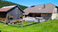
(2) Ignore the main track on your left and take a steeply ascending path opposite. It rejoins the track after about fifteen minutes: follow this track to the right and cross a torrent (the Ruisseau des Rubis). Climb along the hillside and make a wide circular loop to the left around the clearing to reach the Betzalin chalets.
(3) Take the path branching off to the left (west), make sure you close the electric fence properly, and head up this wide path, which soon turns north-west. Note a few remarkable trees on your left as you climb. You’ll reach the Covagnes chalets.
(4) Continue westwards along a path that keeps climbing. You’ll reach theGR® 5.
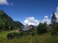
(5) Cross theGR® 5and take the path opposite, which descends south-south-west towards the Chalets de Lens. There is a fine view of the chalets and the Arête des Fours, framed by the Pointe de la Chavasse (on the right) and the Tête de Lindaret (on the left).
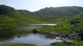
(6) At the 1622-metre mark, take an inconspicuous path that branches off to the left, retracing your steps for 20 metres. The path then climbs steeply at the bottom of the valley. It crosses a wetland area and emerges, after a very gentle descent, onto theGR® 5. Follow theGR® to the right until you reach a junction of several paths (a sort of pass at an elevation of 1663).
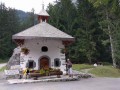
(7) Follow the main path down towards the south-east. Cross a stream via a bridge. About twenty metres further on, turn left and wade across the stream again. Continue to a wayside shrine (not shown on the map).
(8) From here, the path becomes more enclosed and descends more steeply. It emerges at the exit of a ski lift tunnel. Walk alongside the tunnel, cross the bridge over the stream, go round the chairlift departure point (be careful, there are lots of mountain bikes), cross the Dranse and head back to the car park (S/E).

 Visorando Member

 Difficult