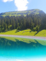
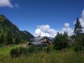
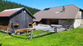
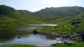
Mont de Grange as seen from Pré-La-Joux

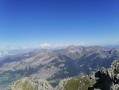
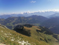
Starting from Châtel, the climb to this summit offers a superb 360° panorama, notably of Lake Geneva and the Mont Blanc massif. The route starts in the woods. The final section is exposed along the long Arête de Coicon. At the top, snowfields may remain even in the height of summer.

You are in a protected area! Please see the regulations in the practical information section.

Details

13469251
Creation:
Last update:
Last review:
  • Walking
    Activity: Walking
  • ↔
    Distance: 8.80 mi
  • ◔
    Average duration: 7h 20 
  • ▲
    Difficulty: Difficult

  • ⚐
    Back to start: Yes
  • ↗
    Ascent: + 3,757 ft
  • ↘
    Descent: - 3,766 ft

  • ▲
    Highest point: 7,956 ft
  • ▼
    Lowest point: 4,183 ft

Photos

Description of the walk

Start from the large car park at Pré-la-Joux (chairlift, ski lifts, summer toboggan run).

(S/E) Head north, leaving the Pierre-Longue chairlift behind you and keeping the ski lifts on your left.

(1) Turn right and head down alongside the conveyor belt, until you reach some houses.

(2) Turn left onto a track between the chalets. Climb slightly and stay on the track, ignoring all side paths. Cross the Ruisseau des Rubis (elevation 1436) and climb up to the Betzalin chalet.

(3) As you emerge from the hairpin bend at the foot of the chalet, turn left onto a path that climbs steeply through the forest. Leave the forest and you will immediately reach the Chalet des Covagnes.

(4) Turn sharply right. At the next junction, turn sharply left. You’ll reach a pass near the Lenlevay chalets (if you turn round, there’s a lovely view of the Dents du Midi).

(5) Then turn right. At the chalets, turn left and then right towards Mont de Grange. Climb gently along a shaded path. Look out for a signpost on the right marking the start of the Arête de Coicon.

(6) Take the path on the left and climb through the scrub. Pass a grassy plateau, then climb steeply along numerous hairpin bends. Continue northwards along the ridge. Cross a rocky scree slope and reach the summit (orientation table).

(7) Descend the entire Arête de Coicon via the same path.

(6) At the bottom (signpost), turn right and head down to the Lenlevay chalets and the unnamed pass.

(5) Continue straight on along the mountain pasture track.

(8) Cross a perpendicular mountain pasture track and carry on straight ahead. Head south-south-east then south-south-west, ignoring all side paths.

(9) At the crossroads, take thefirst path on the left, which descends steeply into the forest. Be careful, as it is somewhat hidden, but there is a sign indicating the direction.

(10) Turn left (east-north-east) and continue the descent through the forest.

(11) Ignore a path on the left and continue down the numerous hairpin bends. You’ll emerge above the ski lifts; go round them on the left.

(1) Turn right and pass downstream of the ski lifts to return to the starting point (S/E).

Waypoints

  1. S/E : mi 0 - alt. 4,252 ft - Pré-la-Joux – Car park - Dranse d'Abondance (rivière)
  2. 1 : mi 0.13 - alt. 4,252 ft - Crossroads at the circular loop
  3. 2 : mi 0.3 - alt. 4,183 ft - Crossroads
  4. 3 : mi 1.2 - alt. 4,872 ft - Le Betzalin
  5. 4 : mi 1.84 - alt. 5,518 ft - Les Covagnes
  6. 5 : mi 2.22 - alt. 5,679 ft - Unnamed Pass - Chalets de Lenlevay
  7. 6 : mi 2.77 - alt. 6,043 ft - Start of the Arête de Coicon trail
  8. 7 : mi 4.13 - alt. 7,956 ft - Mont de Grange
  9. 8 : mi 6.22 - alt. 5,659 ft - Crossing the track
  10. 9 : mi 7.51 - alt. 5,456 ft - Crossroads
  11. 10 : mi 7.65 - alt. 5,338 ft - Junction
  12. 11 : mi 7.92 - alt. 5,125 ft - La Place des Plaines
  13. S/E : mi 8.8 - alt. 4,255 ft - Pré-la-Joux – Car park

Notes

There are no water sources; please wear suitable hiking boots for certain tricky sections. Please note that this is a physically demanding hike. The final section is long and can be discouraging, as there are several points where you might think you’re almost there.

REGULATIONS:

This route passes through the Mont de Grange protected natural area. To avoid disturbing wildlife and to preserve its habitat, please respect the regulations in force.

Permitted:

  • Dogs on a lead
  • Camping is permitted between 7 pm and 9 am.

Prohibited:

  • Picking plants
  • Collecting plants
  • Littering
  • Motor vehicles

During your walk, you may also come across herds grazing in the mountain pastures; please ensure you follow these guidelines:

  • Close gates and fences
  • Keep your dogs on a lead and pick up their faeces
  • Do not wash, bathe or clean any objects in the drinking troughs
  • Do not approach the herds
  • Stay on the paths

Here, as elsewhere, nature deserves your respect

Further information: Protection Biotope (APPB) – Pays d’Evian Vallée d’Abondance

This route passes through a protected area, which may be subject to special regulations:

Worth a visit

At the pass where the route joins theGR®5, there is a lovely view of Lake Plagnes, and at the summit, a breathtaking view across the whole Abondance Valley and Lake Geneva as far as Mont Blanc, weather permitting.
The Pré-La-Joux car park is nearby; there’s no problem finding a space.

Always be cautious and plan ahead when you're outdoors. Visorando and the author of this route cannot be held responsible for any accidents occurring on this route.

The GR® and PR® markings are the intellectual property of the Fédération Française de Randonnée Pédestre.

Reviews and comments

4.8 / 5
Based on 2 reviews

Reliability of the description
5 / 5
Ease of following the route
5 / 5
Route interest
4.5 / 5
bbn35bzh
bbn35bzh

Overall rating : 4.5 / 5

Date of your route : Sep 10, 2024
Reliability of the description : Not used / Not applicable
Ease of following the route : ★★★★★ Very good
Route interest : ★★★★☆ Good
Very busy route : No

Route completed on 10/09/24 (we turned back at 2,080 m – about 1 km short of the summit – due to fog).
We weren’t very lucky today – it was very cloudy.
However, at around 2,000 metres, we spotted about twenty chamois – not exactly wild, but it was magical!
It must be absolutely stunning in good weather!!
Thanks for posting this

Machine-translated

Sans Plomb
Sans Plomb
• Edited:

Overall rating : 5 / 5

Date of your route : Aug 26, 2023
Reliability of the description : ★★★★★ Very good
Ease of following the route : ★★★★★ Very good
Route interest : ★★★★★ Very good
Very busy route : No

A lovely walk, which can be done in 5 hours.

Keep an eye out at around 12.5 km to make sure you take a hairpin bend to the left onto a small, unmarked path ;-) (you tend to stay on the wider path: see point 9)

Machine-translated

Other walks in the area

For more walks, use our search engine .

The GPS track and description are the property of this route's author. Please do not copy them without permission.