


Refine your search for walks in Chadoulin (cours d'eau) - Affluent du Verdon
Chadoulin (cours d'eau) - Affluent du Verdon walks


 Valplane – Lac d’Allos circular loop
 Visorando Member
 10.86 mi
 +3,589 ft
 -3,612 ft
 8h 05
 Difficult
 Departure from Allos (Alpes-de-Haute-Provence)
A lovely circular walk starting from the Cluite car park on the Lac d’Allos road. Ascend the Vallon de Valplane, pass by the Tête de Valplane and descend towards Lac d’Allos. The Vallon de Valplane is much less frequented than the neighbouring Vallon du Lac d’Allos; you may spot chamois and ibex there. Return via the GR®
Walks near Chadoulin (cours d'eau) - Affluent du Verdon
Lac d’Allos Mountain Hut – La Cantonnière Mountain Hut
 6.84 mi
+1,253 ft
-2,493 ft
4h 15
 Moderate
Departure from Allos (Alpes-de-Haute-Provence)
The final stage, which is longer than the other two, takes you back to the starting point.
Lac d’Allos – Tête de Valplane – La Cluite car park
 4.56 mi
+1,306 ft
-2,707 ft
3h 15
Moderate
Departure from Allos (Alpes-de-Haute-Provence)
Alternative route to reach the Cluite car park from the Lac d’Allos refuge. The route passes via the Tête de Valplane, which offers breathtaking views of Lac d’Allos, the Cirque de l’Encombrette and the valley leading to Colmars. You are in the Mercantour National Park; there are regulations to be observed, and failure to do so may result in a fine of up to €1,500 – see the practical information.This route takes you off the marked trails; please read the reviews.
Mont Pelat - Allos via Le Cimet
 13.63 mi
+2,405 ft
-7,661 ft
8h 20
 Very difficult
Departure from Allos (Alpes-de-Haute-Provence)
Second part of the circular. This second stage will take you to the village of Allos, starting from Mont Pelat, via the Trou de l'Aigle, the Cimet and its many waterfalls, including the Cascade du Pich and the Bois de Vacheresse.
From Les Louiqs to La Cantonnière via the Gialorgues and Roche Trouée passes
 9.77 mi
+3,428 ft
-2,910 ft
7h 30
Difficult
Departure from Entraunes (Alpes-Maritimes)
This final stage starts from the Refuge Ferran aux Louiqs and ends at the Refuge de la Cantonnière via the Col de Gialorgues and the Col de la Roche Trouée. You ascend the Vallon de l’Estrop, then descend after the Col de Gialorgues into the valley before climbing again via the three lakes of Giarlogues to the Col de la Roche Trouée. The route then descends along the right bank of the Ruisseau de Gorgias, finally rejoining the path from the first day along the Ruisseau de Sanguinière and arriving at the Refuge de la Cantonnière.
From the Refuge de la Cantonnière to the Refuge de la Cayolle via the Col de la Boucharde
 6.90 mi
+2,874 ft
-1,503 ft
5h 40
Moderate
Departure from Entraunes (Alpes-Maritimes)
This route from the Refuge de la Cantonnière to the Refuge de la Cayolle via the Col de la Boucharde is the first day of a three-day route in the Haut-Var. After a shaded climb alongside the Ruisseau de Sanguinière, the route ascends the Ravin de la Boucharde before descending to the Bachelard after crossing the pass. You then need to follow the left bank of the Bachelard back up to the Refuge de la Cayolle, where you will spend the night.
Refuge de la Cantonnière – Col de la Cayolle
 3.32 mi
+1,677 ft
-351 ft
3h 00
Moderate
Departure from Entraunes (Alpes-Maritimes)
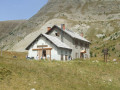
A climb that offers views of different levels of the mountain: meadows, coniferous forest and alpine pastures.
Around Les Garrets
 14.67 mi
+4,055 ft
-4,108 ft
3 days
Moderate
Departure from Entraunes (Alpes-Maritimes)
A 3-day mountain hike going from refuge to refuge.
The daily stages are relatively short (3 to 5 hours), making it accessible to people of average fitness.
Wildlife (marmots, chamois, ibex and birds of prey) can be spotted quite easily at higher altitudes.
Col de la Cayolle – Lac d’Allos Mountain Hut
4.49 mi
+1,204 ft
-1,312 ft
3h 05
Moderate
Departure from Uvernet-Fours (Alpes-de-Haute-Provence)
A climb to a pass, followed by a descent of roughly the same length, with two beautiful lakes to admire. This walk also gives you the chance to compare the two sides of the mountain, which are quite different.
From the Refuge de La Cayolle to Les Louiqs via the Col de la Petite Cayolle
 8.50 mi
+1,496 ft
-3,389 ft
5h 15
Moderate
Departure from Uvernet-Fours (Alpes-de-Haute-Provence)
This second stage will take you from the La Cayolle refuge to the Ferran lodge at the Louiqs farm via the Col de La Petite Cayolle and the Pas de Lausson. It offers views of numerous mountain lakes and the Var waterfalls beneath the Pont du Diable. You can stop at the La Cantonnière refuge to shorten the route or have a snack.
Allos - Mont Pelat
 10.09 mi
+5,577 ft
-328 ft
9h 30
Difficult
Departure from Allos (Alpes-de-Haute-Provence)
The first part of this two-day circular is challenging and breathtaking, taking you through the heart of Mercantour National Park from the village of Allos, via Lac d'Allos and its refuge, Mont Pelat, Lac du Trou de l'Aigle, Le Cimet and its many waterfalls, including Cascade du Pich and Les Bois de Vacheresse.