Country:

 City:
City:


The walk starts from the Cluite car park, which can be reached from the village of Allos via the Route du Lac.
Park at the far end of the car park where the start point is located (yellow sign pointing to the Valplane Waterfall).
(S/E) Set off south-east into the woods on a steep climb along a wide path; gradually the slope levels out as the path winds its way through the larch trees. You’ll come within sight of the pretty Valplane Waterfall (which is not accessible).
(1) Continue to the right along the path, which is still signposted, for 200 m.
(2) Turn sharply left and continue along the edge of a deep ravine until you reach the Valplane Hut. Take care on this section; the path becomes less visible but is still relatively easy to follow. Sheep are present in the valley during the grazing season.
(3) Head up the valley as close as possible to the small stream and, a little further up, head for the Baisse de Valplane, which is clearly visible to the south-southeast, between the Tête de Valplane and the summit of Les Graus. There is no marked path here (apart from a cairn at the start); make your way as best you can to reach the Baisse de Valplane, as the final slopes are very steep, between 25 and 30°. However, there are no technical difficulties for experienced mountaineers.
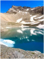
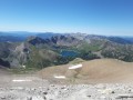
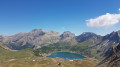
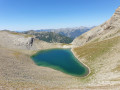
(4) Turn left and follow the ridge to the Tête de Valplane, marked by a large cairn. Magnificent views over the Lacs de l’Encombrette and the Lac d’Allos.
(5) Descend by sight,
- either by following the ridge,
- or directly north-east down the steep slope, though it is possible to take wide switchbacks here. There are no problems with navigation; simply head towards the magnificent Lac d’Allos until you reach the GRP® Tour du Haut-Verdon trail.
(6) Turn right onto the GRP® to begin the steady climb ending at the Col de l’Encombrette at an elevation of 2,527 metres.
(7) Head back down to the previous junction.
(6) Carry on straight ahead, still on the GRP®, until you reach a crossroads 450 metres further on.
(8) Leave the GRP® here, turn right and head down through the lush green meadows towards the lake. Reach the shore of Lac d’Allos.
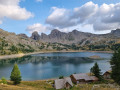
(9) Turn left and follow the magnificent path, which is stony in places, to the Refuge du Lac d’Allos, where you’ll rejoin the GRP® and the GR®52.
(10) Head north on the shared GR®-GRP® path; the route is almost flat at first, followed by a gentle descent, leading to a four-way junction.
(11) Leave the GR® and turn left onto the lovely path through the larch trees towards Mont Pelat or the Lausson plateau until you reach a vast, flat expanse. Here, you’ll rejoin the GR® and the GRP®.
(12) Turn right, following the plateau and the Laus wetland. You’ll reach the Laus car park.
(13) Walk alongside it and, as soon as the descent begins, take the path on the left which runs alongside the road at times; look out for the GR® on the other side of the road, which descends towards the hamlet of Champ Richard.
(14) Continue along this lovely path, passing the Chadoulin torrent and overlooking it in places. Don’t miss the magnificent waterfalls that dot the path; you can get closer to them by stepping off the path for a few dozen metres. There’s even a viewing point where you can take photos or simply admire the most beautiful of them. Pass beneath the hamlet of Champ Richard, which now lies in ruins.
(15) Continue along the path to reach the footbridge over the Chadoulin. From there, the path climbs back up towards the Cluite car park (S/E), passing by the Fontaine de Valplane.
 Tourist office

 Moderate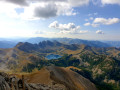
 Visorando Member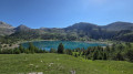
 Easy
Easy