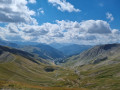
Route from Val d'Allos la Foux to Val d'Allos le Seignus

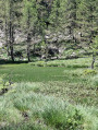
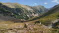
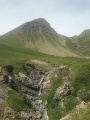
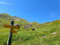
A forest trail that will take you to the Val d’Allos Le Seignus ski resort.

Details

n°46611022
Creation:
Last update:
Last review:
  • Walking
    Activity: Walking
  • ↔
    Distance: 9.34 mi
  • ◔
    Average duration: 5h 40 
  • ▲
    Difficulty: Moderate

  • ⚐
    Back to start: No
  • ↗
    Ascent: + 1,611 ft
  • ↘
    Descent: - 2,385 ft

  • ▲
    Highest point: 7,152 ft
  • ▼
    Lowest point: 4,990 ft

Photos

Description of the walk

Park near the tennis courts in the area known as Pont de Labrau.

(S) Leave the tennis courts behind you and head towards the bridge over the Verdon. At the bend in the Verdon torrent, walk past the residential chalets on your right and then continue along the signposted path. Your first few steps will take you straight to the Auriac ravine, which you cross via a wooden footbridge. Carry on to the Cabane de la Selette.

(1) Turn left until you reach a Fork in the road.

(2) An alternative route is available by turning left towards Lac des Grenouilles.
Then continue along theGR® de Pays Tour du Haut Verdon; you’ll see the Cabane de Rougnouse on your right.

(3) Carry on towards the Valdemars Forest House, which you can reach by turning left.

(4) Carry on. You can see the peaks of Pra Bertrand, Valcibière and Gros Tapi; nearby, the Pra Bertrand hut is on your right and the Valminette hut on your left (you can visit them via a short detour). You’ll reach a track at the Ravin de Valcibière.

(5) Follow it to the right. Then head down towards Seignus Bas, at an altitude of 1,500 metres. Ignore a track on the right and carry on straight ahead until you reach a hairpin bend to the left. Head downhill and you’ll arrive at the Val d’Allos Le Seignus ski resort.

(6) Carry on straight ahead, then head down to the right to reach Val d’Allos Seignus (E).

Waypoints

  1. S : mi 0 - alt. 5,764 ft - Tennis court
  2. 1 : mi 1.21 - alt. 6,342 ft - Cabane de la Selette
  3. 2 : mi 1.69 - alt. 6,611 ft - Alternative route towards Lac des Grenouilles
  4. 3 : mi 2.9 - alt. 6,594 ft - Rougnouse Hut
  5. 4 : mi 4.93 - alt. 6,660 ft - Valdemars forest house on the right
  6. 5 : mi 6.29 - alt. 6,161 ft - Ravine
  7. 6 : mi 8.95 - alt. 5,302 ft - Val d'Allos le Seignus
  8. E : mi 9.34 - alt. 4,990 ft - Le Seignus

Notes

Arrange for a vehicle to meet you on arrival at Val d’Allos le Seignus or check with the Tourist Offices for shuttle bus timetables and fares.
Pets welcome.
Not recommended in bad weather.
For further information: Val d’Allos Tourist Office Tel. 04 92 83 02 81.

Worth a visit

Nearby in Val d’Allos le Seignus you’ll find the Bike Park.

Val d’Allos, the birthplace of French enduro. 1,000 metres of descent to tackle.
Come and ride in the footsteps of the legendary Tribe 10,000.
The ski lifts… provide access to the bike park facilities and the downhill trails.
Open in July and August.
Enquiries: Val d’Allos Tourist Office 04 92 83 02 81
https://www.valdallos.com

Always be cautious and plan ahead when you're outdoors. Visorando and the author of this route cannot be held responsible for any accidents occurring on this route.

The GR® and PR® markings are the intellectual property of the Fédération Française de Randonnée Pédestre.

Reviews and comments

5 / 5
Based on 1 review

Reliability of the description
Not used
Ease of following the route
Non utilisé
Route interest
5 / 5
Val d'Allos
Val d'Allos

Hello Gamagi, thank you very much for this feedback from the field. Have a lovely walk

Machine-translated

gamagi
gamagi

Overall rating : 5 / 5

Date of your route : Aug 25, 2024
Reliability of the description : Not used / Not applicable
Ease of following the route : Not used / Not applicable
Route interest : ★★★★★ Very good
Very busy route : No

Hello – whilst on holiday in the area, we did this route, following someone who knew the area well. There were a few sections over scree, but it was a very pleasant route. Stunning views once you reach the top of the route. The descent is a bit long, but it’s an easy enough walk.

Machine-translated

Other walks in the area

For more walks, use our search engine .

The GPS track and description are the property of this route's author. Please do not copy them without permission.