


Refine your search for walks in Canal de Malcros
Canal de Malcros walks


 The Balcony of Champsaur
 Visorando Member
 6.14 mi
 +1,572 ft
 -1,558 ft
 4h 10
4h 10
 Moderate
 Departure from Saint-Michel-de-Chaillol (Hautes-Alpes)
A balcony walk offering magnificent views of the plain at the entrance to the Champsaur.
Mal Cros Canal starting from Chaillol 1600
 4.40 mi
+814 ft
-781 ft
2h 45
Moderate
Departure from Saint-Michel-de-Chaillol (Hautes-Alpes)
4.40 mi
+814 ft
-781 ft
2h 45
Moderate
Departure from Saint-Michel-de-Chaillol (Hautes-Alpes)
Hike along the remains of the Mal Cros Canal, starting from Chaillol 1600. This canal supplied water for irrigation in the area from a glacier above the Champoleon valley (Drac Blanc).
Short tour of Chaillol
4.68 mi
+965 ft
-945 ft
3h 00
Moderate
Departure from Saint-Michel-de-Chaillol (Hautes-Alpes)
A short, easy circular loop around Chaillol, starting from Chaillol village, suitable for families. Passes over the Canal Malcros.
Pic Queyrel via the Col du Viallet
 10.95 mi
+3,176 ft
-3,153 ft
7h 50
10.95 mi
+3,176 ft
-3,153 ft
7h 50
 Difficult
Departure from Saint-Michel-de-Chaillol (Hautes-Alpes)
Difficult
Departure from Saint-Michel-de-Chaillol (Hautes-Alpes)
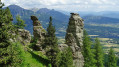
On this hike, nature is the artist, offering us geological formations carved into the sandstone, each one as astonishing as the next.
Not to mention Pic Queyrel with its extensive panorama from the horizontal ridge line that connects the two high points.
At the end of the hike, you can discover the remains of the Malcros Canal. A somewhat crazy project which, from 1881 to 1923, supplied water to the valleys from a... glacier.
Col de la Pisse from Chaillol 1600
 9.42 mi
+2,766 ft
-2,743 ft
6h 45
Difficult
Departure from Saint-Michel-de-Chaillol (Hautes-Alpes)
9.42 mi
+2,766 ft
-2,743 ft
6h 45
Difficult
Departure from Saint-Michel-de-Chaillol (Hautes-Alpes)
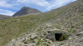
A hike mostly along a balcony path in a sort of cirque, before reaching the foot of the Vieux Chaillol with a lovely panorama. This hike also offers the chance to discover the remains of the Malcros Canal. A somewhat crazy project which, from 1881 to 1923, ensured the water supply to the valleys from a... glacier! Despite the elevation gain, the route involves ascending and descending fairly gentle and very even slopes.
Walks near Canal de Malcros
From Chaillol 1600 to Chantaussel
 3.05 mi
+121 ft
-1,138 ft
1h 30
3.05 mi
+121 ft
-1,138 ft
1h 30
 Easy
Departure from Saint-Michel-de-Chaillol (Hautes-Alpes)
Easy
Departure from Saint-Michel-de-Chaillol (Hautes-Alpes)
A short walk, with very little uphill climb and no difficulty, starting from Chaillol 1600 to the hamlet of Chantaussel (municipality of Saint-Julien-en-Champsaur).
Round-trip walk: you’ll need at least two cars.
Up the Gap Canal: from Pont de Frappe to Les Ricous
 6.71 mi
+328 ft
-489 ft
3h 20
Easy
Departure from Chabottes (Hautes-Alpes)
6.71 mi
+328 ft
-489 ft
3h 20
Easy
Departure from Chabottes (Hautes-Alpes)
A lovely, idyllic walk with virtually no elevation gain, easy and shaded. Ideal for families. You can walk part of the route and turn back, or tackle it in short sections. Of course, it’s possible to do this walk in the opposite direction.
The canal is always covered, so you can’t see the water.
Please note that between the start and point 2 there is a steep descent through the woods.
Sebeyras Lakes – Les Prés de Lauplat
 7.56 mi
+3,369 ft
-3,970 ft
6h 25
Difficult
Departure from La Chapelle-en-Valgaudemar (Hautes-Alpes)
7.56 mi
+3,369 ft
-3,970 ft
6h 25
Difficult
Departure from La Chapelle-en-Valgaudemar (Hautes-Alpes)
This stage takes you from the Sebeyras Lakes to the Lauplat Meadows via the Col de Pétarel and the Col de la Béranne. The route then descends towards the hamlet of Navette and the Buchardet Waterfall, before a long climb along a more rugged path.
Lakes of Sebeyras - Le Lauvet
 11.28 mi
+5,371 ft
-6,191 ft
9h 50
11.28 mi
+5,371 ft
-6,191 ft
9h 50
 Very difficult
Departure from La Chapelle-en-Valgaudemar (Hautes-Alpes)
Very difficult
Departure from La Chapelle-en-Valgaudemar (Hautes-Alpes)
From the Sebeyras Lakes, the route will first take you to the Col de Pétarel. From there, you will descend towards Saint-Maurice-en-Valgodemar. You will then follow the old transhumance paths to reach the Six Cabanes, then climb the Col de Menoux to Lauvet.
Les Prés de Lauplat – Les Naizets
 6.38 mi
+2,762 ft
-3,547 ft
5h 20
Moderate
Departure from La Chapelle-en-Valgaudemar (Hautes-Alpes)
6.38 mi
+2,762 ft
-3,547 ft
5h 20
Moderate
Departure from La Chapelle-en-Valgaudemar (Hautes-Alpes)
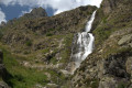
This stage takes you from the Prés de Lauplat to the Naizets bivouac, passing through the village of La Chapelle-en-Valgaudémar. The route follows the Oulles du Diable before climbing via the GR®54, passing the Combefroide Waterfall to reach a grassy plateau.
The six lakes of Orcières-Merlette, including Les Estaris
 4.13 mi
+299 ft
-1,447 ft
2h 10
Easy
Departure from Orcières (Hautes-Alpes)
4.13 mi
+299 ft
-1,447 ft
2h 10
Easy
Departure from Orcières (Hautes-Alpes)
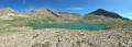
This hike has been suitable for all ages since 2020. Using the chairlifts (Drouvet 1 and 2 for the outward journey and Roche Rousse for the return journey) makes it easy. The six large lakes are visited on the way down. A variant towards the Col de Freissinières is possible. The landscapes are magnificent, especially at the starting point at the top of Drouvet. The lakes are all very beautiful and diverse.
A 13-day grand tour of the Parc des Ecrins via the GR® 54
 105.16 mi
+37,625 ft
-39,075 ft
13 days
Very difficult
Departure from La Chapelle-en-Valgaudemar (Hautes-Alpes)
105.16 mi
+37,625 ft
-39,075 ft
13 days
Very difficult
Departure from La Chapelle-en-Valgaudemar (Hautes-Alpes)
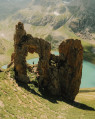
A very challenging 180 km route with 12,000 metres of elevation gain, requiring excellent physical fitness. Stages offering spectacular scenery, steep mountains, passes, wildlife, flora and colours. The most beautifulGR® route we have ever done. We completed the route in August, the ideal time to tackle the most difficult passes, which are likely to be snow-covered early in the season, such as La Muzelle, l’Aup Martin, the Pas de la Cavale, de la Valette, Vallonpierre and de La Vaurze.
La Chapelle-en-Valgaudemar - Refuge des Souffles
 6.40 mi
+4,393 ft
-1,496 ft
7 hrs
Very difficult
Departure from La Chapelle-en-Valgaudemar (Hautes-Alpes)
6.40 mi
+4,393 ft
-1,496 ft
7 hrs
Very difficult
Departure from La Chapelle-en-Valgaudemar (Hautes-Alpes)
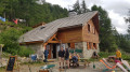
Thefirst stage begins with a variant ofthe GR® 54 and takes you to the Refuge des Souffles via the Col de Colombes, Lac Lautier and the Col des Clochettes, avoiding the route through Villar-Loubière.
A challenging route with a 1,400-metre climb and steep gradients right from the start. A good way to get your legs going for thefirst stage and a good warm-up for the rest of the route.
The scenery is already exceptional, promising some fabulous stages ahead.
Villar Loubière – Sebeyras Lakes
 5.63 mi
+4,511 ft
-354 ft
6h 30
Difficult
Departure from Villar-Loubière (Hautes-Alpes)
5.63 mi
+4,511 ft
-354 ft
6h 30
Difficult
Departure from Villar-Loubière (Hautes-Alpes)
This first stage takes you along the GRP® Tour du Vieux Chaillol trail, linking Villar-Loubière to the Sebeyras Lakes. The route passes by the Pétarel Lakes, with a gradual climb through the Valgaudémar State Forest.
From Villar-Loubière to La Chapelle-en-Valgaudemar via Lac du Lautier
8.29 mi
+4,780 ft
-4,475 ft
8h 00
Difficult
Departure from Villar-Loubière (Hautes-Alpes)
A beautiful, varied hike with stunning views and a lake perfect for relaxing. A pleasant climb (a little steep at the start and very end), in the shade (early in the morning) for a good half of the route; a fairly long and difficult descent over scree. A full day's hike. Use the shuttle bus or bring two vehicles.