


Refine your search for walks in Campagna-de-Sault
Campagna-de-Sault walks
 Pic de l'Ourtiset
 Visorando Member
 4.02 mi
 +1,509 ft
 -1,506 ft
 3h 10
3h 10
 Moderate
 Departure from Mazuby (Aude)
This route takes you through an exceptional site with its mountain landscapes, fauna and flora. From the summit, you can see the whole of the Pays de Sault, the Ariège and Catalan Pyrenees and, if visibility is good, the Pic de Bugarach above the Carcassonne plain and the Montagne Noire.
Tour of Donezan
 10.74 mi
+1,726 ft
-1,703 ft
6h 25
Moderate
Departure from Rouze (Ariège)
10.74 mi
+1,726 ft
-1,703 ft
6h 25
Moderate
Departure from Rouze (Ariège)
This hike is best done at the end of October. If the weather is favourable, the "French Quebec" will dazzle you with its autumn colours. But there's nothing to stop you coming back in spring or summer. There are some beautiful views of the plateau and its villages: Rouze, Mijanes, Artigues, Le Pla, Le Puch, Quérigut and the peaks overlooking Donezan. The first half of the route follows the Vauban trail.
Vauban Trail from Rouze to Aunat
9.41 mi
+1,414 ft
-1,585 ft
5h 35
Moderate
Departure from Rouze (Ariège)
This section of the Chemin Vauban links Rouze to Aunat, gradually leaving the Donezan behind to reach the Aude Pyrenees. The route, which is generally easy and accessible, alternates between sections through woodland and pleasant paths, notably crossing the border between Ariège and Aude. The section between Campagna-de-Sault and the Col de la Clause is particularly interesting for its heritage and numerous information boards, which provide a better understanding of the areas passed through, especially around the Dournes tunnel.From the Col de la Clause, the route continues mainly downhill through woodland before gradually reaching the village of Aunat.
Pic de Tarbésou from the Mijanès ski resort
 9.49 mi
+2,999 ft
-2,982 ft
7h 00
9.49 mi
+2,999 ft
-2,982 ft
7h 00
 Difficult
Departure from Mijanès (Ariège)
Difficult
Departure from Mijanès (Ariège)
The Pic de Tarbésou circular route, starting from the Mijanès ski resort, passing by:Étang de Rabassoles,Étang Noir,Étang Bleu,the Col de la Coumeille de l'Ours,Pic de TarbésouReturn via the Crête de Mounégou.
The Pic de Tarbésou loop
 6.71 mi
+2,388 ft
-2,388 ft
5h 10
Moderate
Departure from Ascou (Ariège)
6.71 mi
+2,388 ft
-2,388 ft
5h 10
Moderate
Departure from Ascou (Ariège)
This summit is a magnificent viewpoint overlooking much of the Aude, the Pyrénées-Orientales and the Ariège. This ridge walk takes you to the Étang Noir and Étang Bleu lakes. These lakes are bordered by small pine groves where you can relax.
The Pic de Tarbésou and Étangs de Rabassoles loop
 8.00 mi
+2,661 ft
-2,631 ft
6h 00
Difficult
Departure from Ascou (Ariège)
8.00 mi
+2,661 ft
-2,631 ft
6h 00
Difficult
Departure from Ascou (Ariège)
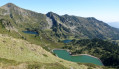
A circular hike around the Étangs de Rabassoles lakes via the Pic de Tarbésou (2,364 metres), which offers magnificent views of the surrounding 2,000-metre peaks.
Pic de Tarbésou and Étang Noir from Col de Pailhères
 5.24 mi
+2,087 ft
-2,073 ft
4h 15
Moderate
Departure from Ascou (Ariège)
5.24 mi
+2,087 ft
-2,073 ft
4h 15
Moderate
Departure from Ascou (Ariège)
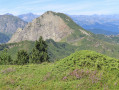
An easy hike from the Col de Pailhères. Magnificent 360° panorama from the summit of Tarbésou (2,364 m), then descent into a slightly more mineral landscape towards the Étang Noir de Rabassoles. The climb up to the Col de la Coumeilles de l'Ours is fairly quick, then a gentle descent back to the Col de Pailhères through the mountain pines.
Pic de Tarbesou and the Rabassoles Lakes
 7.67 mi
+2,060 ft
-4,078 ft
5h 20
Difficult
Departure from Ascou (Ariège)
7.67 mi
+2,060 ft
-4,078 ft
5h 20
Difficult
Departure from Ascou (Ariège)
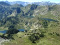
A beautiful hike not far from the Ascou-Pailhères resort. On the agenda are the magnificent Pic de Tarbesou viewpoint (2364m) and the three Rabassoles lakes. To spice things up, the last part requires good navigation skills to find your way.
Pic de la Camisette, starting from the Plaine d’Artigues
 7.40 mi
+2,657 ft
-2,657 ft
5h 45
Difficult
Departure from Artigues (Ariège)
7.40 mi
+2,657 ft
-2,657 ft
5h 45
Difficult
Departure from Artigues (Ariège)
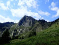
The ascent of the Pic de la Camisette, a granite peak, offers the chance to explore a wild area around the Étangs de la Camisette, the site of a tragedy in 1944 (a plane crash). Starting from Plaine d’Artigues, the route follows a section of the GR®7A, then a section off the beaten track but marked in yellow and with cairns.
The three ponds of Rabassoles
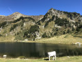 4.97 mi
+1,388 ft
-1,388 ft
3h 30
Moderate
Departure from Mijanès (Ariège)
4.97 mi
+1,388 ft
-1,388 ft
3h 30
Moderate
Departure from Mijanès (Ariège)
A magnificent hike through forests and meadows to discover three lakes surrounded by peaks.
The Pic de Tarbesou via the Coumeille de l’Ours then the Col de l’Egue
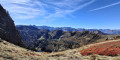 8.36 mi
+3,077 ft
-3,048 ft
6h 30
Difficult
Departure from Mijanès (Ariège)
8.36 mi
+3,077 ft
-3,048 ft
6h 30
Difficult
Departure from Mijanès (Ariège)
Five lakes to see, a peak to climb and two passes to cross on this walk.
This hike is classified as difficult because the descent from the Col de l’Egue is very challenging with a steep gradient.
The route is accurate. Do not cut the bends. Zone Natura 2000 site: specific rules apply.
Signposting in good condition (18 July 2021). There are very few directional posts.
Allow at least 5 hours’ walking time. Marked in yellow / red and yellow.
The Étang de Balbonne
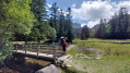 3.33 mi
+1,073 ft
-1,056 ft
2h 30
Moderate
Departure from Mijanès (Ariège)
3.33 mi
+1,073 ft
-1,056 ft
2h 30
Moderate
Departure from Mijanès (Ariège)
A superb getaway in the ‘Little Quebec’ of the Ariège, taking you to one of the countless ponds in the Donezan region, namely the Étang de Balbonne.
Loop via the Étang de l'Estagnet, the Étang Bleu and the Étang de Rabassoles
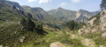 5.70 mi
+1,732 ft
-1,722 ft
4h 10
Moderate
Departure from Mijanès (Ariège)
5.70 mi
+1,732 ft
-1,722 ft
4h 10
Moderate
Departure from Mijanès (Ariège)
This little loop is a lovely surprise. You'll discover ponds away from the crowds and various small lakes, as well as two of the three Rabassoles ponds, including the famous Étang Bleu... which is green!
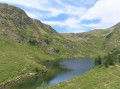
The three ponds of Rabassoles
 4.49 mi
+1,352 ft
-1,352 ft
3h 15
Moderate
Departure from Mijanès (Ariège)
4.49 mi
+1,352 ft
-1,352 ft
3h 15
Moderate
Departure from Mijanès (Ariège)
Wild and beautiful landscapes with blue ponds.
Balbonne Pond
 7.18 mi
+2,257 ft
-2,251 ft
5h 15
Difficult
Departure from Mijanès (Ariège)
7.18 mi
+2,257 ft
-2,251 ft
5h 15
Difficult
Departure from Mijanès (Ariège)
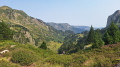
This demanding hike requires a good sense of direction. It first leads to the Étang de Balbonne lake and then continues off-trail to join theGR®7B. The return journey is on the Vallée d'Orlu side to reach the Col de l'Egue and then descend to the Estagnet. Magnificent landscapes where water is omnipresent, but you will have to work hard to reach them, sparing no effort to cross the steepest sections such as the aptly named Échelle de Balbonne.
Pic de Tarbesou from the Restanque car park
 8.45 mi
+3,192 ft
-3,192 ft
6h 40
Difficult
Departure from Mijanès (Ariège)
8.45 mi
+3,192 ft
-3,192 ft
6h 40
Difficult
Departure from Mijanès (Ariège)
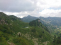
Peak accessible from the car park before La Restanque, with a view of the Dent d'Orlu.See practical information ¹GPX track highly recommended.
Tour of the villages of Donezan
12.58 mi
+2,356 ft
-2,372 ft
7h 50
Difficult
Departure from Quérigut (Ariège)
A fantastic hike in the Donezan, allowing you to discover all of its villages and rich heritage.The main difficulty of this route is its length, covering nearly 20 km.Best enjoyed in autumn, when the flamboyant colours of Donezan offer landscapes of exceptional beauty.
Le Roc Blanc via the Étang du Laurenti then the Porteille de Barbouillère
 7.93 mi
+3,058 ft
-3,058 ft
6h 20
Difficult
Departure from Le Pla (Ariège)
7.93 mi
+3,058 ft
-3,058 ft
6h 20
Difficult
Departure from Le Pla (Ariège)
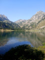
A refuge, a large pond, a pass, a legendary peak and a small pass during this mountain hike.
The route is accurate. Do not cut corners. Natura 2000 site: specific rules apply.
Signposting in good condition (17 July 2021). There are very few directional posts.
Allow at least 5 hours’ walking time. Marked in yellow / red and yellow / unmarked sections.
The walk around Étang du Laurenti
 3.97 mi
+1,129 ft
-1,102 ft
2h 50
Moderate
Departure from Le Pla (Ariège)
3.97 mi
+1,129 ft
-1,102 ft
2h 50
Moderate
Departure from Le Pla (Ariège)
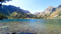
Discover the Étang de Laurenti, one of the most beautiful lakes in the Ariège region, which reveals all the magic of the Donezan, a mountain range rightly nicknamed ‘the little Quebec of the Ariège’.
On arrival, after passing through a beautiful forest of beech and fir trees, you’ll discover, in an enchanting and majestic setting, a lake fringed with pine trees, nestled at the foot of the Roc Blanc.
Roc Blanc via the Étang de Laurenti
 6.43 mi
+2,963 ft
-2,963 ft
5h 30
Difficult
Departure from Le Pla (Ariège)
6.43 mi
+2,963 ft
-2,963 ft
5h 30
Difficult
Departure from Le Pla (Ariège)
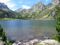
This climb in the sunny Pyrenees is a real classic, which means it can get quite busy in good weather. However, the magnificent Étang de Laurenti and the 360° view from the summit of Roc Blanc are well worth the effort required during the hike.
From Roquefeuil to Pic du Midi
 6.78 mi
+1,427 ft
-1,411 ft
4h 20
Moderate
Departure from Roquefeuil (Aude)
6.78 mi
+1,427 ft
-1,411 ft
4h 20
Moderate
Departure from Roquefeuil (Aude)
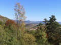
A beautiful hike in the Pays de Sault starting from Roquefeuil with climbs up Pic des Sarrasis and Pic du Midi offering stunning panoramic views.
Circular above the Col du Pradel
 4.59 mi
+1,112 ft
-1,138 ft
3h 05
Moderate
Departure from Ascou (Ariège)
4.59 mi
+1,112 ft
-1,138 ft
3h 05
Moderate
Departure from Ascou (Ariège)
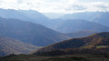
A short circular half-day loop starting from a little-known pass between Aude and Ariège, with magnificent views. Recommended in spring (as soon as the snow has melted) and autumn, or even in summer if it is not too hot.
The Barrenc de Picaussel chasm from Belvis
6.58 mi
+830 ft
-827 ft
3h 45
Moderate
Departure from Belvis (Aude)
This easy hike takes you through the woods above Belvis, alternating between footpaths and forest roads. There are some beautiful views of the region, as well as the Barrenc de Picaussel chasm. The chasm, located at the edge of the path, is very well secured (barriers and gates prevent accidents).
Pic des Rives
 3.61 mi
+1,358 ft
-1,358 ft
2h 50
Moderate
Departure from Belcaire (Aude)
3.61 mi
+1,358 ft
-1,358 ft
2h 50
Moderate
Departure from Belcaire (Aude)
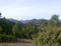
A beautiful circular starting from Lake Belcaire, towards Pic des Rives (1,436 m), which offers a magnificent panorama of the Pyrenees peaks and Bugarach in the Aude. A shorter alternative route is possible by descending after the bench (3); it offers a view of the lake and Belcaire: the route can then be taken in the opposite direction.
More walks in Campagna-de-Sault
Select a point of interest below: