Country:

 City:


At Ax-les-Thermes, turn left at the roundabout by the church, following the road signs towards Col de Chioula – Ascou-Pailhères. About 3.5 km further on, turn right onto the D25, drive through Ascou and then the small ski resort, and, at the fifth hairpin bend, leave the road to park in the large car park near the Mounégou ski lift.
No signposting
(S/E) Head towards the start of the ski lift, go round the guardhouse on the left, then take the dirt track running alongside a ski run on your right. Further up, pass the arrival pylon of another ski lift, then head back down to the Jasse de l’Orri. Continue, keeping a water reservoir on your left at a distance, to begin the very steep climb leading to the top of the Orri chairlift.
(1) About thirty metres before the top pylons, look out for the small cairn on the left marking the inconspicuous start of the path leading to the Étangs de Bauzeille. The very narrow but clearly marked trail climbs up the shoulder of the Sarrat de Bauzeille and emerges at a small jasse through which a stream winds.
As you begin the ascent, the path disappears into the tall grass, so take care to keep heading in the same direction to quickly reach a grassy clearing facing a small hillock planted with pine trees (several very wet and muddy sections in October 2019).
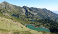
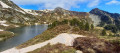
(2) Turn off to the right to quickly rejoin a narrow path, where you must turn left. About a hundred metres further on, you’ll come to a Fork in the road, which is difficult to make out and barely visible on the ground. Head right to quickly reach the first pond, watching out for stones and hollows hidden beneath the tall grass (watch your ankles).
(3) Turn left onto the path leading to the second pond after crossing a short patch of spongy ground. Head towards the outlet, cross it in a single stride to tackle the steep slope where a very faint track leads to the east-southeast-facing ridge.
(4) Turn right along the track and begin the very steep climb through the pine trees and blueberry bushes. After passing a small rock outcrop where you’ll need to use your hands (no difficulty), the track disappears. Continue up the slope, using the edge of the pine trees on your right as a guide. Keep heading in the same direction until you come across a well-marked cross-country path.
(5) Head right along level ground for about a hundred metres, then turn left onto a diagonal ascent to join the Crête de Mounégou path and the standard route up Pic de Tarbésou.
Marked with yellow PR® signs and cairns.
Turn right and begin the ascent of the peak, which you’ll reach after a final steep climb.
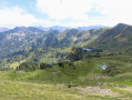
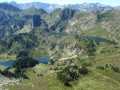
(6) Pic de Tarbésou: exceptional 360° panorama. Pass a rough stone shelter and descend for about a hundred metres to enjoy the second viewpoint over the three Rabassoles ponds.
Continue downhill towards the east, ignoring the path on the right which leads to the Crête des Escales. Reach the unnamed pass at the foot of the Pic de la Coumeille de l’Ours, where a large cairn and a wooden post – which is in dire need of straightening – stand.
GR® white and red markings
(7) Turn left. The wide path alternates between flat sections and steep descents on stony ground, which require care. After crossing several streams, you’ll reach a Fork in the road where there is a signpost.
(8) Turn left, following the sign for the Col de Pailhères via the GR®7B. Shortly afterwards, don’t hesitate to take a short detour to the left to read the two very informative signs about the Maure peat bog. Then return to the GR® and continue to the left. Further signs, part of the nature trail, line the path.
(9) Ignore the PR® on the left, which leads to the Pic de Tarbésou via the standard route, and carry on straight ahead until you reach the Col de Pailhères road (D25).
(10) Turn left and walk alongside the road on the wide, safe verge.
(11) Just after passing a building below which houses the snow-clearing machinery, leave the road and turn left onto the wide, stony track leading to it. Immediately turn right onto a grassy, downhill track.
A little further on, turn right again to pass between some wooden barriers and follow the wide track down the Jasse de Font Nère straight on to the car park at the start (S/E).

 Visorando Member

 Moderate