The Pic de Tarbesou via the Coumeille de l’Ours then the Col de l’Egue

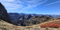
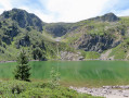
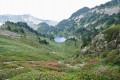
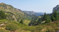
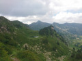
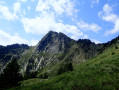
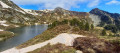
Five lakes to see, a peak to climb and two passes to cross on this walk.
This hike is classified as difficult because the descent from the Col de l’Egue is very challenging with a steep gradient.
The route is accurate. Do not cut the bends. Zone Natura 2000 site: specific rules apply.
Signposting in good condition (18 July 2021). There are very few directional posts.
Allow at least 5 hours’ walking time. Marked in yellow / red and yellow.

Details

11972179
Creation:
Last update:
Last review:
  • Walking
    Activity: Walking
  • ↔
    Distance: 8.36 mi
  • ◔
    Average duration: 6h 30 
  • ▲
    Difficulty: Difficult

  • ⚐
    Back to start: Yes
  • ↗
    Ascent: + 3,077 ft
  • ↘
    Descent: - 3,048 ft

  • ▲
    Highest point: 7,743 ft
  • ▼
    Lowest point: 5,164 ft

Photos

Description of the walk

From Quérigut, head to Mijanes, drive through the village on the D25 via an S-bend, continue for 500 m along this road and, at the first sharp bend to the right, head straight on, crossing this road very carefully. Continue for 3.5 km, south-west, along the small Route de la Restanque, which deteriorates into a track.
Park at the first car park at La Restanque.

Yellow markings

(S/E) With your back to the car park, head left, westwards.

(1) Head up to the right along the Piste de la Restanque, which is closed to vehicles and blocked by a barrier. You’ll reach a large grassy area with picnic spots. Signposted as a Natura 2000 site.

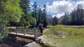
(2) Pass the footbridge and a track on your left. Head uphill via a right-hand bend onto a track. Continue the ascent through the Bois de l’Agréboul.

(3) Cross the Ruisseau d’Artournant via the footbridge. Continue the climb alongside the stream.
You’ll come to a fork in the path with a wooden signpost.

(4) Carry on straight ahead, continuing to climb alongside the stream. This will take you to the Étang de Rabassoles.

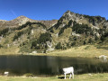
(5) Go round it to the left, now climbing more steeply. This will take you to theGR® 7B and theGRP® Tour du Pays de Donnezan, and the Étang Bleu.

Yellow and red markings forthe GR® 7B, which takes precedence over theGRP® Tour du Pays de Donnezan.

(6) Turn right onto theGR® andGRP®, skirting the lake on the right. A little further on, you’ll reach the Étang Noir.

(7) Walk along its right-hand side and begin a long north-easterly climb towards the Col de la Coumeille de l’Ours. Directional signpost destroyed.

Yellow markings

(8) Turn left (north-west), continuing to climb towards the Pic de Tarbésou. Head slightly north to reach the viewpoint.

(9) Retrace your steps slightly and, on the right after the wind shelter, find a path that descends very steeply south-west via the Sarrat des Escales. This path joins the magnificent Sarrat de Gabensa ridge and heads due south. Follow the ridge for a long while until you reach an altitude of 2090. Turn left at a 90° angle, heading down towards a small, unnamed pond at a crossroads of paths.

Followthe yellow and red markings ofthe GR® 7B, which replaces theGRP® Tour du Pays de Donnezan.

(10) If you get lost, head left to the Étang Bleu, then turn right, following the route in the opposite direction to your outward journey.
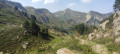
Otherwise, turn right, following theGR® 7B which climbs along the rock face. Continue climbing steeply to the Col de l’Egue. Stunning views.

Yellow markings

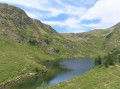
(11) Turn sharply left downhill into the Coume de l’Estagnet towards the pond. After a gruelling and steep descent, you’ll reach the Étang de l’Estagnet. The beauty of the landscape makes it all worthwhile.

(12) Go round the pond on the left. From here, take another gruelling, steep descent before reaching the Ruisseau de l’Estagnet. The path, which heads north-east, becomes easier going. Return to the path you took on the way out.

(4) Turn right and follow the path in the opposite direction back to the car park (S/E).

Waypoints

  1. S/E : mi 0 - alt. 5,164 ft - Car park at - Parking de la Restanque
  2. 1 : mi 0.07 - alt. 5,171 ft - Barrier
  3. 2 : mi 0.37 - alt. 5,299 ft - A large picnic area, close to the - Bruyante (rivière)
  4. 3 : mi 0.9 - alt. 5,535 ft - Footbridge
  5. 4 : mi 1.14 - alt. 5,781 ft - Common junction for out-and-back route
  6. 5 : mi 1.72 - alt. 6,083 ft - Etang de Rabassoles
  7. 6 : mi 2.08 - alt. 6,312 ft - GR 7B and GRP Tour du Donnezan - Étang Bleu (Rabassoles)
  8. 7 : mi 2.26 - alt. 6,516 ft - GR 7B and GRP Tour du Donnezan - Étang de Rabassoles Noir (Donezan)
  9. 8 : mi 3.04 - alt. 7,133 ft - Col de la Coumeille de l'Ours
  10. 9 : mi 3.46 - alt. 7,743 ft - Pic du Tarbésou
  11. 10 : mi 5.23 - alt. 6,686 ft - Small pond. GR 7B and GRP Tour du Donnezan
  12. 11 : mi 5.64 - alt. 6,959 ft - Coume de l’Estagnet - Col de l'Egue (2121m)
  13. 12 : mi 6.04 - alt. 6,260 ft - Étang de l’Estagnet
  14. S/E : mi 8.36 - alt. 5,164 ft - Car park at - Parking de la Restanque

Notes

The access track is suitable for vehicles, but do be careful if you’re driving a low-slung vehicle...

This is a mountainous area. You will need: rainwear, water, a packed lunch, the GPX track, route description, a map, a GPS or the Visorando app, a camera, good walking boots and a walking stick.

There is no shelter on the route.

Do not underestimate this hike, which features two steep descents:
- from the (11) in the Coume de l’Estagnet towards the pond.
- from the Étang de l’Estagnet (12) down to the Ruisseau de l’Estagnet.

I strongly recommend using the GPX track due to the lack of signposting.

Worth a visit

Always be cautious and plan ahead when you're outdoors. Visorando and the author of this route cannot be held responsible for any accidents occurring on this route.

The GR® and PR® markings are the intellectual property of the Fédération Française de Randonnée Pédestre.

Reviews and comments

4.9 / 5
Based on 3 reviews

Reliability of the description
4.7 / 5
Ease of following the route
5 / 5
Route interest
5 / 5
apierre 34
apierre 34

Overall rating : 5 / 5

Date of your route : Aug 11, 2026
Reliability of the description : ★★★★★ Very good
Ease of following the route : ★★★★★ Very good
Route interest : ★★★★★ Very good
Very busy route : Yes

A brilliant walk to Tarbesou, set off early. The summit and then the ridge were absolutely heaving with people right up to the junction leading to the Col de l’Egue. We were on our own for lunch at the Col de l’Egue (at last!) and there were just a few people on the way back. An excellent hike.

Machine-translated

User 23339453

Overall rating : 5 / 5

Date of your route : Oct 06, 2025
Reliability of the description : ★★★★★ Very good
Ease of following the route : ★★★★★ Very good
Route interest : ★★★★★ Very good
Very busy route : Yes

... Continued...views from Coumeille de l'ours 🤩

Machine-translated

User 23339453

Overall rating : 4.7 / 5

Date of your route : Oct 07, 2025
Reliability of the description : ★★★★☆ Good
Ease of following the route : ★★★★★ Very good
Route interest : ★★★★★ Very good
Very busy route : Yes

A magnificent hike, even though we only completed part of the route, from Pla de Mounegou to Coumeille de l'ours. Because that's where you get a breathtaking panorama 🤩...and an unobstructed view... during your picnic 👍
Return via the same path... Give it a try!

Machine-translated

Other walks in the area

For more walks, use our search engine .

The GPS track and description are the property of this route's author. Please do not copy them without permission.