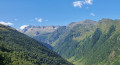
Cabane de Courreau via Cromlech

A very pleasant, easy walk starting from Saint-Aventin, which can also be done from Benque-Dessus. See Montagne d’Espiau from Benque-Dessus.

Details

n°43158477
Creation:
Last update:
Last review:
  • Walking
    Activity: Walking
  • ↔
    Distance: 7.50 mi
  • ◔
    Average duration: 5h 35 
  • ▲
    Difficulty: Difficult

  • ⚐
    Back to start: Yes
  • ↗
    Ascent: + 2,493 ft
  • ↘
    Descent: - 2,497 ft

  • ▲
    Highest point: 5,528 ft
  • ▼
    Lowest point: 3,041 ft

Description of the walk

From Bagnères-de-Luchon, take the D618 towards Saint-Aventin. In Saint-Aventin, there are several car parks along the departmental road. The route starts from the Saint-Aventin cemetery.

(S/E) From the cemetery, head north-east along a path until you reach a junction at elevation 1015 (Voie Claude).

(1) Turn left, heading north-west towards Cromlech, and you’ll reach a second fork at an elevation of 1191.

(2) At the sign (La Lande), go through the gate and continue straight ahead in the same direction, towards Cromlech.

(3) Pass a fountain/watering hole and arrive at Cromlech (altitude 1346).

(4) Continue in the same direction (north-west) along thePR®46(yellow markings) for 200 m.

(5) Head towards Labach de Billière and leave thePR®46. Follow the path running alongside the fence (or continue on thePR®46) and join theGRP® (yellow and red markings) at a crossroads.

(6) Turn left onto it, cross the fence and follow the yellow and red markings ofthe GRP® until you reach a fork in the path (elevation 1649).

(7) Head (north-east) towards the Cabane de Courreau (shepherd’s hut) and make your way there.

(8) Head back down towards the small hut to rejoin a track. Follow it to the left until you reach a sharp bend to the right at elevation 1627. Turn sharply right, descending along the track to reach the crossroads you passed on the way there.

(6) Head back along the same route you took on the way out to return to the Cromlech.

(4) Return to Cromlech: take the “bridge” to cross the fence and turn sharply right, heading towards the hamlet of Bernet. After 150 m, the path turns left, due south, until it reaches a 90° right-hand bend.

(9) End of La Carrere: go through the gates towards Bernet (west). Cross the village of Bernet via the D76e and join the D76h. Follow it to the left until you reach the D618 (Sainte-Anne Church). See Practical Information.

(10) Turn left, pass through Castillon-de-Larboust and follow the D618 as far as Saint-Aventin. Turn slightly left, pass the church and head back to the cemetery car park (S/E).

Waypoints

  1. S/E : mi 0 - alt. 3,097 ft - Car park at the St-Aventin cemetery. Near the - Neste d'Oô (rivière) - Affluent de l'One
  2. 1 : mi 0.41 - alt. 3,317 ft - Via Claude junction. Near the - Neste d'Oueil - Affluent de la Neste d'Oô
  3. 2 : mi 0.88 - alt. 3,885 ft - La Lande Gate
  4. 3 : mi 1.14 - alt. 4,170 ft - Fontaine
  5. 4 : mi 1.57 - alt. 4,396 ft - Junction of the lower circular loop - Cromlechs (Bagnères-de-Luchon)
  6. 5 : mi 1.7 - alt. 4,429 ft - Cap de la Serre
  7. 6 : mi 2.05 - alt. 4,751 ft - Junction of the circular loop. Towards the - Cabane du Cap de la Prade (1384m)
  8. 7 : mi 2.72 - alt. 5,387 ft - Junction
  9. 8 : mi 3.2 - alt. 5,509 ft - Cabane de Courrau d'Antenac (1687m)
  10. 9 : mi 5.74 - alt. 3,852 ft - End of La Carrere
  11. 10 : mi 6.53 - alt. 3,258 ft - D 618 (Sainte-Anne Church)
  12. S/E : mi 7.5 - alt. 3,094 ft - Car park at the St-Aventin cemetery

Notes

There is limited parking in Saint-Aventin, so it may be difficult to park during busy periods. You can start the walk at Castillon de Larboust or take another walk from Benque-Dessus.
Please note that the return journey involves a 500-metre stretch along the D-road and may not be suitable for young children.
(10) You can go via Cazeaux-de-Larboust to avoid part of the D618. Then, on arrival at the town hall in St-Aventin, you can also go through the village to avoid part of the D618.

Worth a visit

The spa town of Luchon.

Always be cautious and plan ahead when you're outdoors. Visorando and the author of this route cannot be held responsible for any accidents occurring on this route.

The GR® and PR® markings are the intellectual property of the Fédération Française de Randonnée Pédestre.

Reviews and comments

4.7 / 5
Based on 1 review

Reliability of the description
5 / 5
Ease of following the route
4 / 5
Route interest
5 / 5
tegon
tegon

Overall rating : 4.7 / 5

Date of your route : Jan 04, 2024
Reliability of the description : ★★★★★ Very good
Ease of following the route : ★★★★☆ Good
Route interest : ★★★★★ Very good
Very busy route : No

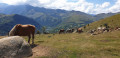
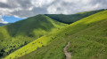
A lovely walk in the sunshine on this beautiful day, with the Oueil valley on one side and the valley leading to the Col de Peyresourde on the other, both dotted with their traditional villages.
We had a bit of trouble finding our way between point 4 and point 9.
We met six other walkers today.

Machine-translated

Other walks in the area

For more walks, use our search engine .

The GPS track and description are the property of this route's author. Please do not copy them without permission.