The Wims Circular Route: a blend of nature and heritage

This lovely circular route, with its varied landscapes, will allow you to explore the two towns of Wimille and Wimereux, as well as the surrounding countryside. You’ll be able to walk along the paths bordering the grounds of Lozembrune Castle, cross the Auvrighen stream, follow a section ofthe GR®120coastal path, and explore the riparian woodland along the River Wimereux, which gave its name to the seaside resort.

Details

66767786
Creation:
Last update:
Last review:
  • Walking
    Activity: Walking
  • ↔
    Distance: 4.10 mi
  • ◔
    Average duration: 2h 05 
  • ▲
    Difficulty: Easy

  • ⚐
    Back to start: Yes
  • ↗
    Ascent: + 243 ft
  • ↘
    Descent: - 236 ft

  • ▲
    Highest point: 167 ft
  • ▼
    Lowest point: 7 ft

Photos

Description of the walk

Park in the car park at Wimille Town Hall.
This walk is also accessible by train. From Wimille-Wimereux station, you can quickly reach Rue Gilbert Regnault; see § Practical Information.

(S/E) Leave the car park and turn left onto Rue de Lozembrune, keeping the football pitches on your right.

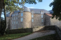
(1) Once you reach the entrance to the castle grounds, leave Rue Raoul Lebeurre and take the Lozembrune path opposite, which climbs through the trees after a movable metal fence.
Follow this path for about 400 metres, ignoring the paths branching off to the left, until you reach Rue d’Auvringhen.

(2) Cross the road carefully and take the tarmac road, heading down towards the hamlet of Auvringhen. Walk past all the houses and, after a slight climb, you’ll reach a crossroads of footpaths.

(3) Take the yellow-marked path on the left across the fields. Further on, you’ll reach a tarmac road. Walk up this road on the left with care; there is little traffic, but there are still some vehicles about. Keep to the right at the next junction and continue to follow the yellow markings. You’ll reach the TER railway line; take the footbridge.

(4) Take the path downhill, going round the Camping de l’Été Indien (caution: muddy area outside the summer season). Head downhill and enter the adjoining woodland. Ignore the small paths and stay on the main track until you reach the hamlet of Honvault. Turn right and follow the road until you reach the D940.

(5) Cross the road with great care, join the cycle path and then turn right. Follow this road downhill until you reach theGR®120coastal path and arrive at the roundabout marking the entrance to Wimereux.

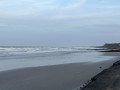
(6) Stay on this pavement and pass the Maison de la Recherche en Environnement Naturel and the Marine Station. Turn left onto Boulevard Alfred Thiriez, then turn left onto the Wimereux sea wall. Stay on the sea wall until you reach the River Wimereux, following the route alongside the town centre.

(7) Ignore the footbridge opposite and turn right, following the river. Walk up the lane until you reach the Church of the Immaculate Conception of Our Lady. When you reach the junction in front of the church, turn left onto the bridge and cross the river.

(8) Turn right, walk past the car park and head up the street towards the viaduct, following the right bank of the river. Pass under the viaduct, turn right onto the path to enter the landscaped wetland area. Stay on the main path, skirting the park as you head up the Wimereux. Ignore the side paths until you reach a meadow and then a junction leading to the Wimille football pitches via a wooden bridge.

(9) Turn left and stay on the path which climbs to the right until you reach some steps and come to Rue de Ledinghen. Walk down the street, turning right, until you reach Saint-Pierre Church. Turn right into Rue de Lozembrune and head for the Town Hall car park (S/E).

Waypoints

  1. S/E : mi 0 - alt. 30 ft - Wimille Town Hall car park
  2. 1 : mi 0.1 - alt. 26 ft - Chateau Lozembrune (Wimille)
  3. 2 : mi 0.34 - alt. 95 ft - Auvringhen
  4. 3 : mi 0.61 - alt. 98 ft - PR junction
  5. 4 : mi 1.25 - alt. 112 ft - Camping de l’Été Indien
  6. 5 : mi 1.62 - alt. 115 ft - D940
  7. 6 : mi 2.06 - alt. 69 ft - Roundabout at the entrance to Wimereux
  8. 7 : mi 2.67 - alt. 20 ft - Wimereux (river)
  9. 8 : mi 2.92 - alt. 16 ft - Bridge over the - Wimereux (fleuve)
  10. 9 : mi 3.85 - alt. 20 ft - Stadium
  11. S/E : mi 4.1 - alt. 33 ft - Wimille Town Hall car park

Notes

(S/E) From the station, take Rue de la Gare, then follow theGRP® trail marked in yellow and red to reach Rue d’Auvringhein and (3).
No special equipment required. Please take care on tarmac roads.

Worth a visit

(S/E) Wimille
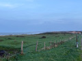
Between (5) and (6) You can see the town of Wimereux in the distance, along with its superb coastline.
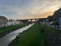
(7) Look out for the railway viaduct opposite.
(7) Wimereux
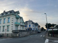
Between (7) and (8) Along the way, you can explore the historic houses in a historic district of Wimereux.

Always be cautious and plan ahead when you're outdoors. Visorando and the author of this route cannot be held responsible for any accidents occurring on this route.

The GR® and PR® markings are the intellectual property of the Fédération Française de Randonnée Pédestre.

Reviews and comments

4.2 / 5
Based on 3 reviews

Reliability of the description
4.3 / 5
Ease of following the route
4 / 5
Route interest
4.3 / 5
Thepatpat
Thepatpat

Overall rating : 5 / 5

Date of your route : Jun 22, 2026
Reliability of the description : ★★★★★ Very good
Ease of following the route : ★★★★★ Very good
Route interest : ★★★★★ Very good
Very busy route : No

A lovely walk

Machine-translated

DE CONINCK
DE CONINCK

Overall rating : 4 / 5

Date of your route : Apr 28, 2026
Reliability of the description : ★★★★☆ Good
Ease of following the route : ★★★★☆ Good
Route interest : ★★★★☆ Good
Very busy route : No

A lovely route, taking in the Wimereux sea wall.

Machine-translated

User 18171033

Overall rating : 3.7 / 5

Date of your route : Nov 08, 2025
Reliability of the description : ★★★★☆ Good
Ease of following the route : ★★★☆☆ Average
Route interest : ★★★★☆ Good
Very busy route : No

A short, easy hike, best done during the day due to the lack of lighting in the evening during winter hours.

Machine-translated

Other walks in the area

For more walks, use our search engine .

The GPS track and description are the property of this route's author. Please do not copy them without permission.