Villages around Wimille

A circular route taking you through a few villages around Wimille.

Details

1437738
Creation:
Last update:
Last review:
  • Walking
    Activity: Walking
  • ↔
    Distance: 12.04 mi
  • ◔
    Average duration: 6h 15 
  • ▲
    Difficulty: Moderate

  • ⚐
    Back to start: Yes
  • ↗
    Ascent: + 827 ft
  • ↘
    Descent: - 797 ft

  • ▲
    Highest point: 315 ft
  • ▼
    Lowest point: 23 ft

Photos

Description of the walk

We park in Wimille opposite the restaurant ‘Le Denacre’ and near the church, on Rue du Général de Gaulle.

(S/E) We head south-east along Rue du Général de Gaulle, passing the former Lebeurre brewery, then head towards the 17th-century Sainte-Antoine fountain.
We pass under a viaduct of the A16 motorway.

(1) We turn immediately right towards the Denacre valley.
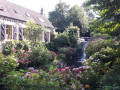
We follow the narrow dirt track. After passing a mill, we come across a waterfall on our left.

(2) We leave the dirt track and turn left onto a narrow tarmac road

(3) Please take care: this section is uphill, with limited visibility for vehicles. Immediately afterwards, we take the D237 E3 and reach a junction at Rupembert. We continue straight ahead onto the D237 E2 and reach the junction at the hamlet of Olincthun.

(4) We cross the road and, facing the junction, take the road leading to the Moulin de Grisendal, slightly to the left.

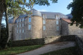
(5) We turn right towards Pittefaux and then reach the Château de Souverain Moulin.

(6) We turn left just after the church. A climb along the D242 takes us to the “Le Trou d’Enfer” lodge (in the commune of Wierre-Effroy).

(7) Before the sign, we turn left towards Hesdres.

(8) At the junction in Hesdres, we go straight on and come to another right-angled junction.

(9) We turn right. At a place called Les Sables, the path veers to the left and we arrive at Offrethun.

(10) We do not go through the village but continue in the same direction, heading due west. After Berguette Castle, we come to a road; we turn left onto it and reach the junction with the D233 E3 near the school and Saint-Antoine Church

(11) We turn onto this road opposite and soon reach a roundabout bypassing the motorway.

(12) We turn right to cross over the motorway and take the third exit to follow the road running parallel to it.

(13) At the next roundabout, we turn right to reach the starting car park (S/E).

Waypoints

  1. S/E : mi 0 - alt. 23 ft - Car park on Rue du Général de Gaulle - Wimereux (fleuve)
  2. 1 : mi 0.18 - alt. 46 ft - Under the A16 motorway, turn right
  3. 2 : mi 1.47 - alt. 112 ft - Departmental road, on the left
  4. 3 : mi 1.85 - alt. 151 ft - Steep section
  5. 4 : mi 3.11 - alt. 299 ft - Olincthun, opposite
  6. 5 : mi 3.99 - alt. 43 ft - Grisendal Mill, on the right
  7. 6 : mi 5.26 - alt. 66 ft - Pittefaux Church, on the left
  8. 7 : mi 6.39 - alt. 272 ft - Before Le Trou d’Enfer, turn left
  9. 8 : mi 7.12 - alt. 272 ft - Hesdres, straight ahead
  10. 9 : mi 7.45 - alt. 256 ft - Junction, on the right
  11. 10 : mi 8.62 - alt. 171 ft - Offrethun, opposite
  12. 11 : mi 9.87 - alt. 180 ft - Saint-Antoine Church in Wacquinghen, straight ahead
  13. 12 : mi 11.01 - alt. 282 ft - At the roundabout, turn right
  14. 13 : mi 11.74 - alt. 85 ft - At the roundabout, turn right
  15. S/E : mi 12.04 - alt. 33 ft - Car park on Rue du Général de Gaulle

Notes

No special equipment is required.
The route is around 20 kilometres long, most of which is on tarmac. It is ideal for running or cycling training. Please be aware, however, that some sections are not particularly suitable for pedestrians or cyclists (particularly between the exit of the Denacre Valley and Olincthun).

Worth a visit

(5) Just before this point, we cross over the Wimereux, a 22-kilometre-long river which rises in Colembert, and into which the Denacre flows before emptying into the English Channel.
The walk offers some sweeping views and takes you through several villages.

Reviews and comments

3.8 / 5
Based on 3 reviews

Reliability of the description
5 / 5
Ease of following the route
4 / 5
Route interest
2.3 / 5
Malyse
Malyse

Overall rating : 3.7 / 5

Date of your route : Aug 05, 2024
Reliability of the description : ★★★★★ Very good
Ease of following the route : ★★★☆☆ Average
Route interest : ★★★☆☆ Average
Very busy route : No

It’s true – there’s a lot of tarmac and the signposting leaves a lot to be desired. After the waterfall, the path splits into two, both marked with Yellow Crosses. I hesitated and went the wrong way. I ended up in Saint-Martin-Boulogne… But the stretch along the river is very pretty.

Machine-translated

jpacmuro
jpacmuro

Overall rating : 4.3 / 5

Date of your route : May 16, 2023
Reliability of the description : ★★★★★ Very good
Ease of following the route : ★★★★★ Very good
Route interest : ★★★☆☆ Average
Very busy route : No

Some parts are very pleasant, particularly the Denacre Valley, but others are far less so, such as the final stretch of the route along very busy roads. In fact, I’d advise against taking the D233E3 at Wacquinghem; instead, take the D242E3, then the D242, and finally a very narrow track to the left of the motorway to return almost to the starting point. This route adds a little to the distance, but avoids a long stretch that’s somewhat dangerous.

Machine-translated

mdxmdx
mdxmdx

Overall rating : 3.3 / 5

Date of your route : Jul 22, 2019
Reliability of the description : ★★★★★ Very good
Ease of following the route : ★★★★☆ Good
Route interest : ★☆☆☆☆ Very disappointing

a walk mainly along a local road with some traffic

Machine-translated

Other walks in the area

For more walks, use our search engine .

The GPS track and description are the property of this route's author. Please do not copy them without permission.