Country:
 City:
City:


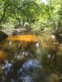
It is best to use the summer swimming pool car park.
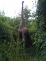
(S/E) Leave this car park, situated between the campsite and the entrance to the swimming pool, heading north-east along the downhill path to the bridge spanning the Petite Leyre. Quite soon, in the grassy area, turn left overlooking the stream and walk past the sculpture of the five-legged mule. Turn right onto a slight incline, cross a car park to Rue Brousta and turn right. In front of the Town Hall, cross the road at the pedestrian crossing and continue due east.
(1) Turn left onto Rue Léon Gambetta (no entry), then onto Rue de la Coopérative. At the end, turn left onto Route du Stade, heading towards the cemetery. Enter the cemetery and walk through it towards the west gate.
(2) Turn right and follow Avenue Bernard Martin, preferably keeping to the left-hand side.
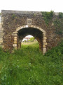
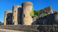
(3) At the sign for “Moulin de Sore” (lodge), turn left onto the access track. From the car park of this establishment, head to the Porte des Anglais on your right.
(4) Turn round and head back to the avenue.
(3) Turn left and walk carefully along the avenue . In the bend, cross to the right and take the Route de la Bourgade for a few metres.
(5) Leave the Rue de la Bourgade (the return route) straight ahead and turn immediately left onto the compacted track ‘Chemin de Picoy’ until you reach the end, in front of the ruins of the Chapel of Saint-Rémy.
(6) Turn right opposite the ruins onto Route de Moucherucq and continue to the next junction with a wide, well-trodden track.
(7) In front of a beautiful property, leave the Route de Moucherucq (return route) on your right and turn left onto the track. After a right-hand bend, it heads north. Stay on this track for a long while.
(8) When you see a farm shed, turn right onto the wide, sandy track. Take the wide track on the right, which turns into a road and passes through the middle of some lovely properties. Turn right to return to the junction where the circular route begins.
(7) Head back along the Route de Moucherucq in the opposite direction, until you reach the ruins of the chapel.
(6) Turn left onto Chemin de Picoy to rejoin Route de Bourgade.
(5) Turn left onto Route de la Bourgade. Leave this road immediately at the Y-junction.
(9) Carry on straight ahead along the “Estrade de Morderet” path until you reach the Airial de Morderet. Turn right onto the road of the same name, which runs alongside the Ruisseau de la Sourdouille and joins Rue de la Gare.
(10) Turn left onto Rue de la Gare, pass a beautifully landscaped property and turn right onto Rue de la Grotte. At the left-hand bend, head right towards the water tower, through this housing estate. Pass to the left of the water tower and cross Boulevard de la Gare.
(11) Enter the woodland, stay on this track until you reach the footbridge over the Petite Leyre and cross it. Continue slightly uphill along this sandy path to the Airial Gadin and turn right onto the access track leading to it.
(12) Turn right at the first track, ignoring all the side paths to the right and left. Continue to the Route de la Piscine and turn right towards the car park (S/E).

 Visorando Member

 Easy
Easy