Country:

 City:
City:


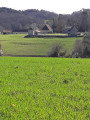
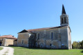
Park in the village of Montagnac-la-Crempse, in the car park between the town hall/school and the village hall. The starting point and the information board about the routes are opposite the church entrance.
(S/E) Head down opposite the church along the Route de la Levade. In the valley, take the path on the right: sign for “Boucles de Montagnac et de Saint-Julien de Crempse”. Ignore the sign opposite for “Boucle de Picatao, Beleymas, Villamblard”.
(1) At the three-way junction with a cross marked with a plaque reading “Chemin de Compostelle”, turn right and continue through the valley. At the first house (no. 653), take the path up to the right. When you reach three green plastic greenhouses, continue along the path to the right (yellow marker). Join a road at the entrance to the Petit Gaillard farm, first turn right then left, and continue along the Route de la Grange.
(2) After a few metres, turn onto the path on the right (yellow marker). Join a slightly wider path and turn left. At the T-junction, continue to the left. At the small road, carry on straight ahead and you’ll immediately reach a main road (Route de Gardonne). Follow it to the right.
(3) After a bend to the left and before a bend to the right, take the path leading off to the left into the pine trees. You’ll reach the junction with a limestone track, where you’ll find numerous signposts and the junction with the GR®361.
(4) Continue along the path straight ahead towards “Boucle de Saint-Julien”. Here, you can shorten the route by turning right towards “Boucle de Montagnac” and heading directly to the point (7).) At the next crossroads, continue straight ahead along the path that runs alongside a meadow.
(5) At the T-junction, leave the signposted route to “Campsegret, Saint-Georges-de-Montclar, Clermont de Beauregard” on your left and keep to the right towards “Circular Route of Saint-Julien”. The path becomes a road.
(6) Before reaching the village, turn right onto the Route de la Sudrie (signposted and marked with a GR® sign).You may wish to take a short stroll through the village: the Place du 9 Août 1944 is so named in tribute to the 17 victims of the massacre carried out by the Germans. When you reach Impasse de Courtaureille, continue to the left; then, at the next three-way junction, leave the GR® and the Route de la Sudrie to turn onto the track on the right (signposted “Circular Route of Saint-Julien, Circular Route of Montagnac”). At the top, at the junction with another track, turn right and continue for about a hundred metres.
(7) Shortly afterwards, leave the track and take a path on the left (signposted). The track coming towards you from the opposite direction originates from the point (4): you will therefore arrive from that direction if you have chosen to do only the Montagnac circular route. At the Domaine du Petit Gardonne, follow the road to the left. At the ‘Give Way’ sign, turn left.
(8) Turn right after house number 47 onto Impasse des Noyers. At the edge of a small meadow, leave the tarmac track for a few dozen metres and take a sheltered footpath on the left, which rejoins the tarmac a little further on. At the junction with a road, turn right.
(9) After a bend to the left, leave the road and take a track that climbs to the right and leads to the hamlet of La Freunie. Leave the hamlet via the road. At the junction with the road you left earlier, turn right and negotiate the bend to the right.
(10) As you come out of the bend, take the track that branches off to the left (yellow marker in the corner). At the junction with a track by a shed, continue to the right. Shortly afterwards, at the T-junction, turn left: note the church of Montagnac on your right. The track becomes a road as you reach the first houses of Fissetot.
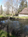
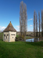
(11) At the signposts, carry on straight ahead along the same road. Here, you can once again shorten the route by turning right to head directly for the village of Montagnac and the starting point, without doing the short Picatao Circular Route:‘picatau’ inOccitan means ‘woodpecker’.) As you continue along the road, enjoy the lovely view to your right of the hamlet, its dovecote and the chapel of Sainte-Marie des Gueyrals. At the first house, turn left and continue along the path. At No. 94, take the left-hand fork onto the path leading downhill. You’ll pass close to two ponds and a charming dovecote. At the T-junction, where the path meets the GR®361, leave the sign for “Circular Walk of Belisama, Circular Walk of the Crêtes” on your left and turn right towards “Montagnac, La Crempse bourg”. You’ll pass close to La Poude,one of the many mills dotting the Crempse valley.
(12) CrosstheD38carefullyand take the path opposite. Follow the leat of the mill and reach the Ruisseau de la Crempse, which flows into the Isle at Mussidan. Continue to the right over a small wooden bridge and rejoin the D38 to the right of a gate. Caution: busy road.
(13) First turn left then right here to take a path (GR® signpost). This path joins a road at a house in the hamlet of La Font Franque. Continue straight ahead; at the next crossroads, turn right to head back up towards the village and return to the car park (S/E).


 Visorando Member
 Easy
Easy