Queyssac Hamlets Circular Route

Queyssac offers two separate walking routes. Both walks start from the same point. This very pleasant walk passes through hamlets in the surrounding woodland. You can see the high standard of the renovation work carried out on the houses.

Details

18824347
Creation:
Last update:
Last review:
  • Walking
    Activity: Walking
  • ↔
    Distance: 4.86 mi
  • ◔
    Average duration: 2h 40 
  • ▲
    Difficulty: Easy

  • ⚐
    Back to start: Yes
  • ↗
    Ascent: + 489 ft
  • ↘
    Descent: - 486 ft

  • ▲
    Highest point: 459 ft
  • ▼
    Lowest point: 210 ft

Photos

Description of the walk

The route starts at the car park opposite the hall near the church, at the foot of the hiking information board. There is ample parking available.

Follow the yellow markings

(S/E) Take the path after the wooden gate, running parallel to the stream on your right. Walk past the pond on the left and, when you reach the gate ahead, join the path running alongside the stone wall. Continue until you reach the road.

(1) Carry on straight ahead, slightly to the left. Follow this road to the next junction with a Stop sign.

(2) Cross with care and carry on straight ahead along the uphill path. Walk past the farm and follow the path to the right, before the house with blue shutters. Carry on until you reach the Route de Pinceguerre.

(3) Turn left and take the path into the woods. Carry on until you reach another road in the hamlet of La Chapelle.

(4) Turn left onto this signposted road. Head towards the hamlet of Bos Nègre, continue on and then turn right to reach a crossroads with a sign opposite a bus shelter.

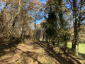
(5) Cross carefully, then continue straight ahead along Impasse du Grand Bos. Follow this tree-lined road to the property with the white gate. Turn right into the forest and you’ll reach a house with a swimming pool. Go round it on the right to reach the edge of the nearby forest.

(6) Turn right at a 90° angle and climb the track up to the Route des Penauds.

(7) Turn left onto it. Continue through the hamlet of Les Penauds and head for the next hairpin bend junction. Turn left to reach the Halle car park (S/E).

Waypoints

  1. S/E : mi 0 - alt. 210 ft - La Halle car park
  2. 1 : mi 0.5 - alt. 240 ft - Road
  3. 2 : mi 0.94 - alt. 262 ft - Stop sign
  4. 3 : mi 1.67 - alt. 377 ft - Route de Pinceguerre
  5. 4 : mi 2.35 - alt. 453 ft - Route de la Mouthe
  6. 5 : mi 3.17 - alt. 315 ft - Bos Nègre crossroads,
  7. 6 : mi 3.73 - alt. 292 ft - Edge of the forest
  8. 7 : mi 4.05 - alt. 433 ft - Route des Penauds
  9. S/E : mi 4.86 - alt. 210 ft - La Halle car park

Notes

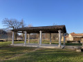
At the car park, there are picnic tables, a fitness trail and a shelter. Toilets are available behind the restaurant, on the other side of the stream.

Worth a visit

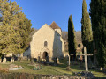
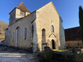
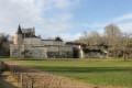
(S/E) The area around the car park provides easy access to the church and its landscaped surroundings (cemetery).
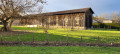
(S/E) A shelter provides cover. Beyond the shelter, a walking and fitness trail is accessible.
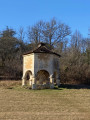
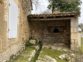
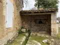
(S/E) A dovecote situated next to the car park is rather unusual.
(S/E) There is a restaurant in front of the church (Le Presbytère).

The valley is ideal for walks and picnics.

Reviews and comments

4.3 / 5
Based on 5 reviews

Reliability of the description
4.6 / 5
Ease of following the route
4.8 / 5
Route interest
3.4 / 5
christophe G
christophe G

Overall rating : 5 / 5

Date of your route : Jul 03, 2026
Reliability of the description : ★★★★★ Very good
Ease of following the route : ★★★★★ Very good
Route interest : ★★★★★ Very good
Very busy route : No

A lovely walk offering the chance to discover some beautiful local houses. It’s easily accessible and shaded for much of the route. A truly wonderful find just a few minutes from Bergerac. The very first review makes no sense, unless the aim is to put off walkers from Queyssac – which, incidentally, is a lovely village with plenty of places to eat after the walk.

Machine-translated

lailler
lailler

Overall rating : 4.7 / 5

Date of your route : May 18, 2026
Reliability of the description : ★★★★★ Very good
Ease of following the route : ★★★★★ Very good
Route interest : ★★★★☆ Good
Very busy route : No

A pleasant route, easy to follow, with lovely scenery.
There are a few roads, but they are quiet

Machine-translated

User 25678832

Overall rating : 4.7 / 5

Date of your route : Oct 20, 2025
Reliability of the description : ★★★★★ Very good
Ease of following the route : ★★★★★ Very good
Route interest : ★★★★☆ Good
Very busy route : No

Very nice route, often through the forest.
I do it regularly

Machine-translated

Coquelicot74
Coquelicot74

Overall rating : 4.3 / 5

Date of your route : Apr 05, 2024
Reliability of the description : ★★★★★ Very good
Ease of following the route : ★★★★★ Very good
Route interest : ★★★☆☆ Average
Very busy route : No

A lovely route starting from the very pretty village of Queyssac.

Machine-translated

Camille24
Camille24

Overall rating : 2.7 / 5

Date of your route : Feb 12, 2022
Reliability of the description : ★★★☆☆ Average
Ease of following the route : ★★★★☆ Good
Route interest : ★☆☆☆☆ Very disappointing
Very busy route : No

Another very disappointing hike in the Queyssac area. We won’t be coming back.

Machine-translated

Other walks in the area

For more walks, use our search engine .

The GPS track and description are the property of this route's author. Please do not copy them without permission.