Peyrima circular trail

Starting from Beauregard-et-Bassac, a short circular route with little elevation gain that is more like a pleasant stroll than a proper hike. Passes by the Peyrelevade dolmen.

Details

65893715
Creation:
Last update:
Last review:
  • Walking
    Activity: Walking
  • ↔
    Distance: 3.87 mi
  • ◔
    Average duration: 2h 05 
  • ▲
    Difficulty: Easy

  • ⚐
    Back to start: Yes
  • ↗
    Ascent: + 318 ft
  • ↘
    Descent: - 315 ft

  • ▲
    Highest point: 741 ft
  • ▼
    Lowest point: 489 ft

Photos

Description of the walk

Park in the car park at Place de la Bascule, on the left after the hill leading up to the village when approaching from Pont-Saint-Mamet. There is a sign for walks and guidebooks in boxes.

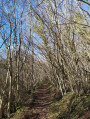
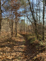
(S/E) The path starts on the right at the far end of the car park (Impasse d’Aubusson) then turns immediately left. Head into the woodland, pass a small pond on your left and continue to the T-junction near the Reygasse.

(1) Turn left onto the Chemin Chez le Tord, following the sign for “Circular Route of Peymirat, Bassac, Saint-Mayme de Péreyrol”. Pass through the hamlet and reach another T-junction.

(2) Turn right onto the DFCI Beauregard and Bassac. At the next junction, carry straight on until you reach a four-way junction.

(3) Turn left, following the signs for “Circular Route of Peymirat, Bassac, Pont Saint-Mamet”. Take a 90° left-hand bend and reach a nearby junction (yellow marker).

(4) Turn right and, at the road, turn left towards Bassac.

(5) At the crossroads, take the first turn left then right to join the Chemin du Dolmen: sign on the corner for “Boucle de Peymirat, bourg de Beauregard”. Carry straight on.

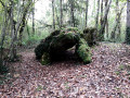
(6) Turn onto a track on the right just before the tarmac (yellow marker). After a gentle descent, you’ll reach the Peyrelevade Dolmen on the right: there’s an information board.

(7) Return to the route, join a road and follow it to the right.

(8) Just before the “give way” sign on the D38, take a path on the left which runs alongside the road for a few metres then climbs towards the village. After joining the tarmac road, take a small street on the left: marker on the corner. Return to Place de la Bascule (S/E).

Waypoints

  1. S/E : mi 0 - alt. 607 ft - Car park at Place de la Bascule
  2. 1 : mi 0.94 - alt. 630 ft - T-junction
  3. 2 : mi 1.18 - alt. 630 ft - Start of the DFCI track
  4. 3 : mi 1.68 - alt. 741 ft - Crossroads
  5. 4 : mi 2.44 - alt. 646 ft - Crossroads, signpost
  6. 5 : mi 2.84 - alt. 607 ft - Crossroads
  7. 6 : mi 3.22 - alt. 623 ft - Start of the track on the right
  8. 7 : mi 3.37 - alt. 600 ft - Peyrelevade dolmen
  9. 8 : mi 3.66 - alt. 502 ft - Start of the track on the left
  10. S/E : mi 3.87 - alt. 617 ft - Car park

Worth a visit

Peyrelevade dolmen on the route (with information board).
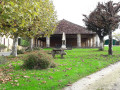
Market hall in the village.
Pomport Castle on the road to Pont Saint-Mamet.

Reviews and comments

4.7 / 5
Based on 2 reviews

Reliability of the description
4.5 / 5
Ease of following the route
5 / 5
Route interest
4.5 / 5
Brina
Brina

Overall rating : 5 / 5

Date of your route : Jun 11, 2026
Reliability of the description : ★★★★★ Very good
Ease of following the route : ★★★★★ Very good
Route interest : ★★★★★ Very good
Very busy route : No

A lovely route with varied scenery (taking you through fields and woods) that’s suitable for children. In summer, the sections through the woodland are particularly pleasant. At the end of the route, the dolmen awaits.

Machine-translated

Naturiel
Naturiel

Overall rating : 4.3 / 5

Date of your route : Apr 06, 2025
Reliability of the description : ★★★★☆ Good
Ease of following the route : ★★★★★ Very good
Route interest : ★★★★☆ Good
Very busy route : No

An easy route to get you started. There’s a section towards the end with a dolmen in the woods, which adds a nice touch to the walk.

Machine-translated

Other walks in the area

For more walks, use our search engine .

The GPS track and description are the property of this route's author. Please do not copy them without permission.